 |
| Sunset, San Antonio Beach, Saipan |
One of our first lectures was from local historian Genevieve Cabrera, who gave us a quick but complete history of the island: Magellan first supposedly came to the Marianas in 1521, though the Spanish colonies (which is why it was named the Marianas – after Spanish queen Maria Ana, the Caroline Islands were named after King Carlos, and the Philippines after King Phillip) weren't started until over a hundred years later. They forcibly removed the native Chamorros to Guam, and the seafaring Carolinians came to the island after a series of devastating typhoons decimated the Caroline Islands – that’s why there are both Carolinians and Chamorros now living here. Spain then gave up the area after their loss in the Spanish American war, and the Germans briefly came to the Saipan. But their occupation quickly ended when WWI broke out, so the Japanese arrived and worked in sugarcane plantations in harmony with the local population. But their symbiotic relationship broke down at the outbreak of WWII, and when they lost the war and the islands, the Americans took over.


After the wave break, the reef drops down to over 100 ft, so the area was an easy and obvious landing area for the LVTs (Landing Vehicle Tracking) and Sherman tanks that the US Marines used for their invasion starting June 15, 1944. Unfortunately, it was also obvious to the Japanese, so it was heavily defended and the invading force had to come ashore under heavy fire. Another problem was that there was a current that the pilots hadn’t accounted for, so the heavy crafts ended up drifting beyond their originally planned landing areas.
 |
| I spy with my little eye... a Sherman tank! |
We had lunch on the beach (homemade local food of chicken, ribs, red rice, and pickled papaya – delicious!) before loading up into the cars for our tour to landmark sites. We first headed up to the As Lito airfield in highlands near the current Saipan International Airport. Although the airfield had been built by the Japanese in 1934, it was captured by the US early in the battle and turned into Isley Field, a base for B-29 bombers.

 |
| Inside the munitions bunker |

 |
| Clearing Japanese foxholes, June 16, 1944 |
From As Lito, we drove back north across the island through Death Valley and Purple Heart Ridge, where the Marines faced difficulty and suffered heavy casualties in their charge to take the island. The goal had been for the US to invade the western side of the island (using the shallow reefs to help get forces onto the island), then push inland and up to capture the high ground. Although the assault was more difficult than originally planned, the US managed to capture the island three weeks after the invasion, on July 9, 1944.
We then drove north to the Marpi area, and stopped at the Banzai Cliffs on the northwest coast.


 |
| May Peace Prevail On Earth |
Being at the Banzai Cliff was emotional and moving. The cliffs themselves are absolutely beautiful, with deep azure blue waters and frothing white waves. But it was a sobering thought that there was a chance you wouldn’t die unless you hit rock, and many people may not have been killed from the jump.
Overlooking the Banzai cliff in the limestone mountain was Suicide Cliff, and we drove to the top for a beautiful view of the Marpi area. Again, it was a bit of a surreal feeling looking at the stunning beauty of the view, yet knowing so many people lost their lives there.
Overlooking the Banzai cliff in the limestone mountain was Suicide Cliff, and we drove to the top for a beautiful view of the Marpi area. Again, it was a bit of a surreal feeling looking at the stunning beauty of the view, yet knowing so many people lost their lives there.
All day Friday was spent touring more sites on the Island.
 |
| Army reinforcements wading ashore, a few days after securing the beach in July, 1944. |
 |
| Hello, Tinian! |
We also saw several sea turtles in the water!
 |
| A view into the bunker from up above |

 |
| The pristine Obyan Beach, Saipan |
 |
| Low tide turns Forbidden Island into a peninsula |
We continued to the center of the Saipan, Mount Tapotchau. Rising up 1,550 feet, it is Saipan's highest point, so it was crucial in the Battle for Saipan. The peak also gives a great view of the entire island. During our picnic lunch, Saipan local Vinny told us about the Easter tradition of a group of locals carrying a large wooden cross up the mountain in a procession and erecting it near the peak.
 |
| The view from the highest point on the island |

Back over to the northern side of the island, we stopped at the Last Command Post (Jen says it isn’t actually the last post the Japanese had, but it was a convenient tourist spot to see several old guns and to view the old command center built into the rock.)
 |
| Inside the Last Command Post cave |

Then we went further up to visit a couple caves - First Kalabera Cave, which was closed but Fred took us anyway to see the petroglyphs and pictographs. It's nice having a local who knows his way around caves! On the site was a reconstructed Chamorro hut, showing the latte stones used to raise the living quarters platform.
On the way home, we stopped for a photo op at Bird Island - a beautiful spot!

That night we had a film presentation at AMP – We Drank Our Tears is a storytelling project by the children of Saipan, who interviewed their elders to get stories from WWII. We viewed three of these stories that had been made into short films. Very moving and sad, since all of them depicted the remembered stories of people who had friends or family members who died during the Battle of Saipan.


 |
| "Have you even HAD dragonfruit unless you've had dragonfruit on a boat after snorkeling in a lagoon on Saipan?" |
Unfortunately Instructor Jen got stung by a box jellyfish (! but she's ok!) so they cut the snorkeling short and we were only able to swim at that one site – but we did get a nice boat tour of the lagoon and of Managaha Island.
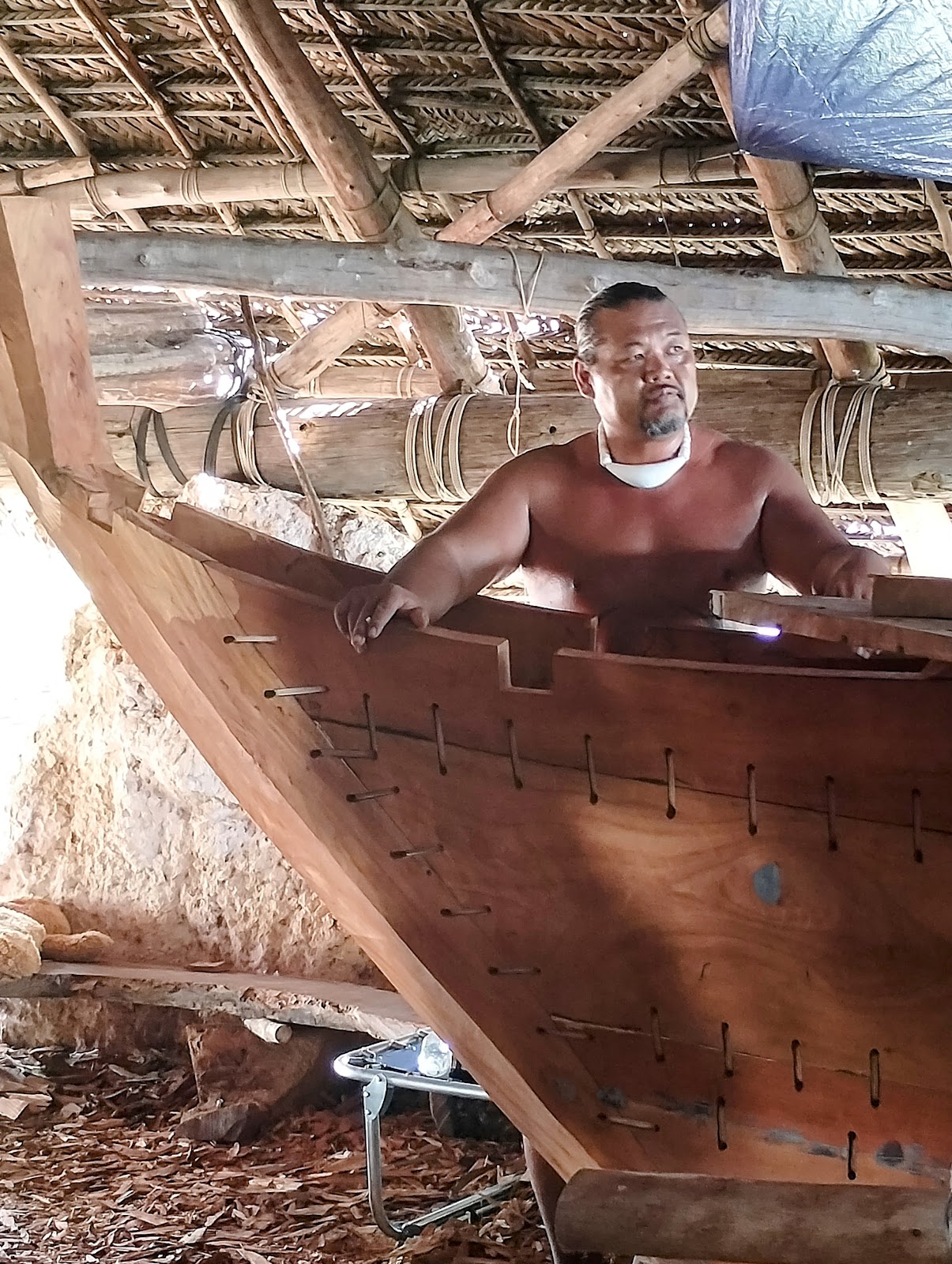 |
| Boatbuilder John |
While at the 500 Sails hut, we also saw the provisions that had been donated for the Alingano Maiso, a twin-hulled catamaran that had sailed with a student crew from Palau and was leaving the next day for the journey back to Palau.

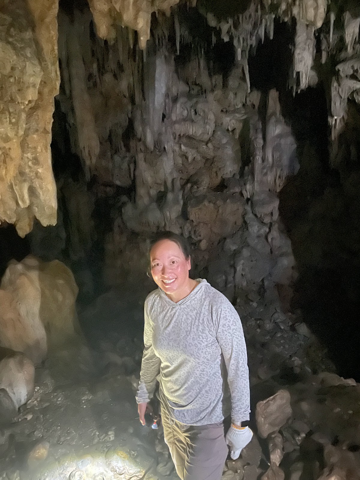
Sunday was our optional day and several of us chose to spend the day "Fredding" - exploring the island's caves with Fred Camacho, local spellunking expert and amateur historian.

The interior of the island is made up of rocky limestone, perfect for a vast network of caves that were used during the war as hideouts, storage bunkers, hospitals, and even command centers. Even before the Japanese had occupied Saipan, prehistoric people had used the caves as different petroglyphs have been found in several of them. Freddy took us to three caves – the first up a rocky stream-bed ravine, scrambling through loose rocks and mud and ducking under fallen trees. There were even areas where we needed a rope to help get us up, and it was very, very, very hot and humid, so it was sooooo dirty…! But so much fun, and a wonderfully immersive experience!
That first cave that we explored was known to be one of Sakae Ōba’s hiding spots – the Japanese soldier who evaded capture for over a year after Japanese surrender by hiding in the dense jungle and caves of the inner island. the Japanese were known to dig the tunnels 6 ft wide by 6ft high, and that particular tunnel was “E” shaped (with a few smaller nooks).

 |
| Preparing the ropes for our climb into Oba's cave |

The second tunnel, a slightly easier hike, had signs of charring/fire, possibly from grenades or flame throwers. The flames were so hot that it melted glass. We could also determine the direction of the flames based on the charring left on the walls of the cave.
 |
| Wild forest mangoes. YUM |

 |
| A mother with four children, found by Marine patrol on June 14, 1944 |
The last cave had more rubble on the ground (a sign that it perhaps had been shelled/bombed), fire scars, and human bone remains. There were more artifacts left in that cave – a glass button, a ‘go’ game piece, remnants from Japanese grenades, bullet casings, a buckle, and part of a pistol.
 |
| Photographer W. Eugene Smith was sent to document the Battle of Saipan |
From what we found, it was obvious that civilians had used the cave to hide out.
 |
| Artifacts left in the cave |

 |
| Dinner at Shirley's with Erin, Emily, Vic, me, Angela, and Aileen |
Monday was an all-day indoor day at Garapan Elementary
 |
| In CA schools, it's all about earthquake prep; in Saipan, it's Unexploded Ordnance |
 |
| Carillon Bell Tower and Memorial |

 |
| Setting off for their month+ long voyage across the Pacific |


We hiked into the forest (where we saw several monitor lizards!) to a sinkhole hidden in the dense jungle growth. We could only imagine running through the dark forest and stumbling into this huge gaping maw! After carefully climbing down, we squeezed our way through a small opening into a large underground chamber used by several Japanese families (or soldiers?). There were many war era sake bottles, as well as Japanese graffiti left on the wall.
Our last stop was at a much more formal tunnel, with smooth concrete walls, floor, and ceiling. It was located near a drainage ditch behind the gas station on the main road, but hidden behind enough greenery that most people probably don't even know it exists. It was also the only place we saw cockroaches - huge ones, all over the walls. Remember that scene in Indiana Jones? Yeah.
 |
| Suicide Cliff. The jagged scar in the limestone is where Americans blasted the cliff wall, attempting to neutralize Japanese anti-aircraft guns |
That evening, we had a happy hour on the beach to say goodbye and reflect on our week. I loved meeting the people, especially the warm and welcoming locals, and I enjoyed learning about the island. I'm particularly fascinated by the War in the Pacific, and wonder why the narrative of the Marianas is so unknown to most Americans. When I first told people about the workshop, not one knew where Saipan even was. To be honest, I didn't even know exactly where the Marianas were located. And I certainly didn't know what role the islands played in World War II's Pacific Theater. I'm so glad I could fill in this missing piece of history!

I'm grateful to Anne, Jen, Fred, Nancy, and the rest of the team for this opportunity and for putting together an amazing workshop. It was a great week of learning, exploring, and meeting wonderful new friends!
Once again I have learned so much. I am now even more fascinated by the caves. Thank you. Have you been to Corrigador in the Philippines? It’s amazing
ReplyDelete