
With such a long distance to travel, I decided to go a few days early and see the nearby island of Guam. It's also a part of the Mariana island archipelago, a chain of (mostly) dormant volcanoes about 1500 miles south-southeast of Japan. In case you didn't know (and don't lie - you probably didn't), the Mariana Islands are about halfway between Japan and Papua New Guinea, in the Western Pacific. The Marianas are actually broken up into two political regions: Guam - a territory of the US, and the Commonwealth of the Northern Mariana Islands (or CNMI) - a commonwealth of the US. (As an aside, commonwealths have a bit more control of their internal government than territories, but neither have representation in Congress.)
* * * * *.* * * * * * * * * * * * * * * * * * * * * A BRIEF HISTORY BREAK * *.* * * * * * * * * * * * * * * * * * * * * *
The history of the Marianas is fascinating and complex. The indigenous people of these Pacific Islands are the Chamorros, who have lived here for thousands of years. Magellan first came to the Mariana Islands in 1521. A hundred years later, Spain colonized the islands, since it was a good stopping point between Mexico and the Philippines - it was named the Marianas after queen Mariana (and the Philippines was named after Philip II of Spain). When Spain lost the Spanish-American War in 1898, it ceded Guam to the US. It sold the Northern Marianas to Germany, who had brief control of Saipan until it was lost to Japan during WWI.

Throughout the rest of 1941 and into 1942, Japan captures Guam, Wake Island, Hong Kong, Singapore, French Indochina, the Philippines, and Burma. In May of 1942, the US stops Japan from advancing on Australia, and in June at the Battle of Midway, the US neutralizes the Japanese Fleet. The US then goes on the offensive starting in early 1944 and begins recapturing the Pacific. The plan in Mariana Islands is a campaign known as Operation Forager - the US recaptures Saipan, Guam, and Tinian, then constructs airfields where B-29 bombers could take off and reach the Japanese home islands.
It was from Runway Able on Tinian’s North Field that the Enola Gay took off carrying the atomic bomb 'Little Boy' on August 6, 1945, flying about 6 hours to reach it’s primary target of Hiroshima. That first atomic bomb, combined with 'Fat Man' dropped on Nagasaki on August 9, finally prompted the Japanese government to sign the Instrument of Surrender on September 2, 1945, ending World War II.
* *.* * * * * * * * * * * * * * * * * * BACK TO OUR REGULAR PROGRAMMING * *.* * * * * * * * * * * * * * * * *
 |
| Damage at the Guam Reef Hotel |
SATURDAY, JULY 8
The next morning we woke up early and headed out to the Guam Farmer’s Market in Dededo. It was a small outdoor market where it seemed like locals go to buy produce - not too many stalls open, so the souvenir booths were scant. There were also a few food trucks, so we decided to get breakfast – copying several of the locals, we had batchoy – basically a ramen soup. We also got huge smoothies (mango strawberry – yum!) since it started getting hot.
The next morning we woke up early and headed out to the Guam Farmer’s Market in Dededo. It was a small outdoor market where it seemed like locals go to buy produce - not too many stalls open, so the souvenir booths were scant. There were also a few food trucks, so we decided to get breakfast – copying several of the locals, we had batchoy – basically a ramen soup. We also got huge smoothies (mango strawberry – yum!) since it started getting hot.

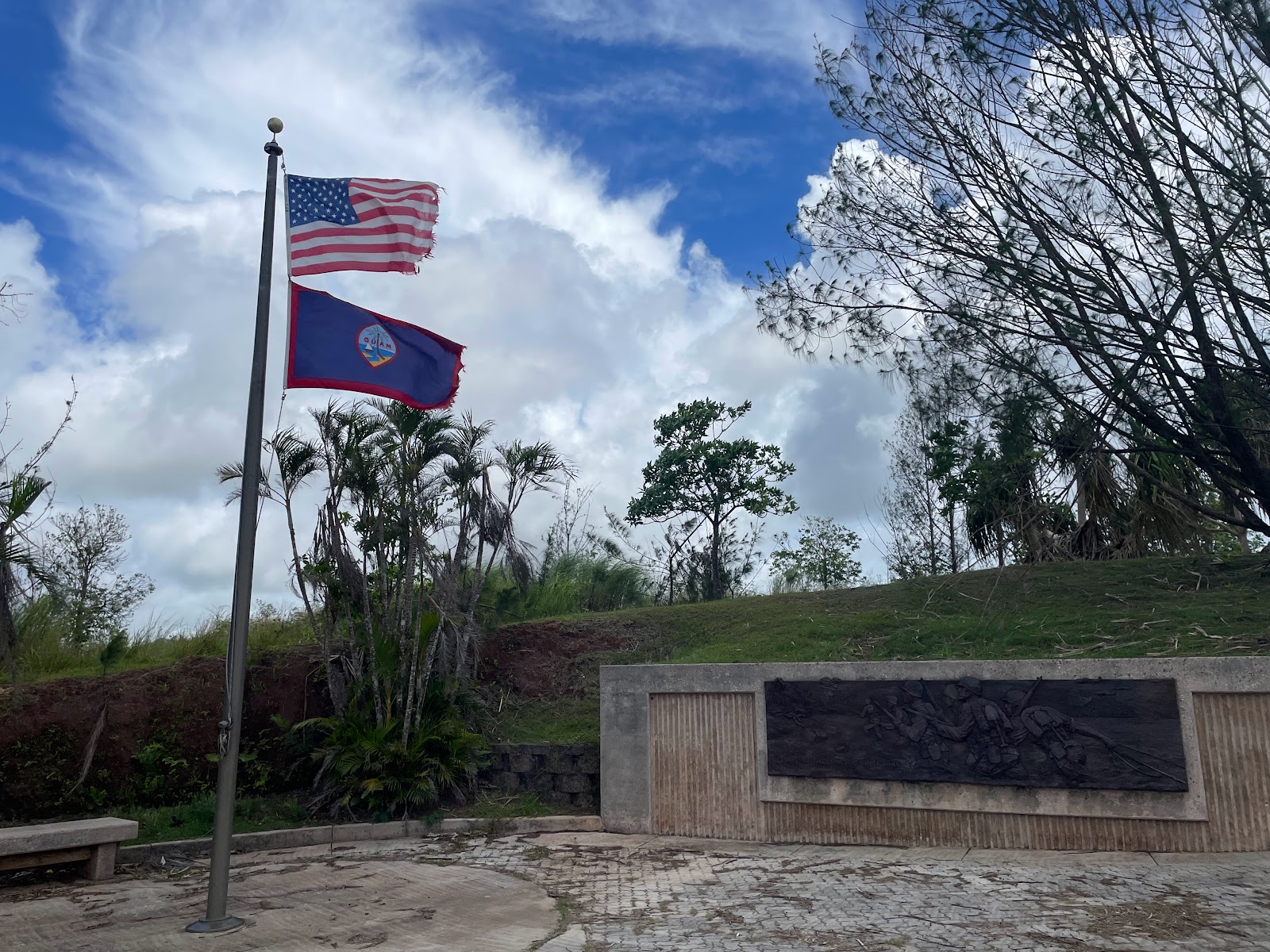
We first went to Ga’an Point in Agat, where American forces landed on July 21,1944 during the battle for the liberation of Guam.
 |
| Ga'an Point, Agat Beach |
 |
| Nature is metal on Guam! |

 |
| Lookout! It's the Nuestra Señora de la Soledad lookout! |
This Spanish fort was built between 1802 and 1819 to protect galleons traveling between Mexico and the Philippines. After Mexican Independence in 1815, the route stopped being used and the fort was abandoned.
We crossed back over the middle of the island via route 17 (after getting slightly lost - but you can't really get lost on this small island), then stopped for lunch at the Taco Shack as recommended by Ranger Shannon.

 Erin and I then decided to visit the Fish Eye underwater observatory. It was surprisingly fun – walking a 1,000 ft boardwalk across VERY shallow Piti Bay to the observatory, then down a spiral staircase about 30 feet underwater. There were plenty of fish around the coral reef just outside the viewing windows, and there were hanging feeders that also attracted more fish. We even saw a few black tipped reef sharks swimming around!
 |
| Blue Linckia sea star |
 |
| Guam shore is pretty! |
 |
| The view of Tumon Bay from our room, and Two Lovers Point in the distance |
Erin and I decided we weren’t up for going out to eat, so we decided to look for a grocery story to see if we could scrounge enough for dinner. After another driving adventure, we ended up at Payless Supermarket – where we discovered that food was very, VERY expensive, and there was very little available. Fruit (apples) were around $8/pound, string cheese was $12 for a package, and a carton of soda was $9. We got the last two straggling containers of yogurt, and I ended up with a ramen cup for dinner and an instant oatmeal for breakfast. We’ve decided it is actually cheaper to eat out than to shop for groceries!
SUNDAY, JULY 9


After lunch, we stopped at Asan Beach where US forces first stormed the beaches of Guam. Because the US first shelled Asan and Agat beaches in the days leading up to the assault, the Japanese knew exactly where they planned to attack and they were heavily defended. Even so, Marines assaulted the beaches and captured Orote Peninsula, then moved inland.
 |
| The shallow waters of Asan Beach, where salvage from the war can still be found |
We returned early to the hotel so we spent a little time in the water in Tumon Bay right outside our hotel, then in the hotel pool. For dinner we went to Three Squares, a nice restaurant a bit outside the main town, and on the waiter’s recommendation I tried the Tinala Katne appetizer – local-style dried meat, which basically turned out to be like Chinese bbq pork. It was a HUGE plate of meat, so I’m glad I paired it with what they called rice ginger soup – which was basically thick Chinese rice porridge.

MONDAY, JULY 10
On our last day in Guam, we decided to see the World’s Largest K-mart. First, we tried again to see Two Lover’s Point (but it was still closed), and we killed some time at the Micronesia Mall since it was on the list of top things to do on Guam (it’s a mall. So we basically visited 1990 for an hour then left).
We did enjoy the giant K-mart. It’s very reminiscent of a Walmart, but unfortunately had no blue-light specials. But it did have a vast array of random snacks, which we stocked up on since it was much cheaper than the Payless supermarket from the day before.
Lunch was at Meskla’s Chamoru Fusion Bistro, which turned out to be a hotspot for what looked like groups of locals doing business. I tried the Kelaguen Manok Ma’Chalek’ – a marinated grilled chicken with salad, which was totally delicious – exactly what I needed after a bit too much meat.
Since we had a bit of time before out 5:15pm flight, we stopped at the local “Statue of Liberty”, on a small promontory near the marina. We then drove to the far north of the island, which was basically uninhabited except for the military installation. The area seemed overgrown and jungly, and every so often there’d be a break through the greenery and we’d see some military buildings. At the end of the road was Ritidian Point, a gorgeous beach (that looked fairly deserted!) and we had a great view from the overlook.
But it was time to head for the airport and our quick flight to Saipan, the largest island of the CNMI. The Commonwealth of the Northern Mariana Islands, or CNMI, is a territory of the US consisting of 14 islands. The main three are Saipan, Tinian, and Rota, and the majority of the others are either uninhabited or inhabited by people living off the grid. Less than 50,000 people live in the entire CNMI.
We ran into another teacher at the airport and shared a taxi ride into Garapan. Immediately we could see the difference between the two islands in that there was much more greenery and there wasn't the storm trash that was littering Guam. We checked into our hotel – GT Guesthouse, which is a small family-run place right in the heart of the downtown. It’s old but clean and comfortable, and MUCH cheaper than the big hotels where most of the teachers are staying. Interestingly, many of the downtown area streets are closed up for construction (and, according to the locals, have been for several years because of the construction of a garish hotel that ended up going bankrupt). The street closures combined with COVID caused many of the businesses to fail, so unfortunately the area seems to be in decline. We"ll find out more in the coming week!
No comments:
Post a Comment