Friday, July 14, 2023

Marianas Part II: Tinian - A Hidden Gem


TUESDAY, JULY 11
About 5 miles from Saipan lies Tinian, a small Mariana Island steeped in WWII history. Since we had the day free, Erin and I decided to take a day trip over to explore. We messaged with teacher Aileen who was also interested in going, and at breakfast, we ran into teacher Emily from Memphis (who I’d met several years ago at the Most Southern Place NEH seminar) and she joined in as well.
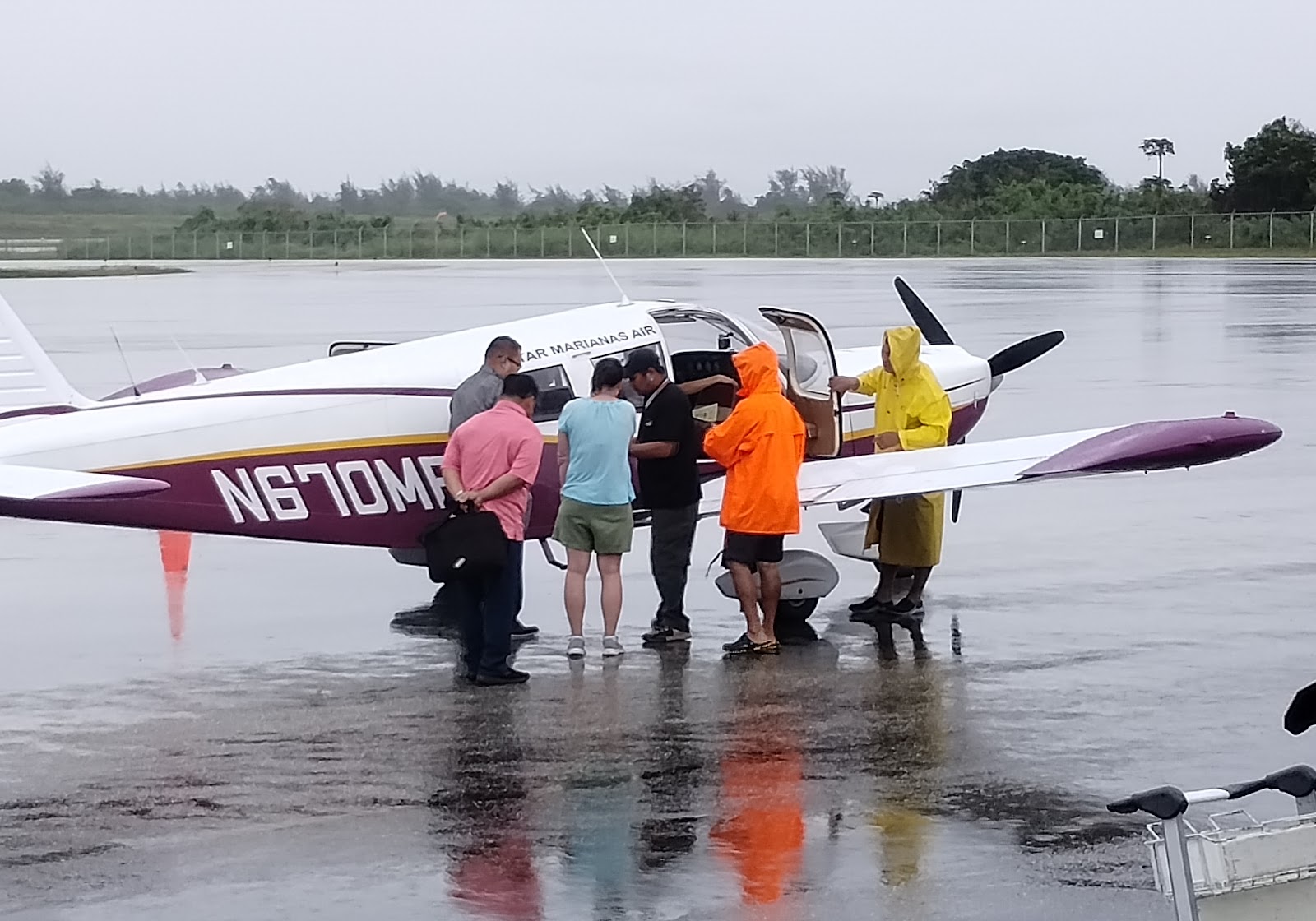
Flights to and from Tinian are a really casual affair, run by Star Marianas Air with a fleet of small 5- and 8- passenger planes. We'd read that we could show up without a reservation, so we arrived at 8:30 AM and easily bought our tickets for the next batch of flights. There aren't flight numbers; instead, you're weighed, given a color, and the planes take off when enough people want to leave. The flights are 7 minutes long, so the route is a training ground for new pilots, who get tons of practice with their takeoffs and landings. 

I ended up leaving on the flight before Erin, Emily, and Aileen, so when I got to Tinian I found my way to the car rental shack to get our ride for the day.

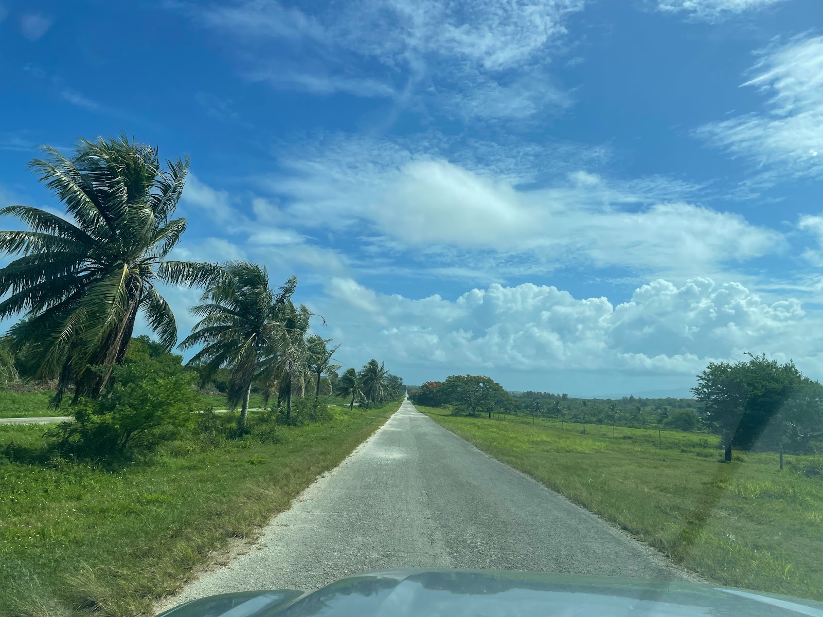
From the maps, all the sites looked straightforward and easy to find, with very few streets on the island. But the rental agent warned us: only drive on the main roads, and we'll definitely want the truck. Not the SUV, not the car - the truck. So for the day, we got a large pickup truck... and were so glad that we did – the roads were so overgrown! 

I don't even recognize
all those languages... !
Because of the vast quantities of unexploded ordinance, the US decided to essentially abandon the island, and nature has reclaimed virtually all but a small community on the southern tip of Tinian. Erin said it best when she compared our day to being in a real-life Jumanji game – flying in the tiny plane, tromping through the jungle, and navigating through the overgrown brush!

🎵"They say the neon lights are bright on Broadwayyy..."🎶
We headed north on the island's main thoroughfare, Broadway, which very quickly became a potholed, overgrown dirt track. During WWII, Tinian was a bustling hub of activity. It was such a change seeing it now, since it was mostly overgrown and abandoned - but it was so peaceful, quiet, and clean! The trails to historic sites were fairly well maintained, and we were surprised how few bugs we encountered.
 
Limestone caves are found
all over the Marianas
Our first stop was to the Japanese Defensive Caves, built into the limestone cliffs to shelter Japanese soldiers in early 1944. American troops attacked cliff caves like these with grenades and flamethrowers during the battles all over the Marianas Islands.


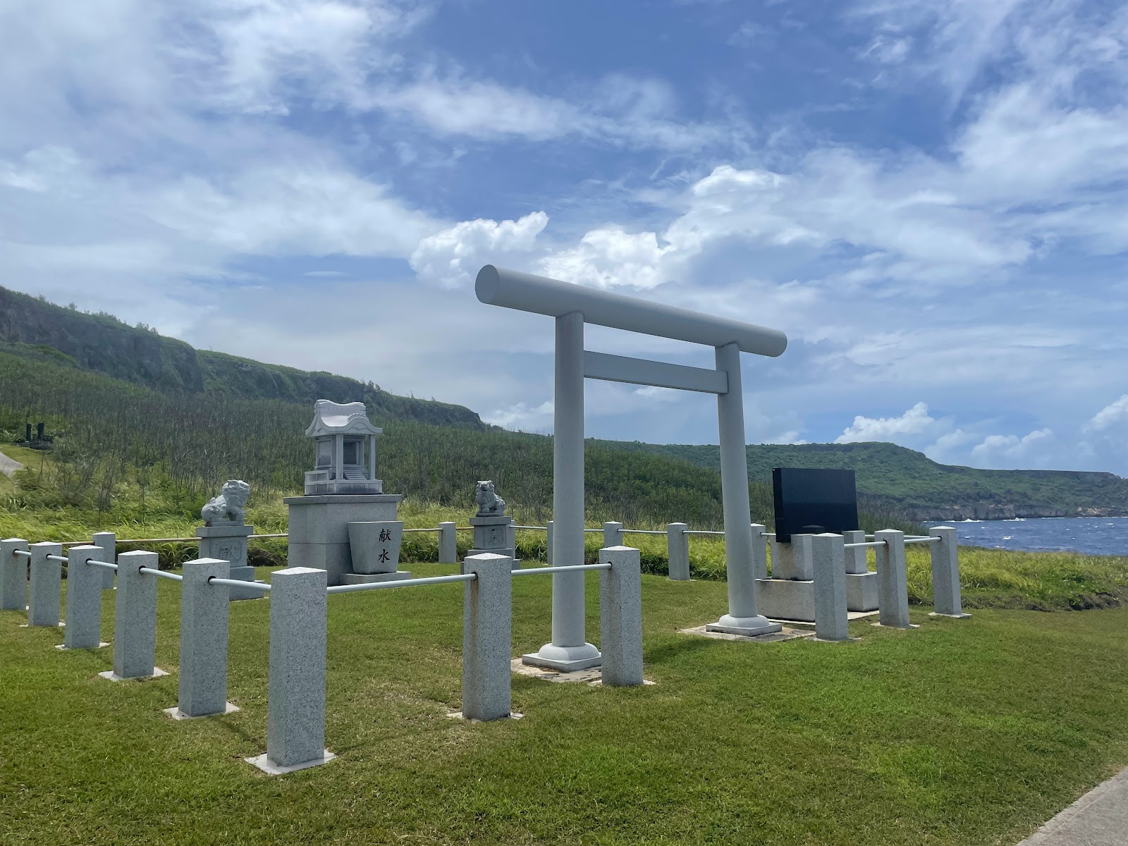
Before the war, the Japanese and Okinawans had settled in all the Mariana Islands and set up successful and lucrative sugar plantations. There were thriving communities, and one of the sugar companies built the Hinode Shrine in 1938. After a quick photo of the torii gate, we headed further north past the American Memorial and over to see the natural blowhole near the water’s edge. 
Look at the left horizon - that's Saipan!
It was a short but rocky walk across the lava bed to the blowhole - such beautiful cerulean waters! From there we drove over to the North Field, the major US airfield of WWII and the base for the B-29 superfortress bombers.
Before the US recaptured the island, Tinian was a Japanese airfield, known as Ushi Field. Many of the existing buildings were originally built by the Japanese, including air raid shelters built with reinforced concrete which also provided protection from gas attacks.

A peek into the shelter

Japanese Air Administration Building

Because it’s just 1,500 miles from Japan, Tinian was the perfect place to launch air strikes during the war. After retaking Tinian in 1944, the US expanded North Field and added two more runways for a total of 4. 
North Field, Tinian, 1945

It was the busiest airfield in the world at the time, with a plane taking off about every 3 to 5 minutes, so it was strange to see how little of the airfield remains – the crushed coral runways still exist but are breaking down and weed-filled, and all around it the dense jungle is reclaiming the land. I can imagine there are tourists who might come to Tinian not understanding the island's history and just think they were standing on an abandoned lot. But for us, a group of teachers and history enthusiasts, there is a surreal, somber, almost eerie quality to being here, knowing the impact of what eventually happened to end the war.
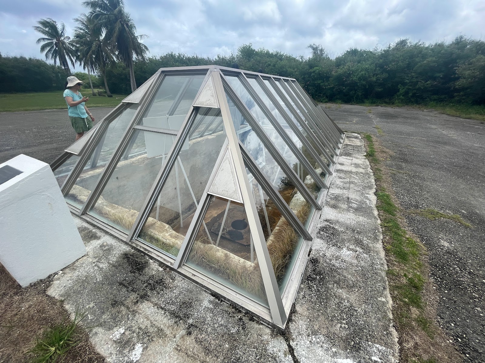
We drove down Runway Able, where early in the morning on August 5, 1945, the B-29 bomber Enola Gay took off carrying the 4-ton uranium bomb “Little Boy” - the first atomic weapon used in warfare. At the far end of the runway are two loading pits, Atomic Bomb Pit No. 1 for "Little Boy" and Pit No. 2 for the plutonium bomb codenamed “Fat Man”. Because the bombs were too big to load onto the B-29 Superfortress Bombers the regular way, the pits were dug so the plane could park directly above it with the bomb bay doors open, and the bomb was winched into the belly with hydraulic mounts. 

Atomic Bomb Pit No. 1
It wasn't unheard of for B-29s (carrying a LOT of fuel for their flights) to crash during takeoff, so Little Boy wasn't armed until they were safely in flight. Most of the crew didn't know what they were carrying until halfway to their destination. Six hours later, the Enola Gay would drop its load over Hiroshima, where Little Boy would detonate 600 meters over the city, ultimately killing 200,000 people. Three days later, on August 9, Fat Man was dropped on Nagasaki from the B-29 'Bockscar'. On August 15, 1945, Emperor Hirohito announced Japan's declaration of surrender.

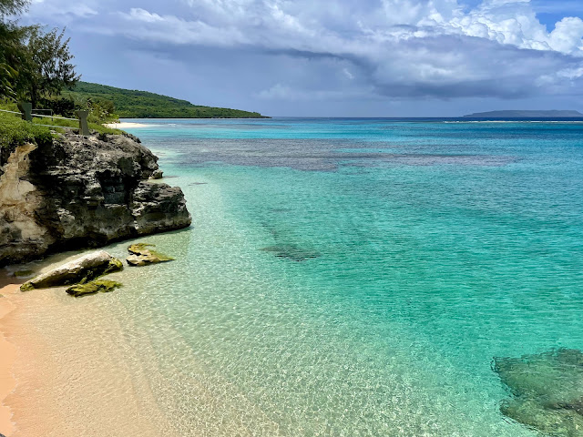
After leaving the North Field, we headed down towards the southern end of the island. We were unexpectedly greeted by the clearest blue waters at Taga Beach – the cleanest, clearest ocean water I’ve ever seen, with zero tourists on the beach. It was directly across the street from the Tinian Dynasty Hotel and Casino, which had closed due to various lawsuits (this seemed to be a recurring theme with Chinese investors in the CNMI) and now the hulking building looked like something out of a zombie video game. Very sad! But I guess it meant the beach would stay sparsely visited, which will hopefully keep it pristine...
The crystal clear waters of Taga Beach

At the furthest south-eastern point on the island is Suicide Cliff, where during the Battle of Tinian in late July 1944, hundreds of Japanese citizens and soldiers jumped to their deaths. There are several shrines to commemorate those that died. These suicide cliffs, that exist also on Saipan, highlight the cultural difference between Eastern and Western philosophies. For the Japanese, it was a dishonor to surrender, and the Emperor and Japanese Army encouraged civilians and soldiers to take their own lives. It's a beautiful yet somber spot.
For lunch we stopped at JC Café (as recommended by our car rental clerk) in the little town of San Jose, and it seems like it is the best (and possibly only) restaurant on the island. It was actually quite good, and the people there were so nice and friendly! I even bought a jar of their chili sauce, made with the locally grown Tinian peppers.
 
Near JC was the House of Taga, the remnants of a prehistoric megalithic structure said to be the home of the 10 ft. tall giant Guamanian chief Taga. Because of his strength, his own father tried to kill him so he jumped off a Guam cliff and landed on Rota, where he lived and married. He then traveled to Tinian, where he impressed the chief so much with his feats of strength that Taga was named chief of the island. He built himself a home, the remains we see today. Of the original twelve 15-ft tall latte stone pillars, only one remains standing. 


According to legend, Taga's wife had 12 children, but when one son showed greater strength than his father, Taga got jealous and killed him. His youngest daughter killed him in retaliation, then died of grief. The 12 latte stones contain the spirits of his 12 children, which can only be released when the latte stone falls; the last remaining standing stone contains the spirit of the murderous daughter.
The first recorded illustration of the House of Taga,
by British Commodore George Anson, 1742
Do NOT put a scratch the car, they said...


We took 8th Ave (and a slight detour to Riverside Drive due to a closed road - it started raining and Erin had to open two cattle gates along the VERY overgrown and narrow trail) back up to the SeaBee Memorial. 
The Seabees were the Navy's Construction Battalion, who quickly finished the North Field construction in 45 days to ready it for the US bombers. 

By then it was raining, and time to head back to the airport. Because of the weather, the two flights ahead of us (the green and blue flights) had to turn back from Saipan, so we were lucky to get off the island. 

The four of us originally were on the same flight, but the chief of staff of the mayor of Tinian missed the call to get on his plane, so he bumped Erin off our flight and onto the next. They're clearly very casual around here - he ran out onto the tarmac yelling that they forgot him, and the man helping us board took one look at him and said, "Oh, shit." Not really what you want to hear from the airport official... 

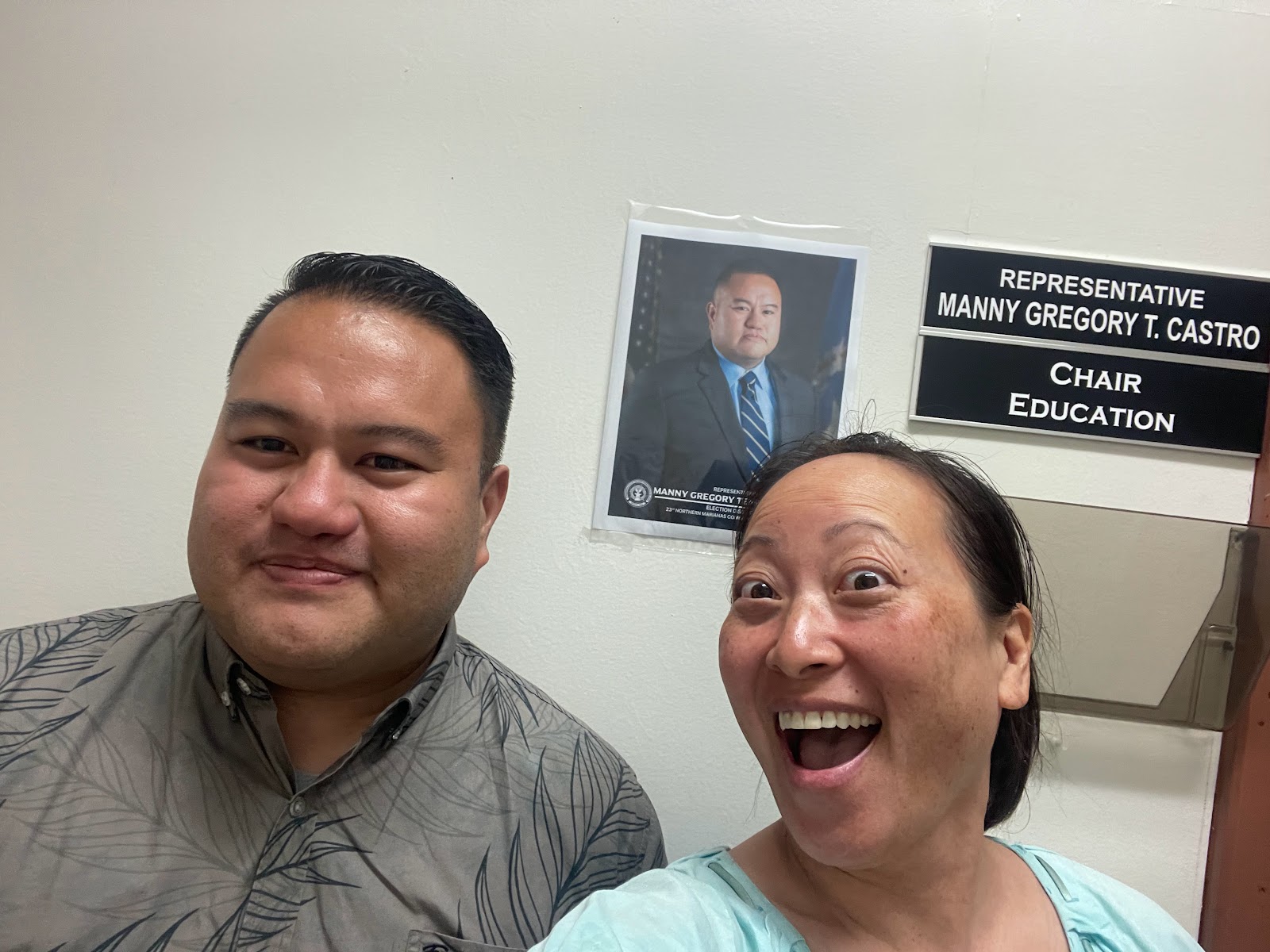
Also on our flight was Saipan congressman Manny Castro from District 2. When he heard we were teachers, he told us he was the Chair of the Education Committee! He was really friendly and ended up driving us back to our hotels, and then came out to dinner with us. 
He was a wealth of information about the history of Saipan and about some of the politics and economic stories of the CNMI, and so friendly! Plus, he seems to be related to pretty much everyone else we met on the island... such is small town life!

Overall, we loved our visit to Tinian. It was a surprising adventure, historically meaningful but a beautiful, sleepy little island that I would encourage anyone to visit.

Tuesday, July 11, 2023

Marianas Part I: Guam - Where America's Day Begins

My third trip of the summer was to the NEH Landmarks of American History & Culture Program Saipan's Land and Sea: Battle Scars & Sites of Resilience to learn about the Battle for Saipan. My knowledge of World War II barely extends past the European theater, yet the vast majority of the US’s involvement in the war was in the Pacific and the effort to stop Japanese expansion.

With such a long distance to travel, I decided to go a few days early and see the nearby island of Guam. It's also a part of the Mariana island archipelago, a chain of (mostly) dormant volcanoes about 1500 miles south-southeast of Japan. In case you didn't know (and don't lie - you probably didn't), the Mariana Islands are about halfway between Japan and Papua New Guinea, in the Western Pacific. The Marianas are actually broken up into two political regions: Guam - a territory of the US, and the Commonwealth of the Northern Mariana Islands (or CNMI) - a commonwealth of the US. (As an aside, commonwealths have a bit more control of their internal government than territories, but neither have representation in Congress.)

* * * * *.* * * * * * * * * * * * * * * * * * * * * A BRIEF HISTORY BREAK * *.* * * * * * * * * * * * * * * * * * * * * *

The history of the Marianas is fascinating and complex. The indigenous people of these Pacific Islands are the Chamorros, who have lived here for thousands of years. Magellan first came to the Mariana Islands in 1521. A hundred years later, Spain colonized the islands, since it was a good stopping point between Mexico and the Philippines - it was named the Marianas after queen Mariana (and the Philippines was named after Philip II of Spain). When Spain lost the Spanish-American War in 1898, it ceded Guam to the US. It sold the Northern Marianas to Germany, who had brief control of Saipan until it was lost to Japan during WWI.

In the early 1900’s, Japan began its Imperialist expansion throughout Asia and the Pacific. It invades China in 1937, then Indonesia (then part of the Dutch East Indies) in 1940. To stop its expansion, the US bans the sale of oil to Japan on August 1, 1941. In retaliation, Japan attacks Pearl Harbor on December 7, destroying the US Pacific Fleet. At the same time, Japan attacks Wake Island and Guam. They make a critical mistake though, and leave the dry docks in Hawaii intact when they retreat - allowing the US to salvage and repair many of their sunken battleships. 

Throughout the rest of 1941 and into 1942, Japan captures Guam, Wake Island, Hong Kong, Singapore, French Indochina, the Philippines, and Burma. In May of 1942, the US stops Japan from advancing on Australia, and in June at the Battle of Midway, the US neutralizes the Japanese Fleet. The US then goes on the offensive starting in early 1944 and begins recapturing the Pacific. The plan in Mariana Islands is a campaign known as Operation Forager - the US recaptures Saipan, Guam, and Tinian, then constructs airfields where B-29 bombers could take off and reach the Japanese home islands. 

It was from Runway Able on Tinian’s North Field that the Enola Gay took off carrying the atomic bomb 'Little Boy' on August 6, 1945, flying about 6 hours to reach it’s primary target of Hiroshima. That first atomic bomb, combined with 'Fat Man' dropped on Nagasaki on August 9, finally prompted the Japanese government to sign the Instrument of Surrender on September 2, 1945, ending World War II.

* *.* * * * * * * * * * * * * * * * * * BACK TO OUR REGULAR PROGRAMMING * *.* * * * * * * * * * * * * * * * *

I met up with teacher Erin (from Wisconsin) in Honolulu, who would be my travel partner and roommate during the trip.
 
Damage at the Guam Reef Hotel
We made it into Guam after a v-e-r-y long day of traveling (and crossing the International Date Line), picked up our rental car, and made our way to the Guam Reef Hotel in Tamuning, just a short drive from the airport. About a month before we arrived, super typhoon Mawar had hit the island with the strongest tropical storm in over 20 years, causing millions of dollars in damages. The aftermath was obvious, with many toppled trees, missing street signs, and broken or mangled roofing. The main entrance to our hotel was closed, the restaurant downstairs was completely destroyed, and an entire wing of the hotel was blocked off because of damage.

SATURDAY, JULY 8
The next morning we woke up early and headed out to the Guam Farmer’s Market in Dededo. It was a small outdoor market where it seemed like locals go to buy produce - not too many stalls open, so the souvenir booths were scant. There were also a few food trucks, so we decided to get breakfast – copying several of the locals, we had batchoy – basically a ramen soup. We also got huge smoothies (mango strawberry – yum!) since it started getting hot.
Our next stop was the T. Stell Newman Visitor Center – the main VC for the War in the Pacific National Historic Site. There are 7 different National Park units around the island that make up the park, but not all are maintained so friendly Ranger Shannon gave us tips on where to go. Since it was so hot and humid – and since we had another two days on the island, Erin and I decided to break up the outdoor activities and just take our time exploring.


We first went to Ga’an Point in Agat, where American forces landed on July 21,1944 during the battle for the liberation of Guam. 
Ga'an Point, Agat Beach
The site was strategically located just to the south of an important airfield and supply port on Orote Peninsula. A shallow reef meant it was easy for troops to wade onto the beach, but the Japanese heavily defended the area with several pillboxes built into the coral outcrops, as well as concrete bunkers. The Americans suffered heavy losses since the Japanese had a strong defensive position, but ultimately secured the island on August 10. 
Nature is metal on Guam!


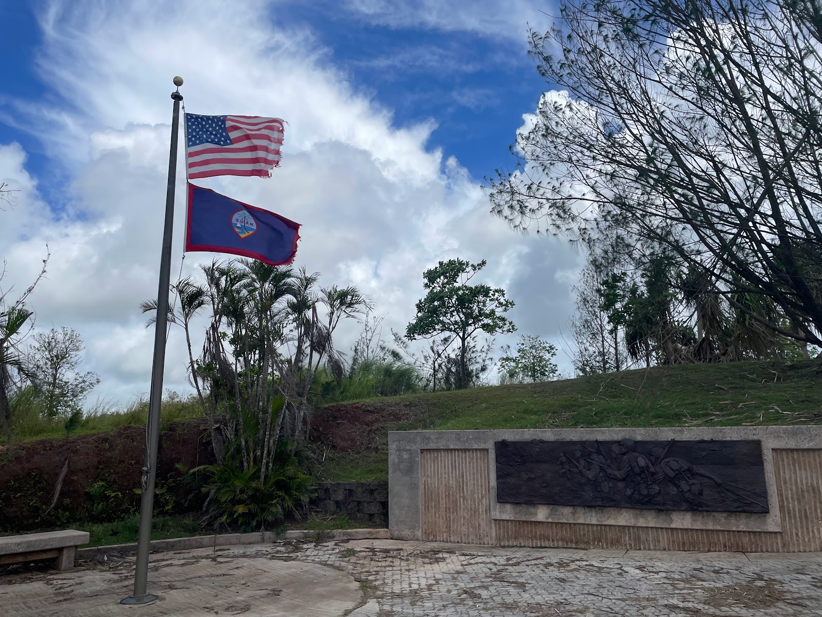
From Agat, we decided to drive around the southern end of the island. A quick stop at the Guam Veterans Memorial gave us lovely view of the Bay of Umatac, and we drove around to stop at Fort Nuestra Señora de la Soledad. 
Lookout! It's the Nuestra Señora de la Soledad lookout!

This Spanish fort was built between 1802 and 1819 to protect galleons traveling between Mexico and the Philippines. After Mexican Independence in 1815, the route stopped being used and the fort was abandoned. 

We crossed back over the middle of the island via route 17 (after getting slightly lost - but you can't really get lost on this small island), then stopped for lunch at the Taco Shack as recommended by Ranger Shannon. 
Erin and I then decided to visit the Fish Eye underwater observatory. It was surprisingly fun – walking a 1,000 ft boardwalk across VERY shallow Piti Bay to the observatory, then down a spiral staircase about 30 feet underwater. There were plenty of fish around the coral reef just outside the viewing windows, and there were hanging feeders that also attracted more fish. We even saw a few black tipped reef sharks swimming around!
 
Blue Linckia sea star
The west side of the island is interesting because it is shallow and you can walk fairly far out into the surf, and the water is so clear that you can easily see to the bottom. As we walked across the boardwalk, dozens of bright blue starfish were scattered throughout the sandy bottom. Beautiful!
Guam shore is pretty!

The view of Tumon Bay from
our room, and Two Lovers
Point in the distance
The last stop on our agenda for the day was Two Lovers Point. Guam is weirdly devoid of signage, and it took a few tries to find the right road only for us to discover a very random and lonely guard telling us it was closed (we later found out it was because of typhoon damage). Oh well – we can actually see it from our hotel room, so we’ll just imagine what it’s like…
 
Erin and I decided we weren’t up for going out to eat, so we decided to look for a grocery story to see if we could scrounge enough for dinner. After another driving adventure, we ended up at Payless Supermarket – where we discovered that food was very, VERY expensive, and there was very little available. Fruit (apples) were around $8/pound, string cheese was $12 for a package, and a carton of soda was $9. We got the last two straggling containers of yogurt, and I ended up with a ramen cup for dinner and an instant oatmeal for breakfast. We’ve decided it is actually cheaper to eat out than to shop for groceries!
 
SUNDAY, JULY 9
The next morning we decided to try hiking to Tarzan Waterfall, which we’d seen the day before during out drive around the island. What we didn’t anticipate was the wet, red mud, and since I was wearing old running shoes and Erin had even flatter soled keds-like shoes, we kept sliding on the steep hills. One thing we’d been noticing all over the island was all the storm damage from Mawar. On the hike, many downed trees crossed the path and we had to either climb over, crawl under, or otherwise make our way around them. After we made it about halfway down the mountain, we decided it would be a bad idea to continue (how were we going to get back up?!). Even so, it was nice seeing the local environment. 
 
We decided instead to try walking the short trail up to see the Piti Guns, another unit of the War in the Pacific National Historic Park. These coastal defense guns were placed on the steep hillside by the Japanese  - who forced the native Chamorro people to build the defenses and carry up the guns through the dense forest. In the end, when the US forces arrived in July 1944 the guns were not yet operational, so they were never fired.
 
After lunch, we stopped at Asan Beach where US forces first stormed the beaches of Guam. Because the US first shelled Asan and Agat beaches in the days leading up to the assault, the Japanese knew exactly where they planned to attack and they were heavily defended. Even so, Marines assaulted the beaches and captured Orote Peninsula, then moved inland. 
The shallow waters of Asan Beach, where salvage from the war can still be found

From Asan Beach, we drove up to the Asan Bay Overlook which gives a beautiful view of Asan and Piti. At the top, there is a memorial with the names of not just the soldiers, but the ordinary citizens who died during the war. On our way back down the mountain, we passed the Fonte Plateau Unit, on the plateau above Asan Beach. On it are two concrete bunkers that were supposedly the command center for Japanese General Takeshima.
 
We returned early to the hotel so we spent a little time in the water in Tumon Bay right outside our hotel, then in the hotel pool. For dinner we went to Three Squares, a nice restaurant a bit outside the main town, and on the waiter’s recommendation I tried the Tinala Katne appetizer – local-style dried meat, which basically turned out to be like Chinese bbq pork. It was a HUGE plate of meat, so I’m glad I paired it with what they called rice ginger soup – which was basically thick Chinese rice porridge. 

MONDAY, JULY 10
On our last day in Guam, we decided to see the World’s Largest K-mart. First, we tried again to see Two Lover’s Point (but it was still closed), and we killed some time at the Micronesia Mall since it was on the list of top things to do on Guam (it’s a mall. So we basically visited 1990 for an hour then left).
 
We did enjoy the giant K-mart. It’s very reminiscent of a Walmart, but unfortunately had no blue-light specials. But it did have a vast array of random snacks, which we stocked up on since it was much cheaper than the Payless supermarket from the day before. 
 
Lunch was at Meskla’s Chamoru Fusion Bistro, which turned out to be a hotspot for what looked like groups of locals doing business. I tried the Kelaguen Manok Ma’Chalek’ – a marinated grilled chicken with salad, which was totally delicious – exactly what I needed after a bit too much meat.
 
Since we had a bit of time before out 5:15pm flight, we stopped at the local “Statue of Liberty”, on a small promontory near the marina. We then drove to the far north of the island, which was basically uninhabited except for the military installation. The area seemed overgrown and jungly, and every so often there’d be a break through the greenery and we’d see some military buildings. At the end of the road was Ritidian Point, a gorgeous beach (that looked fairly deserted!) and we had a great view from the overlook.
 
But it was time to head for the airport and our quick flight to Saipan, the largest island of the CNMI. The Commonwealth of the Northern Mariana Islands, or CNMI, is a territory of the US consisting of 14 islands. The main three are Saipan, Tinian, and Rota, and the majority of the others are either uninhabited or inhabited by people living off the grid. Less than 50,000 people live in the entire CNMI.

We ran into another teacher at the airport and shared a taxi ride into Garapan. Immediately we could see the difference between the two islands in that there was much more greenery and there wasn't the storm trash that was littering Guam. We checked into our hotel – GT Guesthouse, which is a small family-run place right in the heart of the downtown. It’s old but clean and comfortable, and MUCH cheaper than the big hotels where most of the teachers are staying. Interestingly, many of the downtown area streets are closed up for construction (and, according to the locals, have been for several years because of the construction of a garish hotel that ended up going bankrupt). The street closures combined with COVID caused many of the businesses to fail, so unfortunately the area seems to be in decline. We"ll find out more in the coming week!

Sunday, July 2, 2023

🌊🚣The Ultimate Whitewater Experience: Rafting the Grand Canyon🚣🌊

High on my bucket list every since I can remember: rafting down the Grand Canyon. Finally, this summer I fulfilled my lifelong dream! 

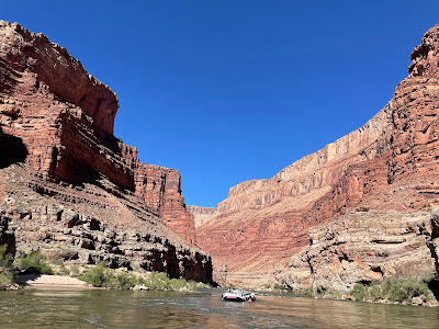
The Colorado River starts at 14,000 ft in elevation in the Rocky Mountains of Colorado and drops about 7 feet per mile, carrying rocks and debris that help cut through the sedimentary rock of the Colorado Plateau. Side tributaries add smaller canyons, and rain, ice wedging, and snowmelt contribute to weathering and erosion. After passing through Marble Canyon, it enters Granite Gorge and cuts down a mile in depth, exposing some of the oldest visible rock on earth. 

This is the Grand Canyon, one of the most famous whitewater rafting trips in the world. I was lucky enough to join the TIES (Teacher Institute for Evolutionary Science) Grand Canyon rafting trip. For 7 days, 28 science teachers and one geologist traveled by motorized raft down 188 miles, from Lee’s Ferry to Whitmore Wash with Hatch River Expeditions. 

I was particularly excited for this trip since I'd visited the South Rim of the Grand Canyon just two weeks prior, learning about deep time and the many layers of rock that surround the region. At the top of the Canyon where the Visitor Center stands, the rock is part of the Kaibab Formation – deposited 270 million years ago. But the further down the river we traveled, the deeper into the past we went – all the way to the 1.8 billion year old basement rock. We were about to see it all!!


Sunday, June 25 

Early on Sunday morning I flew to Las Vegas and met with several other teachers for the shuttle to Cliffdweller’s Lodge.  We'd meet up with the rest of the group and prepare for the next morning, where we'd be shuttled to the put-in at Lee's Ferry. (Funnily enough, there's no ferry at Lee's Ferry, just as there's no cliff dwelling at Cliff Dweller's.) For the next 6 days, we'd raft 188 miles of the Grand Canyon.
The fresh-faced, eager, CLEAN group.

Mon June 26 

Getting ready to load up!
The next morning, we gathered to prepare for our departure. We were to put our night bag into the large orange waterproof bag affectionately known as a pumpkin, which also contained our sleeping kit of a sheet, pillow, and sleeping bag. We also could get a small day bag (I used my own, which was much easier to find since it was neon green instead of orange). Then, we headed off to Lee's Ferry, at river mile 0 to load up our rafts!
AHOY! I'm ready to go!


There are three main areas of the S-Rig motorized raft - the front, known as the Bathtub, was the wettest since it was constantly getting splashed, even in the smallest riffles. The sides were a bit more protected but still got splashes coming in from the edge of the pontoons, and the 'tea room' in the back was the driest - but still got wet in the larger waves. Our charter group split between two boats - one captained by trip leader Josh and helped by swamper Zack, and the other by Holden who we later learned was Josh's son (and way later, on our final day, we learned this was his first ever trip driving his own boat)!

Ready for our great adventure!

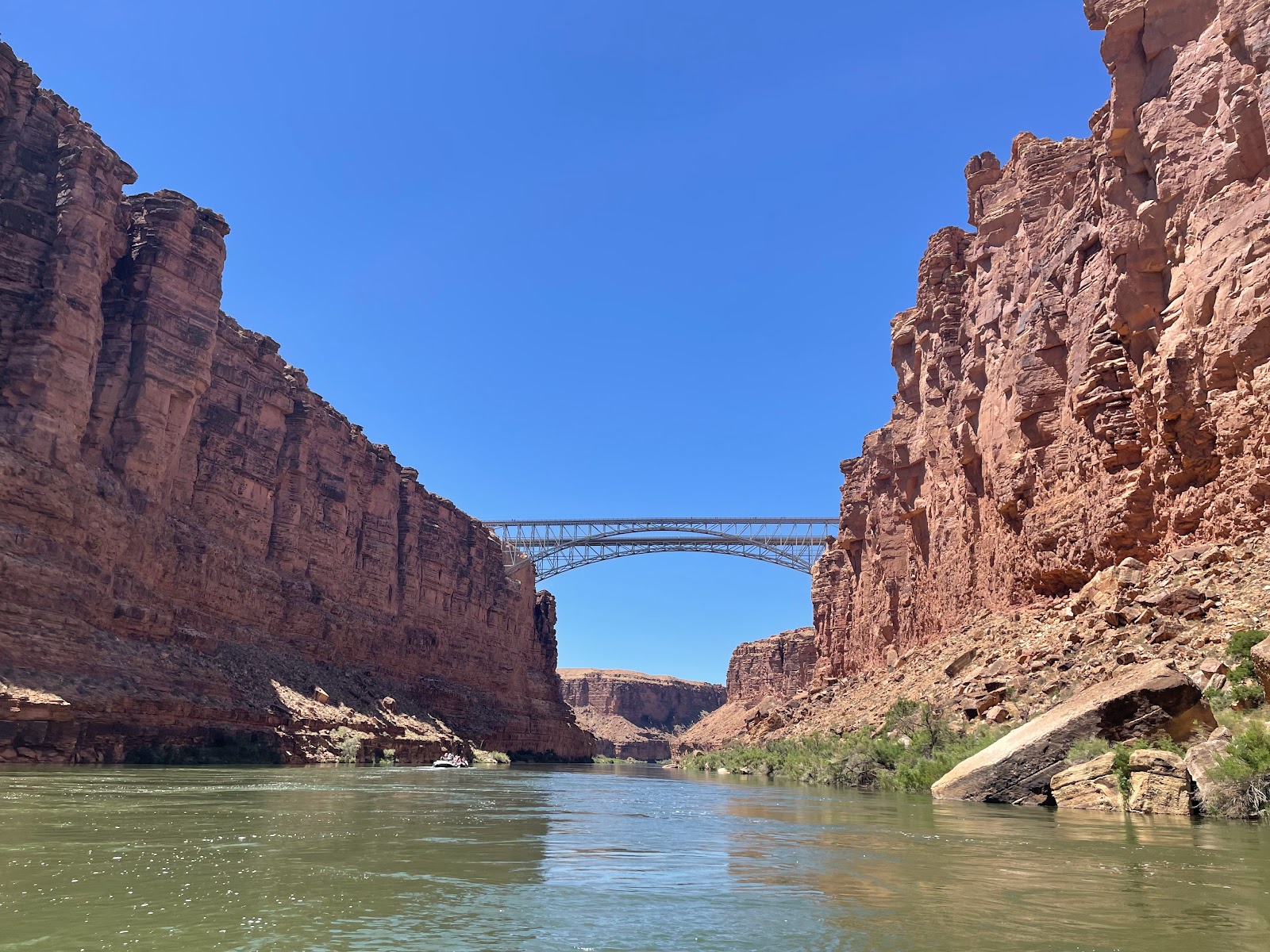
At this point, though we were technically within Grand Canyon National Park, we were actually in Marble Canyon - we wouldn't get into the actual Grand Canyon until Nankoweap. Our final glimpse of civilization was the Navajo Bridge, the last car crossing of the Colorado River until Hoover Dam, 350 miles away. Looking up, we actually saw two condors on the support beams under the bridge.  

That's me in the far left of the bathtub, as seen by
Amanda's family from the top of Navajo Bridge!

The Grand Canyon uses its own rapids rating system - while most rivers use a I-VI system (I being calm water and VI being unraftable), the Grand Canyon rates its rapids on a 1-10 scale. We started the trip with several significant rapids, including Badger Creek (5-6), Soap Creek (5-6), and House Rock (7-8). But most of the ride was peaceful and scenic, and we just enjoyed the majesty of the canyon.


Justin, enjoying a groovy view
Swamper Zack, preparing
another delicious meal!
That night, we camped at Lone Cedar (mile 23). Getting the boats unpacked required a 'fire line', where we all helped to unload the pumpkins, cots, chairs, and kitchen. We then found our individual spots to camp and set up our cots. We learned how to use the groover, our portable bathrooms that were set in private places on the far end of camp, often with the loveliest of views. Dinner each night was delicious and plentiful, including appetizers and dessert. It was amazing what they can do at the bottom of a remote canyon! 

Tues June 27 

The day began with a series of rapids in quick succession: Georgie, 24.5 Mile, Hansbrough-Richards, Cave Springs, and Tiger Wash.

We'd just started getting hot when we turned a corner to find an interesting sight. An underground karst system brings groundwater to the side of the canyon, creating surprising waterfalls that appear out of the side of the dry limestone cliff. This was Vasey's Paradise - Powell named the unexpected patch of green after his botanist friend George Vasey, who had traveled with him on a previous expedition. 


Redwall Cavern looks so tiny!


In this area of the journey, the steep cliffs of the canyon walls rose up directly from the river. We were traveling through the Redwall Limestone formation, and just around the next corner, a natural amphitheater was carved by the outer bend of the river during high river flows. Redwall Cavern was dwarfed by the tall canyon walls around it, but as we got closer we could see how big it actually was. 

John Wesley Powell estimated the cavern could hold 50,000 people!

Nautiloid
After a brief stop in Redwall Canyon, we continued on to Nautiloid Canyon where we stopped to look for paleozoic fossils. We found several corals, crinoids (fan-like sea lily), and brachiopods.
Fossil-hunting with Len


Thank goodness the Marble Dam proposal failed!
In the 1940s, the US Gov’t wanted more hydroelectric power and proposed a dam in Marble Canyon. Luckily, there was huge public outcry led by the Sierra Club and the proposal was scrapped. Nonetheless, we could see remnants of the Marble Canyon Dam site around mile 39.

The logs were huge, but barely
discernable on the towering cliffs
Near here, about 300 ft above the river, we could just make out the remnants of a prehistoric pine footbridge used by ancestral Puebloans to hike in and out of the canyon. The giant logs were probably huge, but from the river they looked like toothpicks.

Camp on the second night was at Nankoweap (mile 53). As we were setting up camp, we endured significant gusts of wind, and one of the heavy kitchen tables blew over and hit our boat driver Holden in the leg. For a while, they thought his leg might be broken and debated calling a helicopter to get him out of the canyon, but luckily after sitting in the river to ice it down, he felt better and was able to continue on the trip. Very scary!

High above Nankoweap on a steep slope are four granaries – storage units that Puebloans used 1,000 years ago to store the crops grown on the delta below. The hike isn't that long, but it's a steep (and very exposed) climb up.  


We could only imagine those ancient people carrying their corn and pumpkin seeds up the nearly vertical cliffs, keeping their food dry during floods and protecting it from hungry critters. 

Nankoweap: Not for the acrophobic!


From the top, it is an amazing view downstream into the Grand Canyon, our camp, and the meandering river below. 

That evening, we gathered around to get to know each other - there are 28 teachers and one geologist, plus our three guides (Josh, Holden, and Zack). While we were standing in a circle, something flew into my hair - Roger who was standing next to me confirmed that it was a bat!! Who knew bats really did that??

It's an unbelievable blue

Wed June 28 

Such a contrast between the waters of
the Little Colorado and the Colorado


My favorite stop of the trip was the confluence of the Little Colorado River with the main Colorado, at mile 62. Dissolved calcium carbonate in the river water has turned the Little Colorado River an unbelievable robin’s egg blue - I'd seen pictures but had always assumed they were manipulated or oversaturated - nope - it really was a vibrant baby blue. Additionally, travertine deposits on the rocks turn them white, so it looks like a long swimming pool. We stopped to swim in the river, wearing our life jackets as sitting floaters as we bobbed downriver. Ali and I even made a little train! Glorious!!
With my new pals Jenny and Dustin
The 1956 crash site
This is also where the canyon becomes deeper and becomes the proper Grand Canyon. Soon after leaving the Little Colorado, Josh pointed out the remnants of a crashed airplane. In 1956, a TWA Super Constellation collided with a United Airlines DC7 in what was at the time the greatest aviation disaster in history. At the time, rules of flight were by visual contact even though the number of flights had skyrocketed after WWII. The crash, which killed all 128 people on board both flights, caused the creation of the FAA. 

Three weeks prior, I'd looked down at the Colorado River from the South Rim overlook at the Desert Watchtower. It was weird to look up from the river at the teeeeny tiny tower high up on the rim at mile 66!

Zoom in to see the teeny tiny tower!
The view of the Colorado River from the
Watchtower, on June 5

Fluid escape structures
Our lunch stop also included a hike to see “not that interesting geology” (around mile 70). It was on a shadeless open beach, which was very very hot! It wasn't that far to go into a nearby canyon where Len showed us some fluid escape structures, caused by dewatering - when water got trapped in the earth but was agitated, it would eventually 'erupt' out of the ground causing these swirling wave patterns in the sand.

Since it was so hot and we were about to hit some big rapids, Dustin convinced me to sit in the bathtub for the rest of the afternoon ride. And we did have several large and fun rapids, including Hance Rapid (8-9) and Sockdolager Rapid (7-9). In the bathtub, you are constantly bombarded with walls of water - and since the water comes from the bottom of Glen Canyon Dam, it's COLD - around 48-50°, as compared to the 105° air temperature. But while you're moving down the river, the wind continually blows on your wet clothes (which stay wet with the splashes from the river) so I was surprised that on several occasions I was actually shivering!

The black Vishnu Schist is intruded
with pink Zoroaster Granite
This is also the area where Vishnu Schist and Zoroaster Granite first appear - so now we knew we had entered the inner gorge. These basement rocks were formed during the early Proterozoic around 2 billion years ago.

The bridge to Phantom Ranch
We passed Phantom Ranch at mile 88, and camped that night at Trinity Creek (mile 92). 

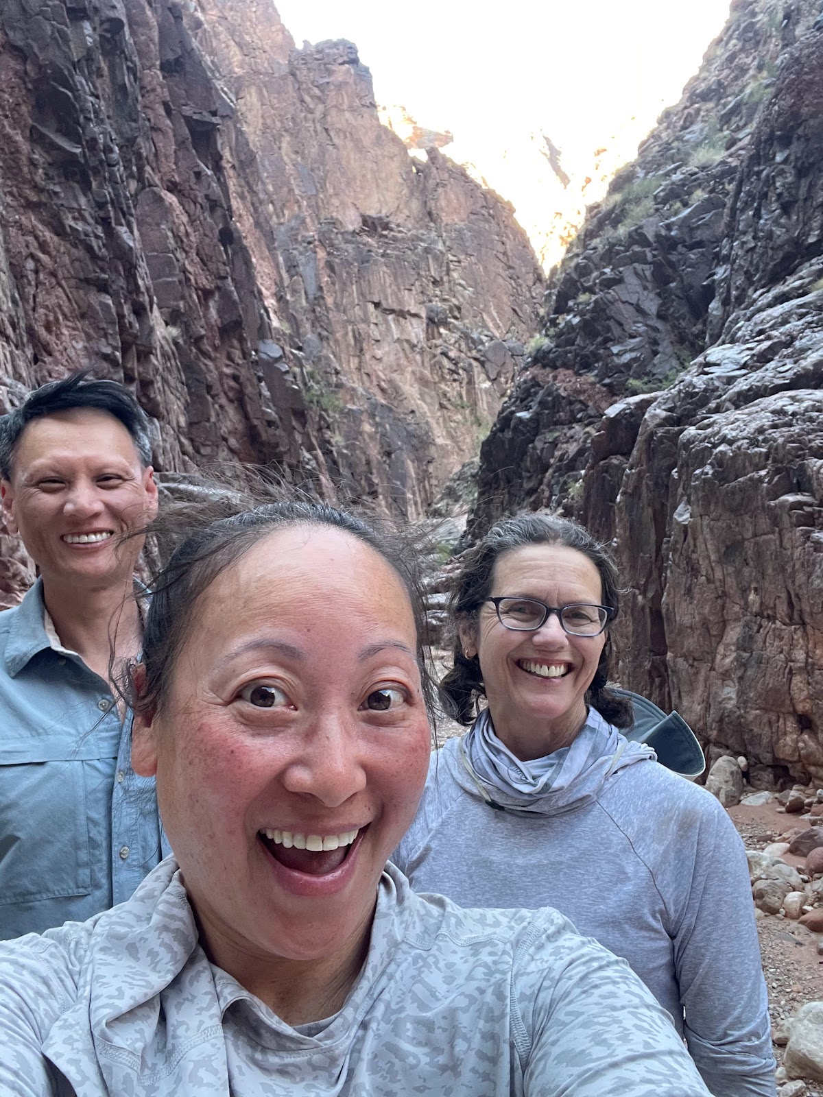
Behind the canyon groover, there was a nice hike into the gorge, so Dustin, Jenny, and I decided to explore before dinner. It was fun sliding down the rocks to get out! After dinner we even tried to find scorpions in the gorge with my blacklight - even though we didn't find any, we did find some strange day-glow orange fluorescent rocks.


There were some pretty fun animals that we saw in the canyon, like bighorn sheep, pink rattlesnakes, collard lizards, and even one poor ornate tree lizard who had grown a second tail:


Thurs June 29 

The next morning started wet, with a series of rapids (Granite, Hermit, Crystal, and the gem rapids) in quick succession.  Crystal rapids became much larger overnight from a debris flow in 1966, when car-sized boulders came down the side canyon during a flash flood. Pre-dam times, periodic flooding would disperse smaller boulders to make the rapids smaller, but not anymore! 

One lovely side hike was to Elves Chasm, a moss-covered waterfall not far from the river. There was a deep pool so a few people jumped in from an opening in the rock, but many of us were way too cold to get in!


We did stop at Blacktail Canyon to see (and touch!) the Great Unconformity. This is where we could see a nearly billion year gap in geologic history, between the 505 million year old Tapeats (marine/beach) sandstone sitting directly above the 1.2 billion year old Vishnu Schist. For our group of science nerds, this was geology heaven! 

A billion years, at my fingertip!
For an extra treat at our Stone Creek campsite (mile 132.5) that night, a small waterfall lay at the end of a short hike. This became our first “shower” in 5 days! 

Fri June 30 

Dustin, jumping into the narrowest
(and deepest) part of the river
After passing the narrowest point in river, at 76 ft wide (and where a handful of people braved the cold and jumped in), we stopped for a leisurely morning at Deer Creek Falls. 
The hike to the Patio

While some of the group stayed at the bottom of the falls,  the majority chose to hike up to the top, following a narrow canyon carved into the Tapeats sandstone. 

At one point, we had to hug the cliff as we maneuvered across a narrow ledge with a sheer drop into the slot canyon below. Hidden along the walls were different pictographs of handprints - some say they were put there by the Ancient Puebloans, others thing they're a hoax left by bored boatmen. At the end of the hike, we found a lovely little oasis with an unexpected stand of cottonwood trees - an area known as the Patio. It was a nice area to lounge around and relax.

Cooling off after a hot hike!

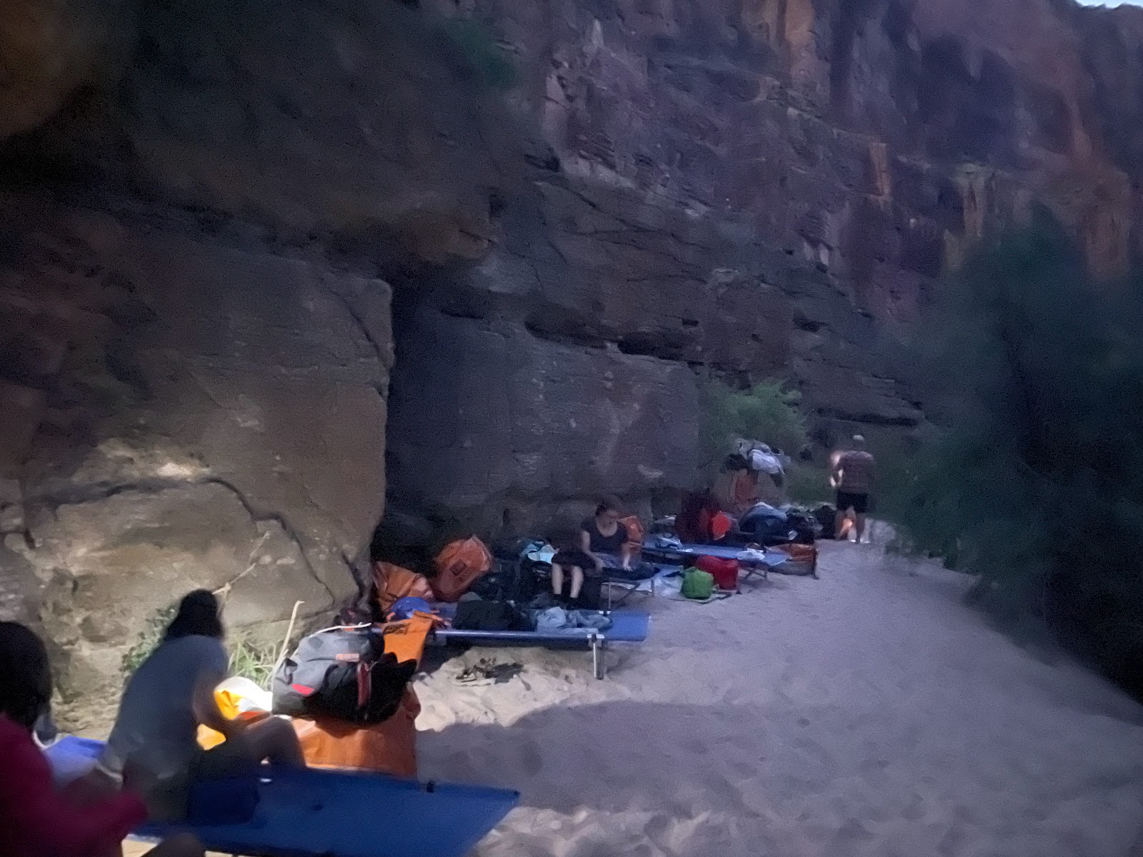
Camp that night was at the Matkat Hotel, a narrow ledge nestled at the base of a sheer cliff wall. With virtually no beach, we found sleeping spots in a row against the rock. It was like sleeping next to a furnace, since the rock sat baking in the sun all the day and radiated heat all night. 


Sat July 1 

Our final full day in the Canyon started with a harrowing (for our boat drivers) stop at Havasu Creek. Since the pullout was in the middle of a rapid, it was harder for them to tie off (and in fact another boat that came after us pushed our (Holden's) boat so close to the adjoining boat that we couldn't unhitch from Josh's boat, so when we left Zach had to make a daring quick-clip-jump maneuver to get us safely out of the rapid.) 
The lovely waters of Havasu Creek


But Havasu was worth it - we climbed around in the Travertine ledges and boulders and played in lots of small pools and waterfalls. The area was much more crowded than any other place we'd been - the guides called it HavaZoo, but it was still well worth the visit.

Shortly thereafter, we reached the edge of the National Park and the border of the Hualapai Reservation. The landscape was distinctly volcanic, with dark black waves of lava clearly identifiable - this area is known as the Uinkaret Volcanic Field, an area of 213 cinder cones. All around we could see remnants of the lava dams that once reached from Lee's Ferry down past Lava Falls, as well as peacock tail and fan structures formed by cooling lava. 
The columnar basalt of the Uinkaret Volcanic Field

August 25, 1869 – “Great Quantities of lava are seen on either side; and then we come to an abrupt cataract. Just over the fall a cinder cone, or extinct volcano stands on the very brink of the canyon. What a conflict of water and fire there must have been here! Just imagine a river of molten rock running down into a river of melted snow. What a seething and boiling of waters; what clouds of steam rolled into the heavens!” ~ Powell Report 

Soon we saw a large volcanic plug jutting out of the river - Vulcan's Anvil, the marker that warned us the most notorious rapid on the river, Lava Falls, was just a mile ahead. It's flat water for that mile, but as we got closer, the low hum became louder and louder until it was an ominous thunderous roar. Lava Falls, a class 10 (on the Grand Canyon 1 through 10 rapids rating system), was formed in the sediment debris of the alluvial fan accumulated at the foot of Prospect Canyon. The rapids at Lava Falls are famous for the giant Ledge Hole that has capsized many boats, and the V-Waves along the side. Nonetheless, we tackled it head on (much easier to do in a motorized raft), and came out the other side with no casualties.

The final night was spent at Whitmore Wash, where in the morning we were picked up by helicopter and taken to Bar 10 for a cleansing shower. In that final 24 hours, I took a raft, helicopter, van, plane, bus, train, and car. Phew.
Bye, Colorado River!


The plane back to Las Vegas
Things I learned while rafting the Grand Canyon:

1. After crossing Navajo Bridge, you’re completely cut off from the rest of the world. No phones, no internet, no signs of civilization! It hit home when Holden was injured and we wondered how they were going to get him out, and how a replacement guide would get to us. I also wondered what it would have been like for a group to set off right before the start of the pandemic, then come out at the other end not realizing the world had completely shut down. What a surprise that would have been!

2. There is sand E V E R Y W H E R E. In all the places. In your hair (but you aren’t washing it anyway), your sleeping bag (after day 1, you’re dirty anyway so who cares), your sunscreen (which makes for a lovely facial every time you reapply), and in all your food and drink. Nuthin' like crunching your Gatorade.

3. It’s dry dry dry down there! Your fingers and toes start feeling like sandpaper, and you have to constantly drink water...

4. …which makes you have to pee a lot, but there is zero privacy, and after half a day, there’s no shame. At each stop, all the women go in one direction and just squat together, in a line, butts in the river - when you gotta go, you gotta go.

5. Speaking of pee, you aren’t supposed to pee in the groover, so you have to learn to pee first into a bucket, do your business in the groover, then carry your pee to the river to dump it out. Makes for some strong pelvic muscles.

6. There’s something ineffable about sleeping in the open at the bottom of the Grand Canyon. At night, the looming black cliffs tower above you, and only a slice of sky is visible - full of the brightest of stars. A palpable blanket of heat radiates off the rocks, making even a sheet too uncomfortably warm. The constant roar of the river sings you to sleep. It’s sublime.

7. Nothing can prepare you for that heart-pounding buildup as you approach Lava Falls. There’s smooth, calm water in the mile leading up to it, lulling you into a sense of complacency. Then the low rumble reaches your ears, and you sit up straighter and hold onto your straps tighter. As the thunder grows louder, you begin to feel it in your chest. Your hands tighten into a death grip as you plunge into that first hole, a wall of water crashing over the entire boat and you bounce off your seat as you plummet into the second drop in a disorienting, dizzying rollercoaster ride. It’s thrilling and humbling and impossible not to let our an exuberant whoop of triumph when you come out the other side, soaking wet but still in the boat!

8. It’s a jarring transition to return to the ‘rim world.’ After six days of lazily floating down a pristine and isolated wilderness, getting pulled out by helicopter is instantly going from 2 billion years in the past to the epitome of technological advancement. Being at the bottom of the canyon is hard. But being at the top makes you appreciate every moment of the experience.

Thank you to Bertha, Kenny, Len, TIES, and all the teachers who made this a wonderful memory!

We survived!