For this year’s Spring Break, I really wanted to tour in and around the parks of the Great Plains & Black Hills, in South Dakota, Nebraska, and Wyoming. Seeing this area of the world had been on my wish-list for a long time and was so excited when my friend Julia decided to join me on this National Park road trip. We flew into Rapid City and picked up our rental car late on Friday, and off we went!
MINUTEMAN MISSILE NATIONAL HISTORIC SITE
During the Cold War, the US and USSR battled for global dominance through conflicting culture, politics, and economics. Each nation began building up their nuclear arsenals as a deterrent – each believed that having these missiles that could potentially devastate the world would prevent an attack because the aggressor nation would fear retaliation. It was basically a global game of chicken, played right in our backyard, with no winner - the end result if anyone fired was mutually assured destruction. Luckily, we never went to war (and it really was sheer luck – we came uncomfortably close).
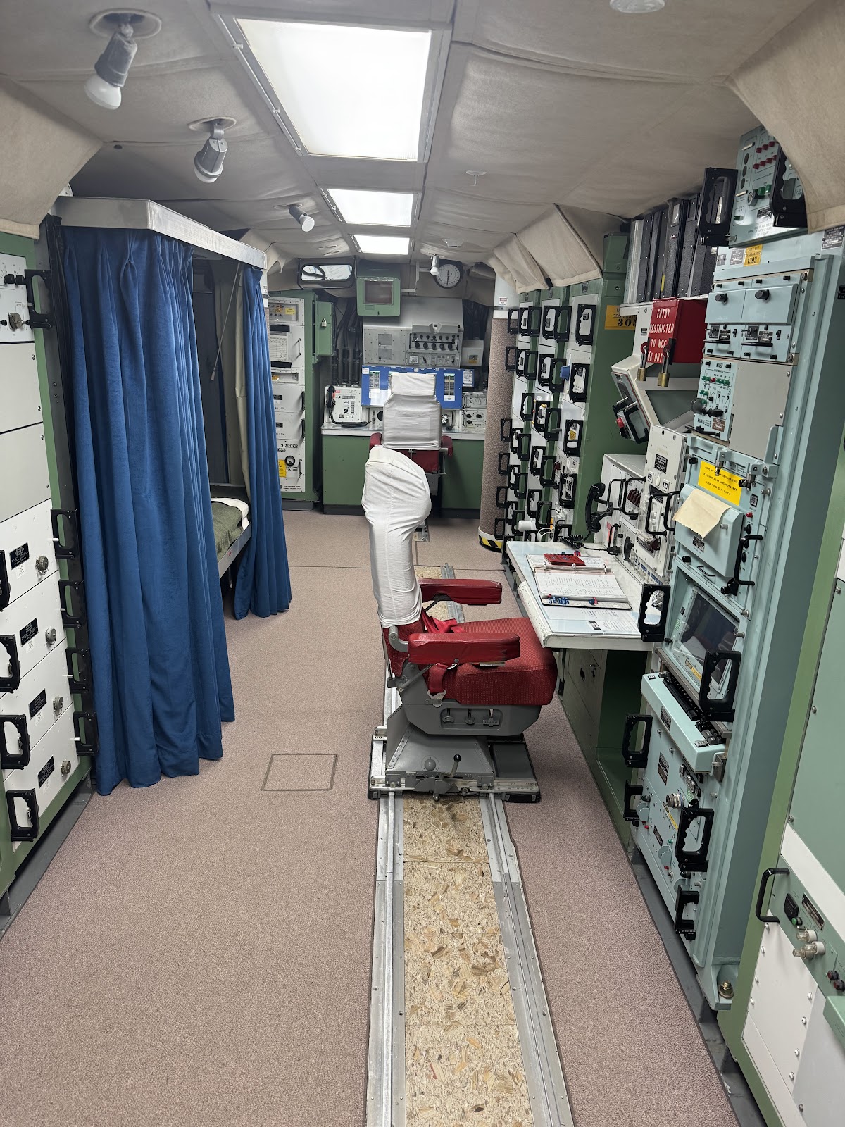
We got to tour the Delta 01 facility, the control center for the 10 Minuteman Missiles that surround it. The Minuteman II intercontinental ballistic missile (ICBM) was a solid-fueled missile designed in the mid 1960’s to carry a single nuclear warhead over 6,000 miles within minutes. The facility that was home for the soldier technicians was actually much nicer inside than I had anticipated – looking very much like a normal ranch house, with a shared recreational space decked out straight from a 1980’s living room. A kitchen, bedrooms, and guest rooms allowed the 8-person crew to live there for their 3-day shifts.
 |
| The 8 ton blast door |
But 31 feet below them, in a tightly secure control room located behind an 8-ton blast door, two missileers were locked in for 24-hour shifts to monitor and potentially launch the 10 minuteman missiles located in silos scattered around the surrounding prairie.
 |
| Just like in War Games...! |
All around South Dakota, Nebraska, and Wyoming, 100 Launch Control Centers controlled 1000 Minuteman Missiles from 1963 until the 1990s. They were hidden here in the seemingly vast and empty land because... hey! Who'd woulda thunk something so terrifying would be here in the bland prairie??
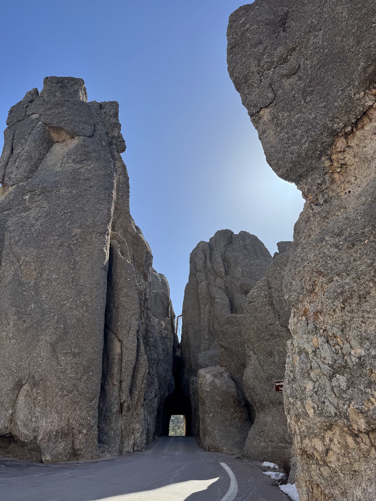
BADLANDS NATIONAL PARK
Julia and I met up with our friend Anne Lewis, another Nat Geo GTF and Explorer, who hung out with us in the Badlands. She introduced us to The Bearded Ranger, the social-media-famous Ranger Ed, who spent the next two days hanging out and showing us around the park. We started off seeing the Paleontology Lab (which had yet to open for the season, but Ed gave us a private tour), where we learned about the preservation of fossils found around the park. And there are a LOT of fossils.
Badlands is a vast mixed-grass prairie that features one of the world’s richest fossil beds from the Oligocene (23-25 million years ago). Years of wind and water have eroded the underlying layers of sedimentary rock into colorfully sculpted pinnacles, hills, and canyons.
 |
| Getting a paleontology lesson from Ranger Ed |
 |
| Up, up, up the Notch Trail! |
Ranger Ed took us to the Notch trail to look for fossils, and very soon we saw that they were everywhere!!! There were fossilized turtles, as well as teeth, jaws, and bones from oreodonts (camel-pig like mammals), horses, and nimravids (saber-toothed cat-bear carnivores). At first I didn't notice anything, then Ed kept pointing out exploded-round features all over the landscape - ancient turtles!
 |
| Baby brontothere skull |
It was especially mind-blowing when Ed took us off-trail to see the fossil of a baby rhino-like brontothere!! The skull was imbedded in a large hard-to-move rock, so it was just left in the field.
 |
| Fossil tortoise |
 |
| Clastic dike |
This area is a feast of geologic features. The Badlands are known for its distinctive landscape, and many of the formations of ridges and peaks are kept from eroding because of the clastic dikes that provide a stable foundation underneath. A clastic dike is a layer of different, usually erosion-resistant material that cuts through the other rock layers. We could see these dikes crossing through the landscape.
The most fun was when Ed showed us a peculiar characteristic of fossils that help us identify them. Unlike rock, if you lick a fossil it will stick to your tongue. Because fossils have that porous structure of the original bone, it draws moisture from your tongue into the pores through capillary action. Julia made a tiktok of Ed explaining this phenomena, and it has nearly 20,000 likes!
We stayed in Wall, South Dakota, which is known for the ginormous Wall Drug. This cowboy-themed drug store is the epitome of the kitschy American roadside attraction – established in 1931 as a depression-era pharmacy, it lures in customers with miles and miles of hand-painted billboards, free ice water, and 5¢ coffee. The diner inside is like a museum of cowboy art. It’s also now famous for its donuts (and boy howdy did I partake!!)
 |
| Fossils are everywhere! |
The next day, Ed took us back to the Door and Window area and went off-trail to fossil hunt. Again, it was astounding seeing fossils everywhere and made me realize that I don’t take the time to slow down and observe the world around me. I definitely got better at spotting them as we went along, but it was still thrilling to see perfectly preserved jaws and teeth still imbedded in the layers of soil!
Another thing I loved while in the grasslands was seeing prairie dogs. These social rodents (not dogs!) live in complex tunnel systems known as towns, and their burrows are also home to snakes, black-footed ferrets, and owls. Julia found a lovably catchy Bruce Hornsby song, Prairie Dog Town, that became our soundtrack for the trip!
 |
| 🎵Poppin' up, poppin' down, 🎶 Burrowing making their funny little sounds🎵 |
I loved hearing the chirps, barks, and squeaks of the prairie dogs communicating with each other, and was sad to learn of their population decline due to habitat loss and disease. (Did you know? Bubonic plague still survives in the fleas of the prairie dog population!) Hundreds of millions of prairie dogs once blanketed the midwest, influencing the environment by upturning and aerating the soil, promoting plant growth, and creating a more diverse and and productive habitat. Now, they live in small pockets that we must protect!!
AGATE FOSSIL BEDS NATIONAL MONUMENT
A few hours south of Badlands just across the border in Nebraska is a slightly younger but equally intriguing paleontological site, Agate Fossil Beds. This site in the Niobara River valley features Miocene (19-20 million year old) mammals such as beardogs, 3 ft tall rhinos, bison-sized pig-like dinohyus, and small horses.
 |
| Daemonelix (corkscrew Paleocastor burrows) |
The most interesting remnants at Agate Fossil Beds are the mysterious spiral corkscrews found in the cliffs. Named ‘Daemonelix’ or Devil’s Corkscrews by their discoverer Erwin Barbour, they were originally thought to be fossils of large taproots. But in 1904, scientists found small rodent skeletons in the corkscrew and it was determined that an ancient beaver known as Paleocastor dug these 8 ft tall spiral entries to its burrow. The corkscrew shape kept flood waters out of the bottom chamber, and helped keep consistent temperature and humidity. There are a few really well preserved examples along the trail, and it was interesting trying to spot them in the cliffs.
 |
| The grand views at Agate Fossil Beds |
A surprising collection at the Agate Fossil Beds Visitor Center is the James Cook Collection of Lakota artifacts. Rancher Cook lived in the area in the 1870s and befriended Oglala Lakota chief Red Cloud. Cook traded with the Lakota and Northern Cheyenne, and became close friends with Red Cloud. He received many gifts such as buckskin suits, pipe bags, hide paintings, and items of clothing, which are now all on display.
SCOTTS BLUFF NATIONAL MONUMENT
In the afternoon, we crossed into Nebraska to Scotts Bluff National Monument. Scotts Bluff is an 800 ft high sandstone and clay bluff that rises above the North Platte River. It was an important landmark for emigrants traveling west by covered wagon in the 19th century, who used it as a navigational guide to mark the end of the flat, monotonous plains and the start of the mountainous Rockies.
 |
| The hike up Saddle Rock Trail to the summit |
We made it in time to hike up to the top of the summit, on a path that climbs up and through a foot tunnel, opening onto a gorgeous scenic overlook.
 |
| Hiking down Summit Drive |
The sun was starting to set, so we hurried back down the Summit Drive (that was thankfully closed to cars that late in the day). We decided to return the next day to explore the Visitor’s Center.
 |
| Mitchell Pass at sunset |
Hiram Scott was a fur trapper who died under mysterious circumstances while traveling east in 1828. Some stories say he fell ill and was abandoned somewhere around Mitchell Pass by his traveling companions, who returned the next year only to find his bones. Others say he insisted on being left behind, while still others include Indian attacks. Regardless, the bluffs near where he died soon became known as Scott’s Bluffs.
 |
| It was just a tad windy atop Scotts Bluff! |
Inside the Visitor Center, Ranger Jason showed us the many paintings by William Henry Jackson, the artist that photographed Yellowstone and who helped create the first National Park. His watercolors of life in the American West capture what it was like in the frontier, and Scotts Bluff has the world’s largest collection of his works. Ranger Jason also took the time to tell us stories about Scotts Bluff, and we found out it was his birthday so of course we had to give him some Wall Drug donuts!!
FORT LARAMIE NATIONAL HISTORIC SITE
An hour’s drive west took us into Wyoming, where we visited Fort Laramie National Historic Site. The very knowledgable Ranger Casey took the time to give us an in-depth explanation of the history of the fort. What started as a private fur trading post was first called Fort William in 1834, then named Fort John, and eventually Fort Laramie - the most important military outpost in the Northern Plains during westward expansion. As pioneers crossed the Oregon, California, and Mormon Trails, they stopped to resupply at Fort Laramie.
 |
| Thanks for the history lesson, Ranger Casey! |
As more and more settlers came through the Great Plains, Fort Laramie became an important military post to protect the emigrants. It was also the site of several treaties and negotiations with the Native Americans, but the end result was that the US stole their homeland and the Native Americans were displaced onto reservations. With the building of the transcontinental railroad, fewer emigrants came by wagon and the fort was decommissioned in 1890.
 |
| View of the former barracks |
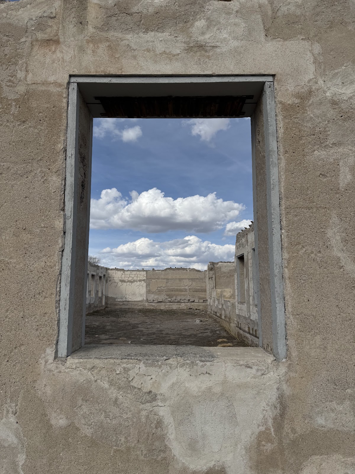
Many of the buildings still exist and tell the story of how the fort turned into a small town as the fort grew. We visited the various barracks for soldiers and officers, the commissary, surgeon's quarters, bakery, and even a jail. They were all situated around a large rectangular parade ground. Many of the buildings are reconstructed and it was interesting to walk through and see what life was like in the 1800s.
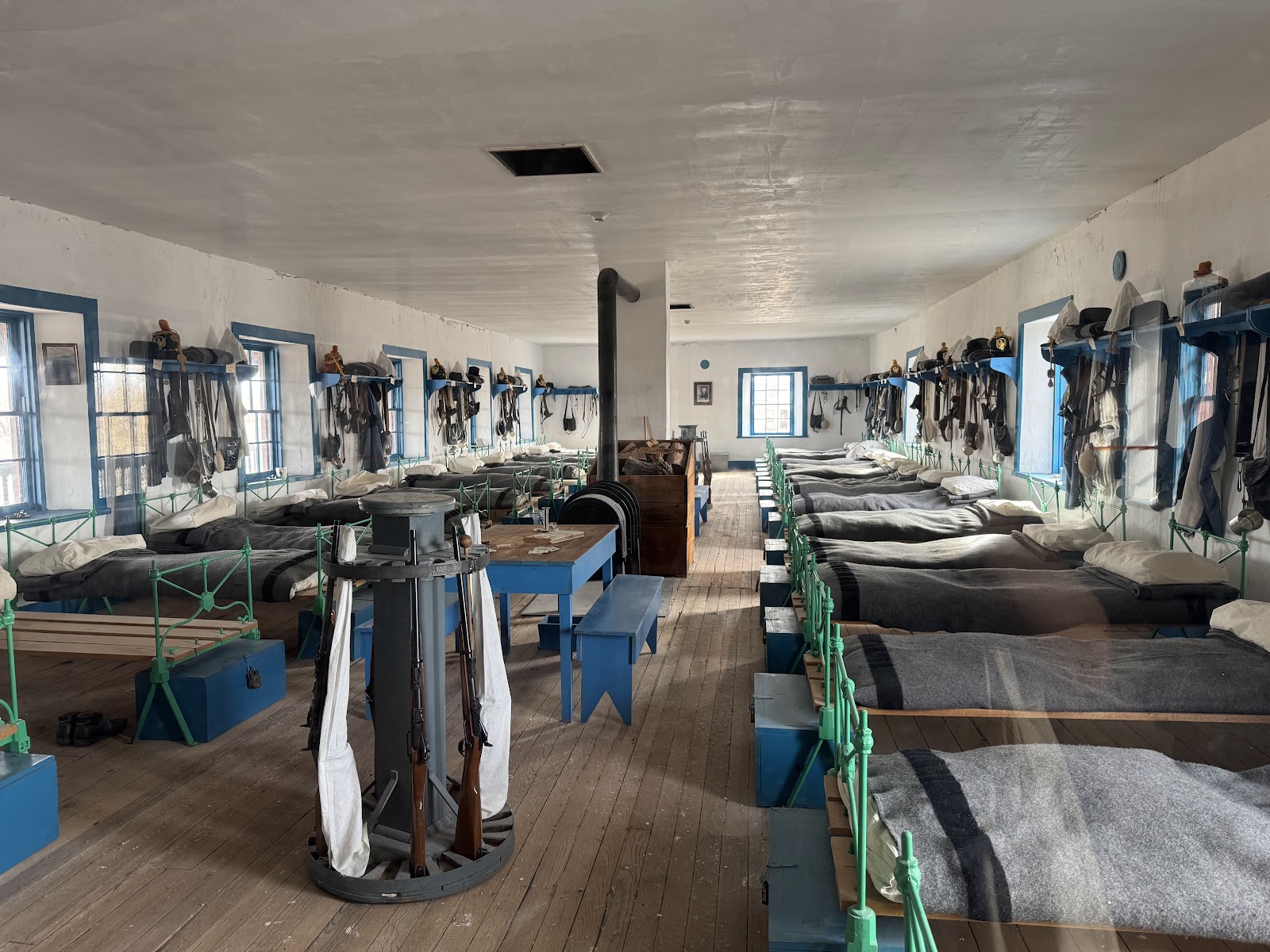 |
| Cavalry barracks |