We boarded the National Geographic Quest after a short bus tour around the city. It’s a luxury ship with room for around 100 passengers, but there were only around 50 of us – making it comfortable yet interesting. I shared a room with Lisa, a retired teacher from Iowa, which was nice since we have similar travel styles. (But honestly, I spent very little time in the room!)
After settling in, we had dinner on board and explored the ship. As we sailed out of Cartagena, the seas started getting rocky so we all went to bed early. 🤢 Early the next morning, we loaded onto the Zodiacs for our first excursion. We were stopped in the Gulf of Morrosquillo at the Reserva Natural Sanguaré. A former livestock farm, the reserve has been reforested and is dedicated to conservation and education. It was raining when we reached the reserve, which unfortunately meant most of the birds we were hoping to see were hiding out.The excursion ended with a local music and dance presentation, and an explanation of the different influences of various cultures on Colombian music. Drums came from the African slaves, the wooden flutes and maracas from the indigenous tribes, and the flowing dresses from the Spanish.
After lunch, we loaded back onto the Zodiacs and headed into the Bay of Cispatá. There, we transferred into panga boats to explore the mangrove estuary at the mouth of the Sinú River. Local fishermen accompanied us and helped to spot the various wildlife.Because of its location on the Caribbean, Colombia has had many foreign influences and waves of immigration. This is reflected not only in the music, food, and dress, but in the culture and architecture seen throughout the region. The next day, we went to see Santa Cruz de Lorica, a town on the Sinú River that was influenced by people from France, Belgium, England, Syria, and Lebanon.
We walked through the Mercado Publico, where the pungent aroma of different spices hung thickly in the air. The building is a mix of Republican and Arabic architecture, and is the most iconic building in this heritage town.
We also visited an Arabic influenced home, seeing the geometric tiles, arches, high ceilings, and ventilation common in the Middle East. In the central square, along with visiting the main cathedral, we saw the mural honoring Colombian writer Manuel Zapata Olivella.Trying to cross the streets in town, we could see how prevalent motorcycles are. In Colombia, motorcycles and motorbikes are really popular – this started during an economic downturn, since motorcycles are cheaper than cars and an easy form transport. People would also use them as a quick taxi service. With so many motorbikes, the government decided to make a law that people could only bring their bikes out every other day, depending on their license plate number. But this just caused people to buy a second bike. In Lorica, there is an average 5 bikes per household!
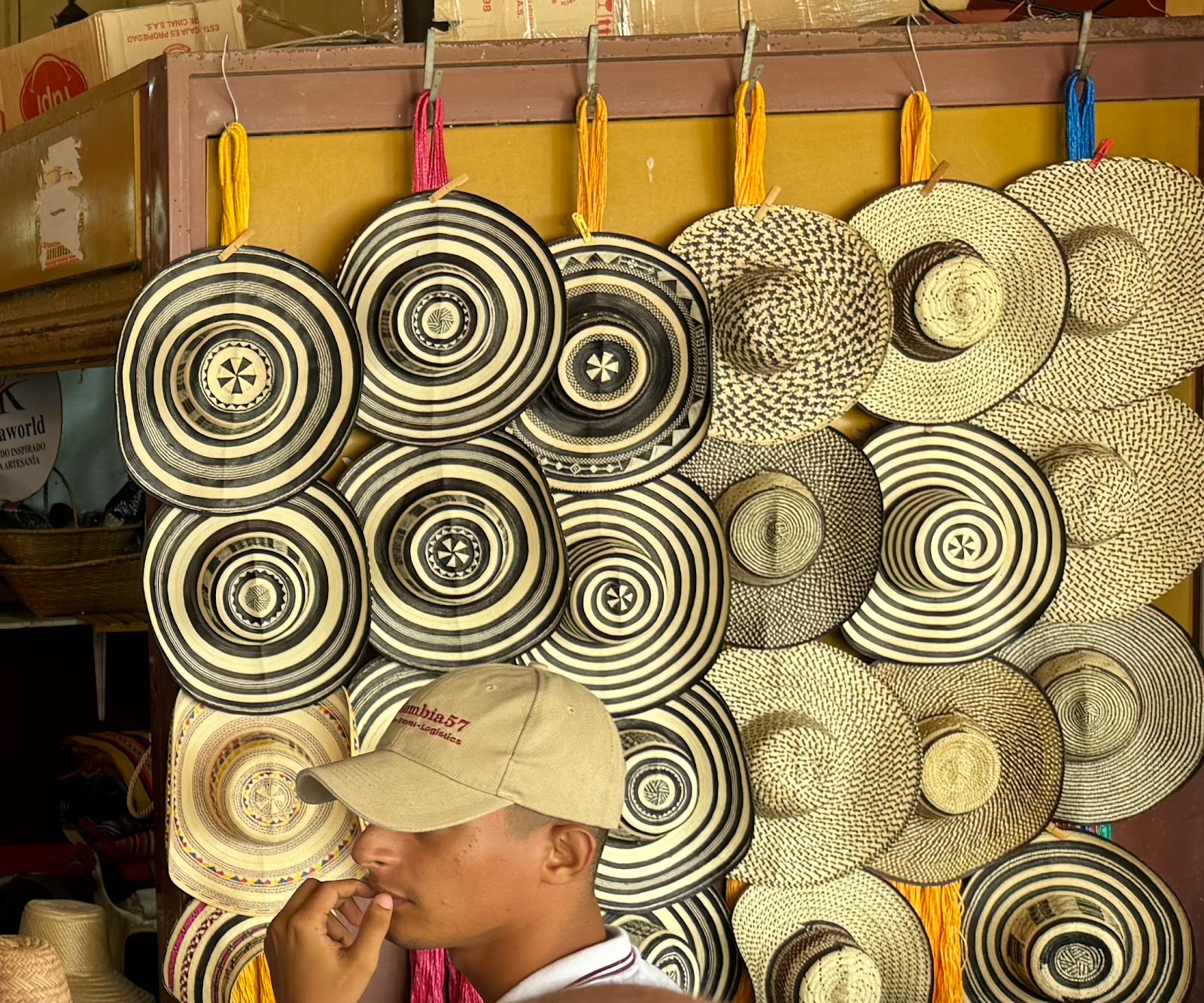
After lunch, we traveled to Tuchín, the small town where Colombia’s traditional cane hats – the sombrero vueltiao – originated with the indigenous Zenu people. Over 1,000 hats are produced daily in this town, and the craft is passed down from generation to generation. |
| The friendly faces of Tuchín |
 |
| Dance by the local Tuchín children showing the importance of weaving |
That night, we continued sailing southwest, to the border between Colombia and Panama. On the Caribbean coast lie two remote villages, La Miel on the Panamanian side, and Sapzurro across a hill in Colombia. There are no roads getting to these villages so there is little tourism; the only access is by plane or boat. But it's a geographically interesting place, because you can easily hike over a small ridge from one country to the other.
 |
| Straddling the Panama/Colombia border |
The Pan-American Highway, a series of roads running from Prudhoe Bay in northern Alaska to the tip of Ushuaia, is the world’s longest “motorable road” – except for a break of 66 miles between Panama and Colombia known as the Darién Gap. There is no road through the Darién, and the jungle is thick and marshy and filled with rivers that often flood. On top of that, rapes and robberies are common; dead bodies are left where they die. Even though it is considered “impassable,” thousands of migrants attempt the 6-day 66 mile trek in their attempt to reach the United States. I had no idea that most of these people come from Africa, the Middle East, and Asia – they do so because Colombia has no visa requirements, and many of these migrants are unaware of the perils of the crossing. They come unprepared. Many think the US lies just on the other side of the gap, not realizing they still need to trek through Central America and Mexico.
Journalist Richard McColl, who was one of the experts accompanying us, had spent lunchtime in town trying to talk migrants and hear their stories. The mafia running the migrant camp wouldn't let him in to talk to anyone, but he did interview two men in town who had recently arrived from Togo and who were preparing to start their journey.
As we pulled into the pier in Capurganá, we could see several boats and many migrants sitting along the waterfront. The town itself is a quaint little seaside resort, with cheerfully colored buildings and oceanside cafes. It seemed like the antithesis of what we now knew was about to be faced by the thousands of migrants passing through here.
 |
| The interesting architecture and vibrant buildings of Capurganá |
We walked around the town, avoiding the dangerous western side near the jungle where the migrant camp was located. We then headed to the local school where the schoolchildren gave us a performance of both traditional and ballet dance.
 |
| Dominoes is a very popular 'sport' in Colombia |


No comments:
Post a Comment