Saturday, January 7, 2023

O Canada!

In what is becoming a Winter Break Tradition, cousin Ev and Mark joined me and Anil for another snowy holiday adventure. We'd planned the trip five months earlier in the summer, during one of the most severe heat waves that Cambridge had ever seen. Anil reaaaaally wanted to go somewhere cold, so after debating a few locations, we decided on the Canadian Rockies.

The plan was to go to Lake Louise for a few days before joining E/M, but weather and incompetence by the airlines meant Anil and I left 4 days later than expected. Instead, E/M picked us up from the airport in Calgary and we immediately drove two hours north to Rocky Mountain House. Before heading out the next morning, we had to try out the infamous Tim Hortons - the Canadian staple known for its donuts. The eponymous Tim was a famous hockey player who played in the NHL for 24 years. It is apparently a Canadian tradition that everyone knows about, but I'd never been there. And I am VERY particular about my donuts, so I was eager to try it. We got a box of "Timbits" - essentially an assortment of overly-sweet donut holes. While it was an exciting prospect, Ev said it best - it's basically like eating Winchell's. I was definitely under-impressed... sigh. 

We headed west past the tiny former coal mining town of Nordegg, on the way to Lake Abraham. Our goal was to see the methane ice bubbles frozen into the lake, before heading up to Jasper via the famous Icefields Parkway, one of the most scenic drives in the world. 

Along the edge of Lake Abraham
Lake Abraham was created when a dam was built by the power company. Decaying vegetation on the bottom of the lake releases methane gas in stacked bubbles, which become trapped as the lake freezes in the winter.

Knowing we were going hiking on ice and snow, we had purchased ice cleats - definitely worth it!! Other tourists around us were sliding around and having difficulty climbing back out of the lake, whose edges were slightly sloped since the dam was releasing water and the water level was lower than when it first froze. We spent some time playing around on the frozen lake - which for me was a little nerve-wracking since there were areas that definitely looked like the water wasn't solid! But seeing the bubbles and playing around the lake was so much fun - absolutely mind blowing!

We then continued to Hwy 93  - but discovered it was closed because of avalanche warnings! This meant instead of a leisurely 2 hour drive to Jasper, we had a detour back through Rocky Mountain House, adding an extra 6 hours. Exhausting! Thanks for driving, Mark!

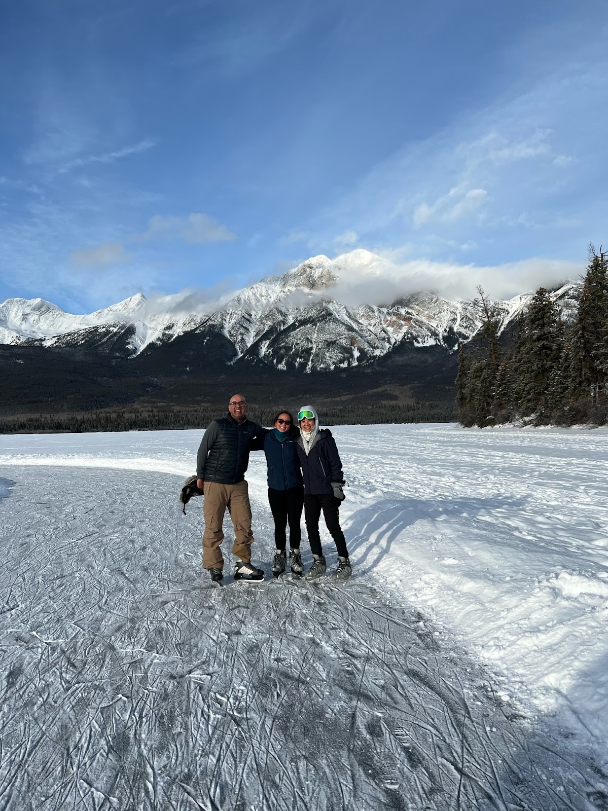
Luckily there was nothing on the agenda for the next day, so we could sleep in and relax. After breakfast, we took advantage of the resort's free skate rentals and went ice skating on Pyramid Lake. It's a common winter activity for Canadians, but it was weird for us Californians! The ice was clearly VERY thick, but it was still so unnerving to skate where we knew there was water under the ice. And it was kind of hard to skate on the areas where the surface was rough and there were cracks and fissures in the ice - particularly for someone like me, who hadn't ice skated in years.

In the afternoon, we went snowshoeing from the resort to Pyramid Island in the middle of Pyramid Lake. We trudged through the snow that accumulated on the frozen lake surface, so it was a pretty easy and flat 2.5 km round trip. As the sun started setting, a thick fog descended on the north side of the lake, and it was an eerie sight watching the fog thicken and creep towards us as we hiked back to the resort!

After dinner, we went to the Fairmont Hotel to the Jasper Planetarium tour. There was a surprisingly interesting show (only because it was a very small canvas dome, and we sat on reclining lawn chairs), and small telescopes that gave a great closeup view of the moon.

The next day we took an underwhelming wildlife tour in Jasper National Park - although we did see some elk and bighorn sheep, and we spotted a northern flicker. 

The trip started late and dropped us off late, which meant we had little time for lunch and a late start for our Maligne Canyon ice walk. The canyon is named after the Maligne River, or "Evil River" - named so because a French or Belgian priest who was an early explorer to the area lost all his gear trying to cross. The river carves into the limestone creating the deep slot canyon.

Maligne Canyon is 50 meters deep, with several waterfalls that freeze in the winter. During our excursion, we walked most of the way along the top of the gorge, crossing several bridges with a vantage of the river below. 


We then worked our way down onto the riverbed and walked a ways up to see the frozen waterfalls. The trip was AWESOME - absolutely gorgeous scenery and a fun hike,  with sliding, crawling, and wading. I'd be so curious to see what the canyon looks like during other times of the year!


An added bonus to the trip was that there were two moose that decided to hang out by the side of the road, to lick the salt. It was a mom and her calf, who was clearly more skittish, but they both were there for several hours and let us ogle them for quite a while!


It was New Year's Eve, so that night we had a lovely dinner at the Pyramid Lake restaurant.


The next morning we had a late start out for our drive down the Icefields Parkway to Banff. 

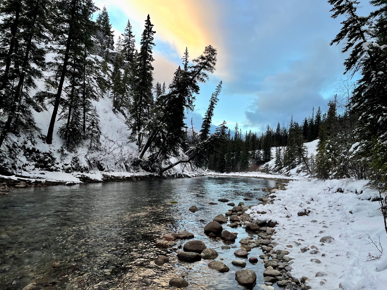
A lovely hike to Sunwapta Falls
I was particularly excited for this drive since it had been closed due to avalanches when we first arrived, but it is such an iconic part of the Canadian Rockies. Along the way there are several small hikes and frozen waterfalls, and we put our ice cleats to good use since we had them!

One of my favorite stops was actually just a quick hop out of the car - the base of Athabasca Glacier. It was so much colder there than just a few miles away - evidence of that katabatic wind! Too bad we didn't have time to hike closer... 

It was SO cold at the base of Athabasca Glacier!

Overall, the Icefields Parkway is a gorgeous drive - not difficult at all, and so much beautiful scenery and plenty of places to stop. I would definitely do it again during the summer months, with the Columbia Icefield is open and you can take tours to Athabasca Glacier. And even with multiple stops along the way, we made it to our next cabin with plenty of time to relax before dinner.


Our home for the next four days was at Baker Creek - a cozy cabin about 15 minutes south of Lake Louise. With a small kitchen and a wood-burning stove, it was a great place to use as base camp since we all were doing different things.

The next day, while E/M went skiing and Anil hung out at the cabin, I drove to Yoho National Park and snowshoed around the Emerald Lake Loop. It was a gorgeous walk, but there was one slightly scary section with huge 'avalanche warning' signs that made me really nervous! Luckily, I made it out alive!

The view of Banff from Sulfur Mountain


That night, we took the Banff Gondola up to the top of Sulfur Mountain. There was an evening light exhibit, and we had the best dinner at the restaurant at the top.

During our drive through the Icefields Parkway, we'd seen several iceclimbers and decided the next day that we needed to try it ourselves! Our guide was a Nepalese Sherpa who'd summited Mt. Everest 7 times(!) - so our little intro to ice climbing adventure was going to be a piece of cake for him. 

We set off for a 30 minute hike to a frozen waterfall - and it is really nerve-wracking since most of these waterfalls still have flowing water behind them! Ice climbing is actually easier than rock climbing, but definitely more intimidating. We have ice cleats on our boots, with sharp spikes sticking out from the front of our toes. Like in rock climbing, you put all your weight on your legs and use your arms to balance yourself - and since you are holding two ice picks that you whack into the ice, unlike rock climbing you always have an easy hand-hold. But since I don't rock climb, I wasn't used to relying on my legs  - plus I had a hard time getting my feet to stay in the ice, so I didn't trust putting all my weight on my legs. My arms got tired reaaallly fast (that's what happens when you have the arm strength of a wet spaghetti noodle... sigh...) but nonetheless I had a great time!

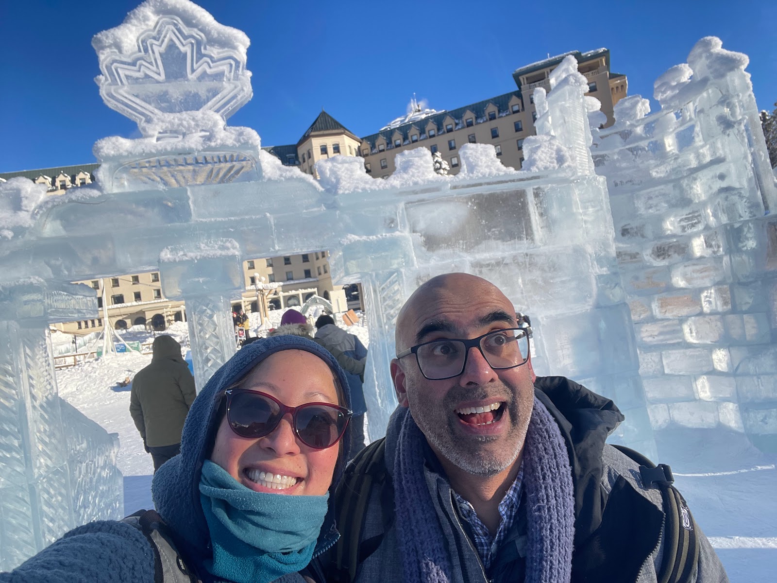
The ice castle on Lake Louise
One of the most famous spots in the Canadian Rockies is Lake Louise - a gorgeous turquoise glacial lake nestled between snowy mountains. In the winter, it freezes over and an ice skating rink is cleared on the ice. Anil and I were supposed to have stayed at the Fairmont resort during the 4 days we missed because of the weather (and stupid United Airlines), but at least we got a little taste of what we missed. 

E&M had snowshoes so they went off on their own, while I went to rent some skis. I cross-country skied across to the back of the lake (but didn't go any further since there were avalanche warnings and I was by myself). Since the track was right on the lake, it was really flat and easy - but it did get so cold that my eyelashes froze!

Anil stayed in the lobby to do some work, and when we all met up afterwards, we decided to have afternoon tea at the Fairmont. I always feel so sophisticated and posh when having afternoon tea - but as always, it was delicious!
Mmmmm, tea!

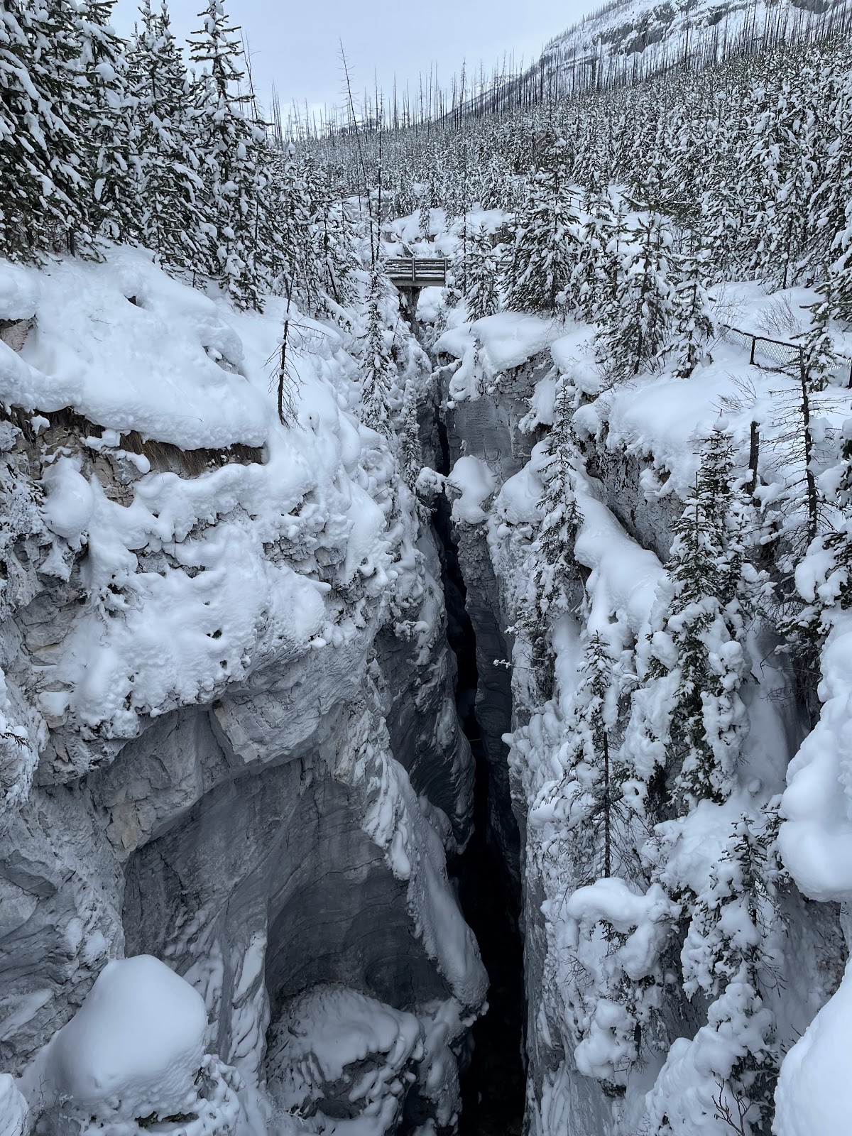
On our last day in Lake Louise, I wanted to experience other National Parks so I spent the day at Kootenay to see Marble Canyon. It is another short but cool hike to see a snowy slot canyon from above, with several bridges crossing it so you can see down into the canyon. Very cool! And just down the road were the Paint Pots, which were unfortunately covered in snow. But it was still a nice, peaceful hike through the snowy forest.

Driving back from the Paint Pots, I notice a 'continental divide' sign so of course I had to snap a picture! So now I can say I've straddled the divide in two different countries! And here, the Divide is also the dividing line between two National Parks - Banff and Kootenay!

National Parks in Canada are quite different from the ones in the US (at least the ones we visited - Jasper, Banff, Yoho, and Kootenay). For one, it doesn't seem like people go to the parks for the sake of the park - they go for activities like skiing or hiking. The vast majority of visitor centers are closed during the winter, so we couldn't even go in to see why the areas that were designated as parks were chosen to be protected. We never saw any rangers, and it was hard to tell when we were even within park boundaries. And in the smaller parks, like Yoho and Kootenay, there were very few people (I think I saw maybe a half dozen on my hikes).

Deep fried dough with cinnamon
sugar? Why yes, please!
On our way back to Calgary, we stopped in Banff and tried Beavertails: delicious deep fried pastries that were SOOO good - I  could see why they are so well known in the area! 


After checking into the hotel, we had a final dinner of Tibetan hot pot before heading to the Calgary Flames hockey game. Even though we had nosebleed seats, it was fun watching them beat the New York Islanders! A fun and very Canadian way to end our trip - Thanks, Canada!


Saturday, August 6, 2022

Florida, Part II

EVERGLADES NATIONAL PARK

After our week learning about the Space Race on the Space Coast, Joann and I decided to take an extra few days and drive south to see more National Parks. For the longest time, I've wanted to go to Everglades National Park, and I finally had the chance to visit. 

Everglades water flow
The Everglades is the largest subtropical wetland in North America. Also known as the "River of Grass," the Everglades is a large drainage basin covering nearly the entire bottom 1/4 of Florida. Lake Okeechobee is a huge but extremely shallow lake fed by the Kissimmee River. During the wet season, water flows south out of Okeechobee in a 60-mile wide river into Florida Bay. This shallow river is called a sheetflow. Since Okeechobee is only 4-5 meters above sea level and the water travels over 100 miles, the gradient is about 2 inches per mile - which means the water moves at the extremely slow rate of about half a mile a day. Sometimes it takes months or even years for water to travel from Lake Okeechobee to Florida Bay. And it provides water to about 1/3 of the state. The Everglades encompasses not just the National Park, but Big Cypress National Preserve and three water conservation areas. Originally, it spanned 6 million acres, from Orlando all the way down to the Florida Keys.

Unfortunately, urban and agricultural development have altered the ecosystem and threatens the Everglades, which is now about half the size as it once was. Canals and ditches have been dug to divert the water and control flooding, causing death of peat and rapid breakdown of soil nutrients. In addition, the introduction of invasive species have wreaked havoc on the delicate native biome.

Getting a few days to explore the Everglades gave us an up-close and personal chance to appreciate the unique environment. We started by taking a boat tour from Flamingo, the southernmost point on the Florida peninsula. We traveled down Tarpon Creek and Coot Bay, seeing the different mangroves and searching for animals. We did see a crocodile sunning on the banks - did you know the Florida Everglades is the only place in the world where alligators and crocodiles coexist?

Slogging through the sawgrass prairie towards
the cypress dome.
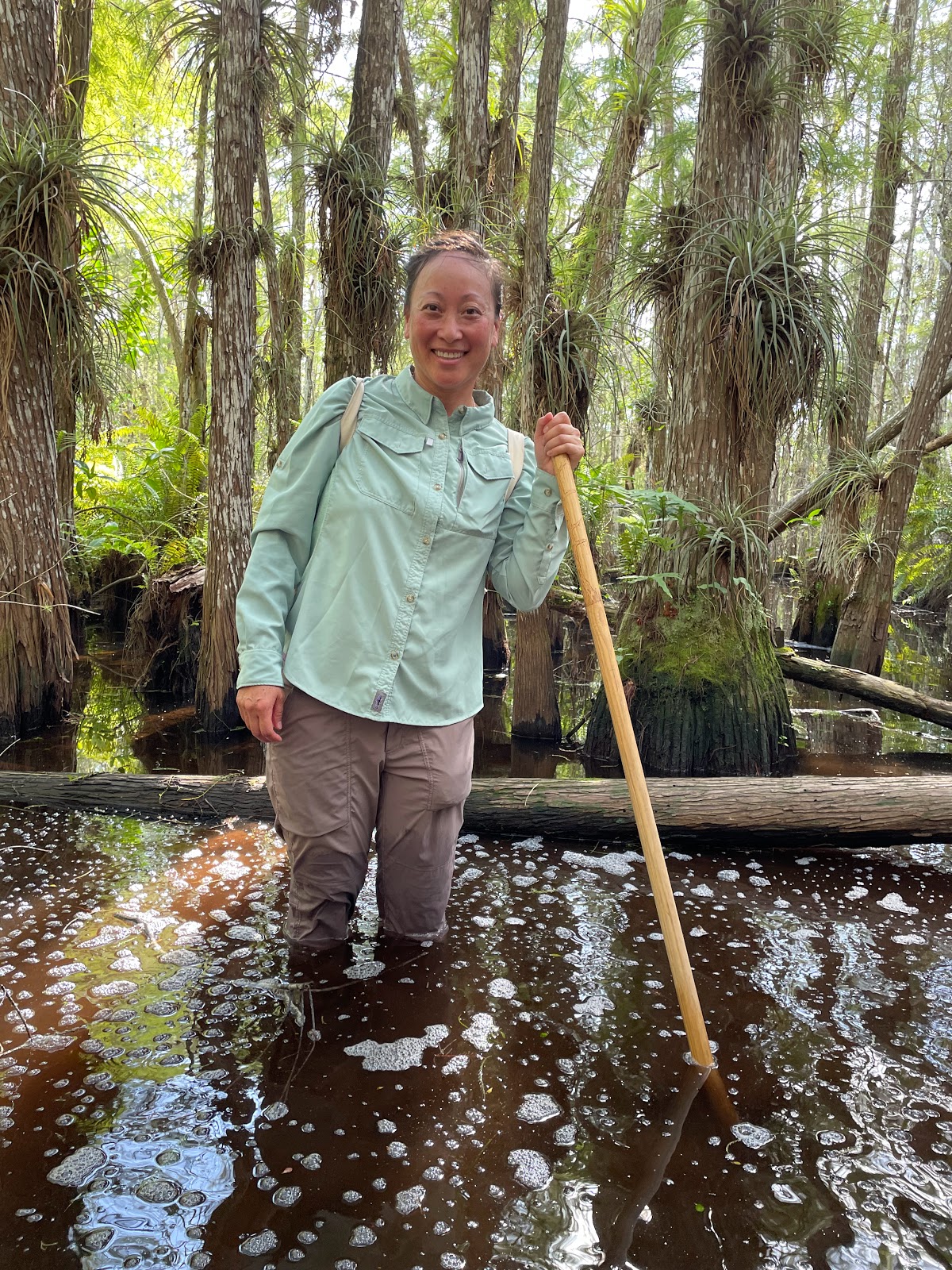
That afternoon we went on the most interesting adventure of the trip - a cypress slog, walking through the sawgrass prairie and into a cypress dome. We started by heading straight into the muddy water, relying on our long hiking poles to help navigate the muddy pits. 

I was surprised how few mosquitoes were there, and it was fun trying to avoid the deeper pits that would suck our feet on each step, pulling on our shoes. I was definitely glad my laces were tied tight!

We headed further away from the road and towards what looked like a hill in the distance. It was actually a cypress dome, where cypress trees grow around solution holes. 

Solution holes are areas where the underlying limestone karst has been dissolved by the acids caused by decaying vegetation. Large cypress trees grow in the deeper centers, with smaller trees around the outside, forming a cluster of trees in the shape of a dome. 


Hope no alligators are lurking nearby!
That's my anti-gator pole.
As we hiked closer to the cypress dome, the vegetation grew taller and the water level started creeping up past our knees. Our guide explained that yes, alligators did live in the cypress forest and we were on our way to find an alligator hole - a refuge where an alligator digs our a deeper hole and breeds. We "most likely" wouldn't run into an alligator, but even if we did, it "most likely" wouldn't bother us. 
        Ermmmm....

Deep in the cypress dome

I did love all the air plants that grew in abundance on all the cypress branches! These were the same air plants that I have in my home, so it really made me appreciate more the type of environment they like to live in.

Getting down and dirty into the swamp was truly amazing, and I'd highly recommend it to anyone who wants a true Everglades experience!

The next day, we drove up to the northern part of the Everglades, to Shark Valley, in the heart of the freshwater marsh. We drove the famous Tamiami Trail to the visitor center, where we took a tram ride along the loop road. At the far end of the loop is a 70-foot high observation tower with an amazing panoramic view of the sawgrass marsh.

From midway up the tower we spotted one small alligator, but we didn't see the abundance that I remember from my childhood visit to the Everglades. I don't know if it is because of habitat loss, climate change, or some other factor, but we definitely had to hunt to see an alligator and there weren't any basking on the roadside or along the banks. We did see several different wading birds, including the white ibis, great white heron, great blue heron, and snowy egret.

Looking across the prairies, we could see several stands of trees. These areas of slightly higher elevation are known as hardwood hammocks - where mahogany, gumbo limbo, and oak trees can survive. Since they are slightly higher in elevation, they don't flood and provide places for animals such as panthers and black bears. A bear had been spotted earlier that month, but they eluded us.


From Shark Valley, we continued east to Everglades City. Since we had some extra time, we took a detour on the Loop Road (which is technically in Big Cypress National Preserve, a slow dirt road that took us close into the swamp. 

Hm, what a peaceful, empty fishing hole...
It ended up being a fun detour - along the way, there were several bridges that crossed over small streams where sometimes you could spot alligators. We decided to stop at one in the hopes of seeing some. And hooray, we did see one! Then, a car came up with a few people who were clearly locals, looking for a spot to go fishing. 

Just waiting for an easy lunch!
It was instantaneous - the moment he cast his line, alligators came out of the woodworks and started swimming over. 


Soon there were a half dozen large gators right under us! The locals explained that the gators have learned to come steal fish from the fishermen - so when they hook a fish, they have to act fast and reel it in before a gator snatched it away. Every time they would cast, one or two gators would slowly sidle closer, just waiting for the right moment. Clever little alligators!!

61.3 sq feet of post officey goodness!


On a side note, did you know the smallest post office in the United States is located in the Everglades? 


The Ten Thousand Islands area of the Everglades is accessed by the Gulf Coast Visitor's Center, in Everglades City on the far northwest corner of the Park. It can only be visited by boat, so we took a tour to see the mangrove islands across Chokoloskee Bay. It's the second largest mangrove forest in the world, second only to Bangladesh.  Despite the name, there are hundreds (not thousands) of little islands here, which are home to lots of wildlife. Because of the abundance of seafood, Native American Calusas once thrived in the area and some of the islands were formed from discarded shells! It's also hard to tell what island is actual land sticking out of the water, versus the tops of mangroves that have grown over submerged oyster mounds.

Taking a 90 minute boat tour was a great introduction to the Ten Thousand Islands, but I would definitely return and take a kayak trip to go camping and spend more time exploring the area. It was fun searching for manatees and seeing various wading and shore birds. And we did see several dolphins frolicking around!


BIG CYPRESS NATIONAL PRESERVE 
Just north of Everglades National Park is Big Cypress National Preserve, protecting 720,000 acres of the Everglades watershed. Because it is a National Preserve instead of a National Park, there are fewer restrictions here than in the Everglades and hunting, fishing, and off-roading is allowed. It's actually the nation's first national preserve, created to save the swampland and to battle the development of a Jetport in the area.


We decided to try a canoe tour, just for a change. I'd never canoed before, and while I did think it was fun, it is harder than kayaking and I probably wouldn't choose to do it again. The boat is less stable than a kayak so Joann wasn't comfortable sitting high on the benches, and chose to sit on the bottom of the boat. It was much harder to paddle that way, so we had a hard time navigating and paddling.

But I loved seeing this yellow rat snake, that had been hiding in the shed where the canoes were stored!

On a side note - the water in the Turner River was incredibly clean and clear. My sunglasses got knocked off my head by a low-hanging branch, and we actually paddled back to look for it and we found it, in 3 foot water! Our guide was nice enough to jump in and rescue them for me!


DE SOTO NATIONAL MEMORIAL
Spanish explorer and conquistador Hernando de Soto, wealthy from the plunder of the Incan Empire, was granted the right to "conquer Florida" from King Charles V of Spain. With an army of 600 soldiers and 9 ships full of supplies, de Soto landed in Tampa Bay in May, 1539. For the next four years, de Soto traveled 4,000 miles to "conquer, populate, and pacify" the land (and search for gold). Along the way, they plundered villages and enslaved the natives.  Ultimately, the expedition introduced North American natives to Europeans and vice versa, and began a narrative of hostile relations between the two.

I spy with my little eye...
a marauding conquistador!
De Soto National Memorial was created to preserve the history of de Soto's expedition and its significance. The grounds are located on the southern end of Tampa Bay, through a really nice residential community. A small beach and walking trail winds around the park, with funny cutouts of natives and Spanish soldiers set up along the way.


It was a lovely walk around the nature trails, and a nice way to end our trip in Florida. 


Overall, I loved learning about the geology, geography, and history of Florida. But it seems worrisome how obviously humans are disrespecting nature. Florida has a fragile but important ecosystem, and I wish it were better taken care of.


Saturday, July 30, 2022

Florida, Part I

My second teacher PD of the summer was again a space related workshop - "The Space Race on the Space Coast" - held at the Kennedy Space Center in Cape Canaveral, Florida. Now to be honest, I wasn't exactly thrilled to be visiting Florida, but I WAS excited to learn about the history of NASA and I was eager to visit the National Parks that happened to be located in Florida. So I connected with a teacher friend and planned a few extra days around our workshop to see the sights. I had met Joann the year before at another teacher seminar, and was glad that she was also eager to see some National Parks.

CASTILLO DE SAN MARCOS NATIONAL MONUMENT

Founded by the Spaniards in 1565, St. Augustine, Florida is the oldest continuously inhabited European settlement in the US. After earlier wooden forts were destroyed by English raids, construction on the coquina stone fort began in 1672. Coquina is a sedimentary rock made up of shells and limestone. It made for an excellent building material, since cannonballs that hit the fort did very little damage. Instead of shattering the walls, coquina stone compressed and absorbed the shock of the hit. 
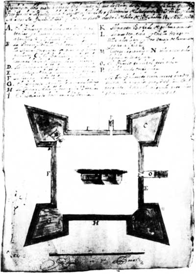
Construction plans, 1677
The fort has a cool design, with diamond-shaped bastions on each of the four corners creating a star-like shape. Since nobody had made a structure with coquina before so they didn't know how strong the walls would be, the Spaniards made extra thick walls - up to 19 feet thick on the ocean side!! Surrounding the fort was a dry moat that could be flooded with seawater in case of land attack. So even though Castillo de San Marcos was attacked several times, it was never taken by force.

The Castillo sits right in downtown St. Augustine, at the mouth of the Matanzas River. We toured the inside of the fort and even got to see a cannon-fire demonstration!
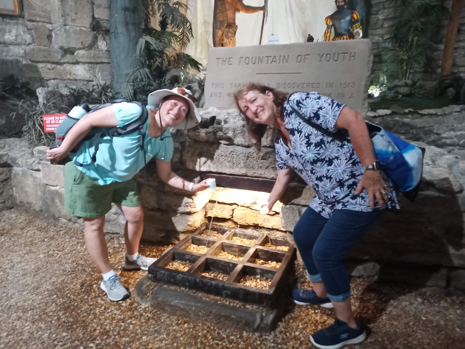
Spoiler alert: It was disgusting. And sadly, I am no younger.


Afterwards, we made a quick stop at the Fountain of Youth Archaeological Park, where Ponce de Leon supposedly landed in 1513 while looking for the Fountain of Youth. 

Yes, we tasted the water. Blechhhhh.🤮


TIMUCUAN ECOLOGICAL & HISTORIC PRESERVE
Before the Europeans reached the new world, the native Timucua people lived in Northern Florida. Sadly, they were completely wiped out by the 1700s. This preserve protects not just the stories of the Timucuan, but the wetlands and marshes of northeastern Florida, the history of slaves at the Kingsley Plantation, and the French colony of Fort Caroline.
The maze of waterways of the salt marsh.

The row of slave houses at Kingsley Plantation
The Kingsley Plantation, which sits on the north end of Fort George Island, grew cotton, sugar, and corn. Zephaniah Kingsley and his wife, a former slave that he bought from Senegal, lived there for about 25 years. The plantation is now known for the well-preserved tabby slave houses - constructed with the durable cement tabby made from burnt oyster shells, sand, and ash.
  
A great audio tour explained the sights around Fort George Island
 

Did you know that gopher tortoises dig long burrows that are home to more than 350 other species? They are one of the keystone species in the area, and it was so exciting to find one in its burrow!
Hello, gopher tortoise! I see you!


Within the preserve is also Fort Caroline National Memorial.
Around the same time that the Spaniards were establishing themselves at St. Augustine, the French also sent small parties to settle in the New World and stake their claim on the riches they hoped to find. In 1562, Jean Ribault set off from France for the first expedition, erecting a monument near the mouth of the St. Johns River in 1564. Rene de Laudonniere (who had accompanied Ribault) established the first permanent settlement - La Caroline.

The 250+ colonists included artisans and women, many of whom were Huguenots (French Protestants) looking for religious freedom. They struggled in their first year, relying heavily on the Native Americans in the area. When Ribault returned from France in August 1565 to bring reinforcements, the Spanish decided to oust the French and maintain their stronghold in Florida. Ribault fled in his ships, but was thwarted by a violent storm. Meanwhile, another Spanish garrison traveled over land and attacked La Caroline. A few dozen people escaped, and of the remaining 200 only around 50 women and children were spared. Ribault surrendered to the Spanish but the colonists were executed as heretics. The location of the massacre is now called Matanzas - Spanish for 'slaughters.'

Even though the exact location of Fort Caroline is unknown, the replica - a small triangular fort - shows the small size of the ill-fated colony and gives a taste as to how the French had to defend themselves.

FORT MATANZAS NATIONAL MONUMENT
All this turmoil amongst the various factions coming to the New World meant each nation needed a way to protect its settlements. The Spanish, to help protect St. Augustine, knew they needed to keep tabs on the Matanzas Inlet, so a few years after the massacre, they began manning a wooden watchtower. The current coquina tower was completed in 1742 on tiny Rattlesnake Island in the middle of the inlet. 


A quick 5-minute boat ride took us to the Island, where we were allowed to wander through the tiny fort. I could easily imagine how the lazy days would be if I were one of the soldiers stationed sent for my 30-day stint... I'm sure there was a lot of fishing and swimming and card games... and not much else going on!
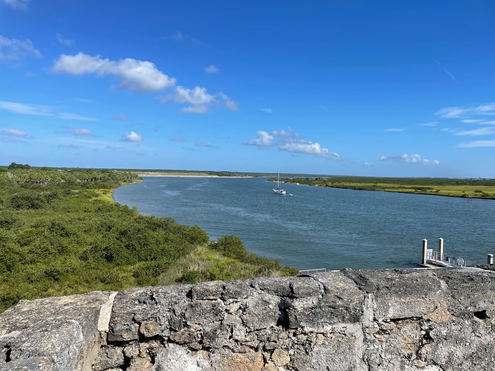
The view up Matanza Inlet towards St. Augustine


CANAVERAL NATIONAL SEASHORE
Before heading back to Orlando to meet up with the other teachers for the NEH seminar, Joann and I stopped off at the Canaveral National Seashore. It's an interesting place since much of it has no roads - and while it is the longest stretch of undeveloped land in Eastern Florida, the Kennedy Space Center and many of the launch pads are within the park boundaries. The road going down from New Smyrna (the northern end) stops at Apollo Beach - and while the timing wasn't right for us, I can only imagine how cool it would be to watch a rocket launch from the beach!!

Before Ponce de Leon and other Europeans came to Florida in the 1500s, the Timucuan people lived up and down the Florida coast, including at sites around Canaveral. We hiked around Turtle Mound, a shell midden from over 2000 years ago. We also saw a few gopher tortoises, which hopefully means they are rebounding from their threatened status!


Many of them had scars ☹️
One of the more interesting sights was later in the week, when we visited the southern end of the park and got to view a large number of manatees. Manatees, or sea cows, are herbivores that feed on aquatic grasses in shallow coastal warm waters. Because they have no natural predators, they are docile and slow-moving - which means they are particularly susceptible to boat collisions. It was sad to see the scars on the backs of many of the manatees that we saw.
While manatees are often solitary, they do congregate during breeding season and in pockets of warmer waters.
We saw over 50 individuals from our viewing deck!

KENNEDY SPACE CENTER
With Launch Director Mike Leinbach -
the man who decides "Go" or "No Go!"
During the next week, we stayed on Merritt Island and attended the NEH seminar "Space Age on the Space Coast". We attended lectures from  historians, scholars, former astronauts, and even the Space Shuttle launch director! Each day we had some time to wander around the Kennedy Space Center, and OMG it was SO COOL. It's like Disneyland for nerds, and I would highly recommend it (I'd even choose it over going to Disney if I ever find myself in Florida again!)

Did you know? The main reason why the Kennedy Space Center is built on Cape Canaveral is due to its location: Because of the rotation of the earth, rockets are always launched to the East - because the velocity of the earth's rotation is added to the speed of the rocket, giving it an extra push! And the velocity of the earth is faster near the equator than it is at the poles. And having a launch pad on the East coast means that in the event of an accident, debris will fall into the ocean instead of onto someone's house... so the most eastern/southern spot is Florida!

Saw my first horseshoe crab!
The week wasn't just about space. We visited the Harry T Moore home, where civil rights activists Harry and Harriet Moore were assassinated when a bomb was placed under their house on Christmas in 1951. We also learned about the environmental impacts made by the space center, and also went kayaking to see bioluminescent plankton - when the sun went down, you could see the trails behind the kayaks and the oars as the plankton would fluoresce after being disturbed - very magical!  

The VAB: The doors on the sides are 456 feet high,
so rockets are assembled vertically and rolled out!
But the coolest thing we did was see the launch complex. We first drove by the Vehicle Assembly Building, the VAB, where each rocket or shuttle is housed ahead of time. While we were there the Orion rocket for the Artemis mission was there, and if we looked reaaaaaally closely through the giant doors, you could just see the ghostly shape of the SLS rocket!

Launch Pad 39B: Ready for Artemis!
On our way to the Apollo/Saturn V Center, we took a detour to see several of the launch pads, including ones used by Blue Origin and SpaceX, as well as Launch Pad 39B where Artemis 1 would be launching from. At the Center, not only can you touch a moon rock but there is a great simulation of being in the control center during the moon landing. I loved it!!

The control center at LC-26 is now a museum
Because the US Space Force is now officially a branch of the US military (no, it isn't just a comedy TV show!), a large swath of Cape Canaveral is now closed to the public. In fact, they said we were one of last civilian tours that was going to be allowed on base, so we definitely appreciated being there and seeing such historic sites! There are SO many historical sites on what is now the Space Force Station, and I'm not sure the public will be allowed in the future. 

The first US satellite was launched from LC-26A in 1958, and it was so cool seeing the computers used over 60 years ago to get an object up into space:
The actual control room for the first satellite, Explorer I in 1958, looks like a sci-fi movie set!
It was America's entry into the Space Race. Those blockhouse windows, protecting the workers, are 4 inches thick.
In 1962, America put John Glenn into orbit. The control center for Launch Complex 14 where he took off was located in a thick blockhouse bunker, which may or may not be where you'd want to be during the zombie apocalypse...
Just outside LC 14
Look at those blast doors! And the thickness of the walls!

A stamp on the side of the complex reads "Abandon
in place," which means to abandon it without maintenance.
By far the most moving (and most somber) of the sites we visited was Launch Complex 34. In 1967, as the US was preparing the Apollo missions to the moon, the Apollo I fire broke out and killed astronauts Grissom, White, and Chaffee.
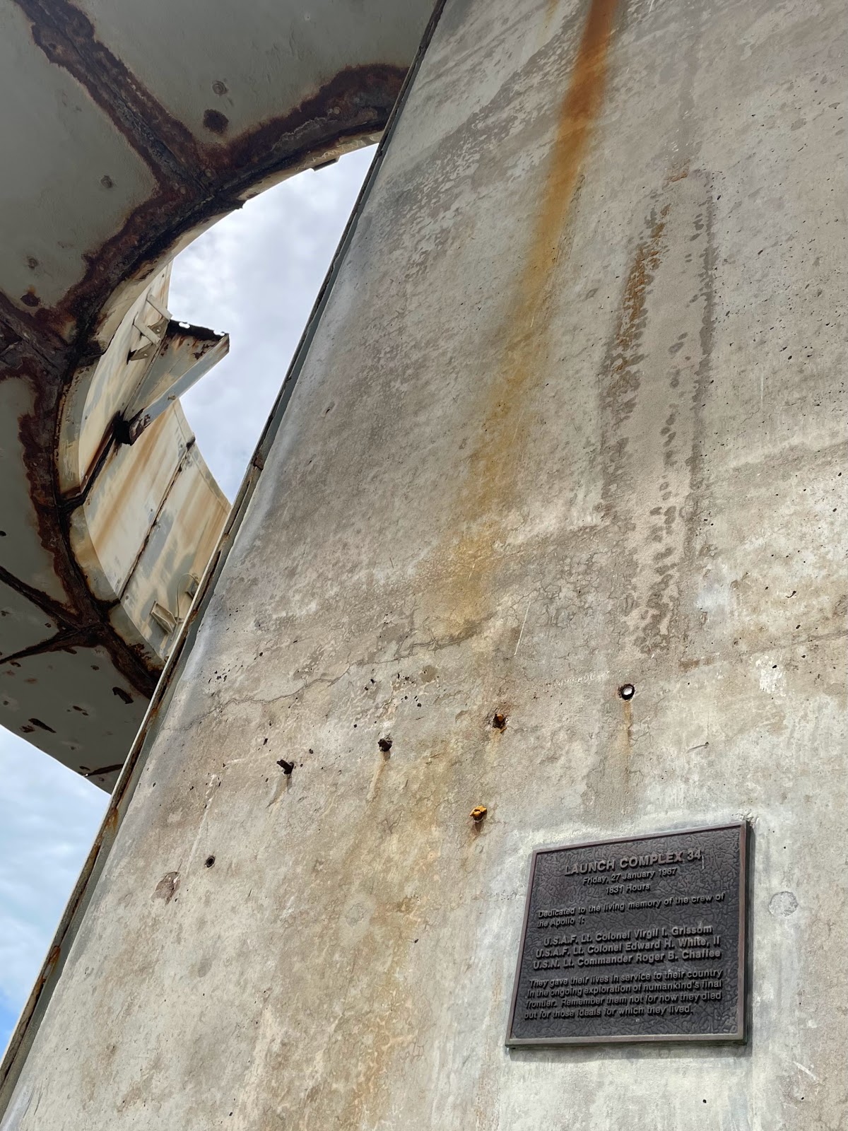
One of the memorial plaques

The complex was decommissioned after the launch of Apollo 7, the first crewed mission, in 1968.  


I'm grateful we got to spend some time at the LC 34 Memorial, because it is a good reminder that there are often setbacks along the road to progress. The vast majority of the week was awe-inspiring, impressive, and uplifting - and I definitely got shivers while touring the Kennedy Space Center exhibits. 
The Atlantis shuttle exhibit was out of this world!
With my new teacher friends Joann,
Pam, and Rebecca!


They did a fantastic job telling the NASA story and explaining why it matters, and I look forward to seeing what future exploration brings!