Sunday, July 2, 2023

🌊🚣The Ultimate Whitewater Experience: Rafting the Grand Canyon🚣🌊

High on my bucket list every since I can remember: rafting down the Grand Canyon. Finally, this summer I fulfilled my lifelong dream! 

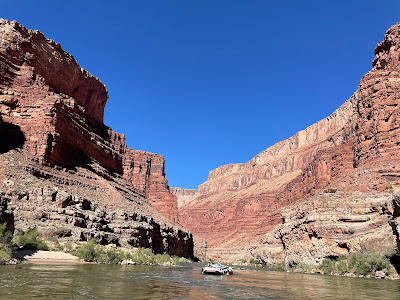
The Colorado River starts at 14,000 ft in elevation in the Rocky Mountains of Colorado and drops about 7 feet per mile, carrying rocks and debris that help cut through the sedimentary rock of the Colorado Plateau. Side tributaries add smaller canyons, and rain, ice wedging, and snowmelt contribute to weathering and erosion. After passing through Marble Canyon, it enters Granite Gorge and cuts down a mile in depth, exposing some of the oldest visible rock on earth. 

This is the Grand Canyon, one of the most famous whitewater rafting trips in the world. I was lucky enough to join the TIES (Teacher Institute for Evolutionary Science) Grand Canyon rafting trip. For 7 days, 28 science teachers and one geologist traveled by motorized raft down 188 miles, from Lee’s Ferry to Whitmore Wash with Hatch River Expeditions. 

I was particularly excited for this trip since I'd visited the South Rim of the Grand Canyon just two weeks prior, learning about deep time and the many layers of rock that surround the region. At the top of the Canyon where the Visitor Center stands, the rock is part of the Kaibab Formation – deposited 270 million years ago. But the further down the river we traveled, the deeper into the past we went – all the way to the 1.8 billion year old basement rock. We were about to see it all!!


Sunday, June 25 

Early on Sunday morning I flew to Las Vegas and met with several other teachers for the shuttle to Cliffdweller’s Lodge.  We'd meet up with the rest of the group and prepare for the next morning, where we'd be shuttled to the put-in at Lee's Ferry. (Funnily enough, there's no ferry at Lee's Ferry, just as there's no cliff dwelling at Cliff Dweller's.) For the next 6 days, we'd raft 188 miles of the Grand Canyon.
The fresh-faced, eager, CLEAN group.

Mon June 26 

Getting ready to load up!
The next morning, we gathered to prepare for our departure. We were to put our night bag into the large orange waterproof bag affectionately known as a pumpkin, which also contained our sleeping kit of a sheet, pillow, and sleeping bag. We also could get a small day bag (I used my own, which was much easier to find since it was neon green instead of orange). Then, we headed off to Lee's Ferry, at river mile 0 to load up our rafts!
AHOY! I'm ready to go!


There are three main areas of the S-Rig motorized raft - the front, known as the Bathtub, was the wettest since it was constantly getting splashed, even in the smallest riffles. The sides were a bit more protected but still got splashes coming in from the edge of the pontoons, and the 'tea room' in the back was the driest - but still got wet in the larger waves. Our charter group split between two boats - one captained by trip leader Josh and helped by swamper Zack, and the other by Holden who we later learned was Josh's son (and way later, on our final day, we learned this was his first ever trip driving his own boat)!

Ready for our great adventure!

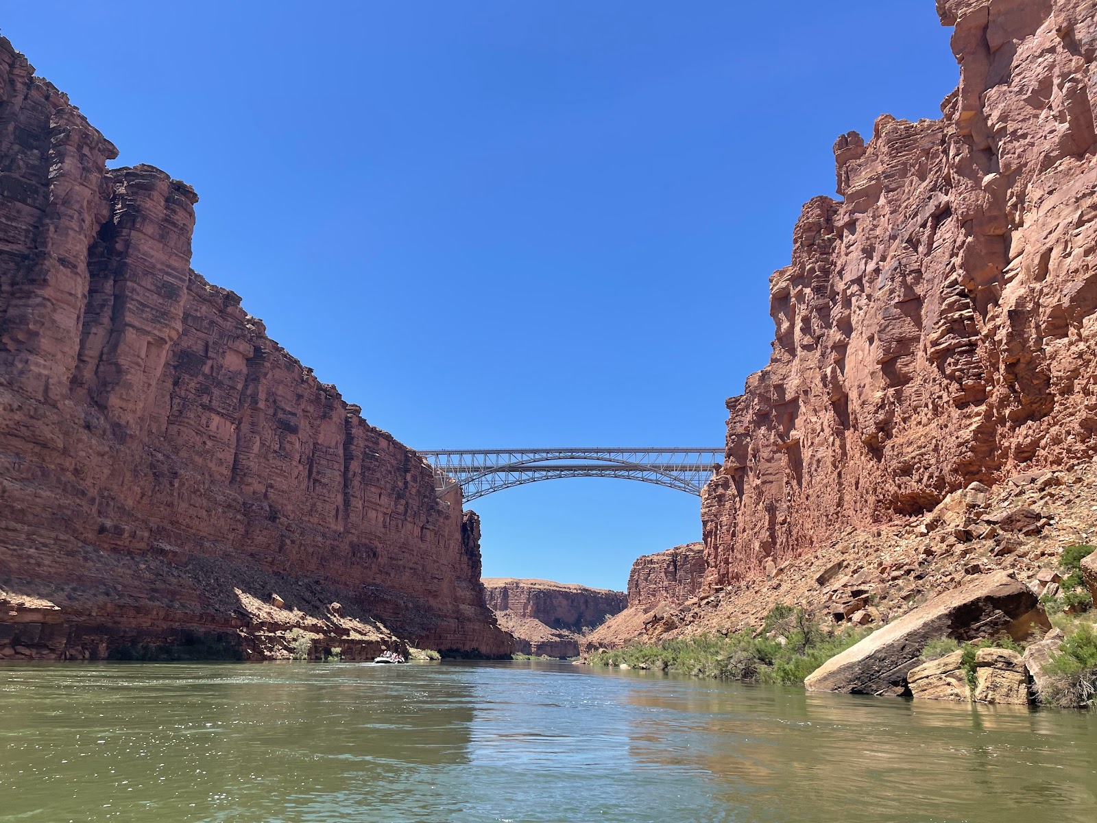
At this point, though we were technically within Grand Canyon National Park, we were actually in Marble Canyon - we wouldn't get into the actual Grand Canyon until Nankoweap. Our final glimpse of civilization was the Navajo Bridge, the last car crossing of the Colorado River until Hoover Dam, 350 miles away. Looking up, we actually saw two condors on the support beams under the bridge.  

That's me in the far left of the bathtub, as seen by
Amanda's family from the top of Navajo Bridge!

The Grand Canyon uses its own rapids rating system - while most rivers use a I-VI system (I being calm water and VI being unraftable), the Grand Canyon rates its rapids on a 1-10 scale. We started the trip with several significant rapids, including Badger Creek (5-6), Soap Creek (5-6), and House Rock (7-8). But most of the ride was peaceful and scenic, and we just enjoyed the majesty of the canyon.


Justin, enjoying a groovy view
Swamper Zack, preparing
another delicious meal!
That night, we camped at Lone Cedar (mile 23). Getting the boats unpacked required a 'fire line', where we all helped to unload the pumpkins, cots, chairs, and kitchen. We then found our individual spots to camp and set up our cots. We learned how to use the groover, our portable bathrooms that were set in private places on the far end of camp, often with the loveliest of views. Dinner each night was delicious and plentiful, including appetizers and dessert. It was amazing what they can do at the bottom of a remote canyon! 

Tues June 27 

The day began with a series of rapids in quick succession: Georgie, 24.5 Mile, Hansbrough-Richards, Cave Springs, and Tiger Wash.

We'd just started getting hot when we turned a corner to find an interesting sight. An underground karst system brings groundwater to the side of the canyon, creating surprising waterfalls that appear out of the side of the dry limestone cliff. This was Vasey's Paradise - Powell named the unexpected patch of green after his botanist friend George Vasey, who had traveled with him on a previous expedition. 


Redwall Cavern looks so tiny!


In this area of the journey, the steep cliffs of the canyon walls rose up directly from the river. We were traveling through the Redwall Limestone formation, and just around the next corner, a natural amphitheater was carved by the outer bend of the river during high river flows. Redwall Cavern was dwarfed by the tall canyon walls around it, but as we got closer we could see how big it actually was. 

John Wesley Powell estimated the cavern could hold 50,000 people!

Nautiloid
After a brief stop in Redwall Canyon, we continued on to Nautiloid Canyon where we stopped to look for paleozoic fossils. We found several corals, crinoids (fan-like sea lily), and brachiopods.
Fossil-hunting with Len


Thank goodness the Marble Dam proposal failed!
In the 1940s, the US Gov’t wanted more hydroelectric power and proposed a dam in Marble Canyon. Luckily, there was huge public outcry led by the Sierra Club and the proposal was scrapped. Nonetheless, we could see remnants of the Marble Canyon Dam site around mile 39.

The logs were huge, but barely
discernable on the towering cliffs
Near here, about 300 ft above the river, we could just make out the remnants of a prehistoric pine footbridge used by ancestral Puebloans to hike in and out of the canyon. The giant logs were probably huge, but from the river they looked like toothpicks.

Camp on the second night was at Nankoweap (mile 53). As we were setting up camp, we endured significant gusts of wind, and one of the heavy kitchen tables blew over and hit our boat driver Holden in the leg. For a while, they thought his leg might be broken and debated calling a helicopter to get him out of the canyon, but luckily after sitting in the river to ice it down, he felt better and was able to continue on the trip. Very scary!

High above Nankoweap on a steep slope are four granaries – storage units that Puebloans used 1,000 years ago to store the crops grown on the delta below. The hike isn't that long, but it's a steep (and very exposed) climb up.  


We could only imagine those ancient people carrying their corn and pumpkin seeds up the nearly vertical cliffs, keeping their food dry during floods and protecting it from hungry critters. 

Nankoweap: Not for the acrophobic!


From the top, it is an amazing view downstream into the Grand Canyon, our camp, and the meandering river below. 

That evening, we gathered around to get to know each other - there are 28 teachers and one geologist, plus our three guides (Josh, Holden, and Zack). While we were standing in a circle, something flew into my hair - Roger who was standing next to me confirmed that it was a bat!! Who knew bats really did that??

It's an unbelievable blue

Wed June 28 

Such a contrast between the waters of
the Little Colorado and the Colorado


My favorite stop of the trip was the confluence of the Little Colorado River with the main Colorado, at mile 62. Dissolved calcium carbonate in the river water has turned the Little Colorado River an unbelievable robin’s egg blue - I'd seen pictures but had always assumed they were manipulated or oversaturated - nope - it really was a vibrant baby blue. Additionally, travertine deposits on the rocks turn them white, so it looks like a long swimming pool. We stopped to swim in the river, wearing our life jackets as sitting floaters as we bobbed downriver. Ali and I even made a little train! Glorious!!
With my new pals Jenny and Dustin
The 1956 crash site
This is also where the canyon becomes deeper and becomes the proper Grand Canyon. Soon after leaving the Little Colorado, Josh pointed out the remnants of a crashed airplane. In 1956, a TWA Super Constellation collided with a United Airlines DC7 in what was at the time the greatest aviation disaster in history. At the time, rules of flight were by visual contact even though the number of flights had skyrocketed after WWII. The crash, which killed all 128 people on board both flights, caused the creation of the FAA. 

Three weeks prior, I'd looked down at the Colorado River from the South Rim overlook at the Desert Watchtower. It was weird to look up from the river at the teeeeny tiny tower high up on the rim at mile 66!

Zoom in to see the teeny tiny tower!
The view of the Colorado River from the
Watchtower, on June 5

Fluid escape structures
Our lunch stop also included a hike to see “not that interesting geology” (around mile 70). It was on a shadeless open beach, which was very very hot! It wasn't that far to go into a nearby canyon where Len showed us some fluid escape structures, caused by dewatering - when water got trapped in the earth but was agitated, it would eventually 'erupt' out of the ground causing these swirling wave patterns in the sand.

Since it was so hot and we were about to hit some big rapids, Dustin convinced me to sit in the bathtub for the rest of the afternoon ride. And we did have several large and fun rapids, including Hance Rapid (8-9) and Sockdolager Rapid (7-9). In the bathtub, you are constantly bombarded with walls of water - and since the water comes from the bottom of Glen Canyon Dam, it's COLD - around 48-50°, as compared to the 105° air temperature. But while you're moving down the river, the wind continually blows on your wet clothes (which stay wet with the splashes from the river) so I was surprised that on several occasions I was actually shivering!

The black Vishnu Schist is intruded
with pink Zoroaster Granite
This is also the area where Vishnu Schist and Zoroaster Granite first appear - so now we knew we had entered the inner gorge. These basement rocks were formed during the early Proterozoic around 2 billion years ago.

The bridge to Phantom Ranch
We passed Phantom Ranch at mile 88, and camped that night at Trinity Creek (mile 92). 

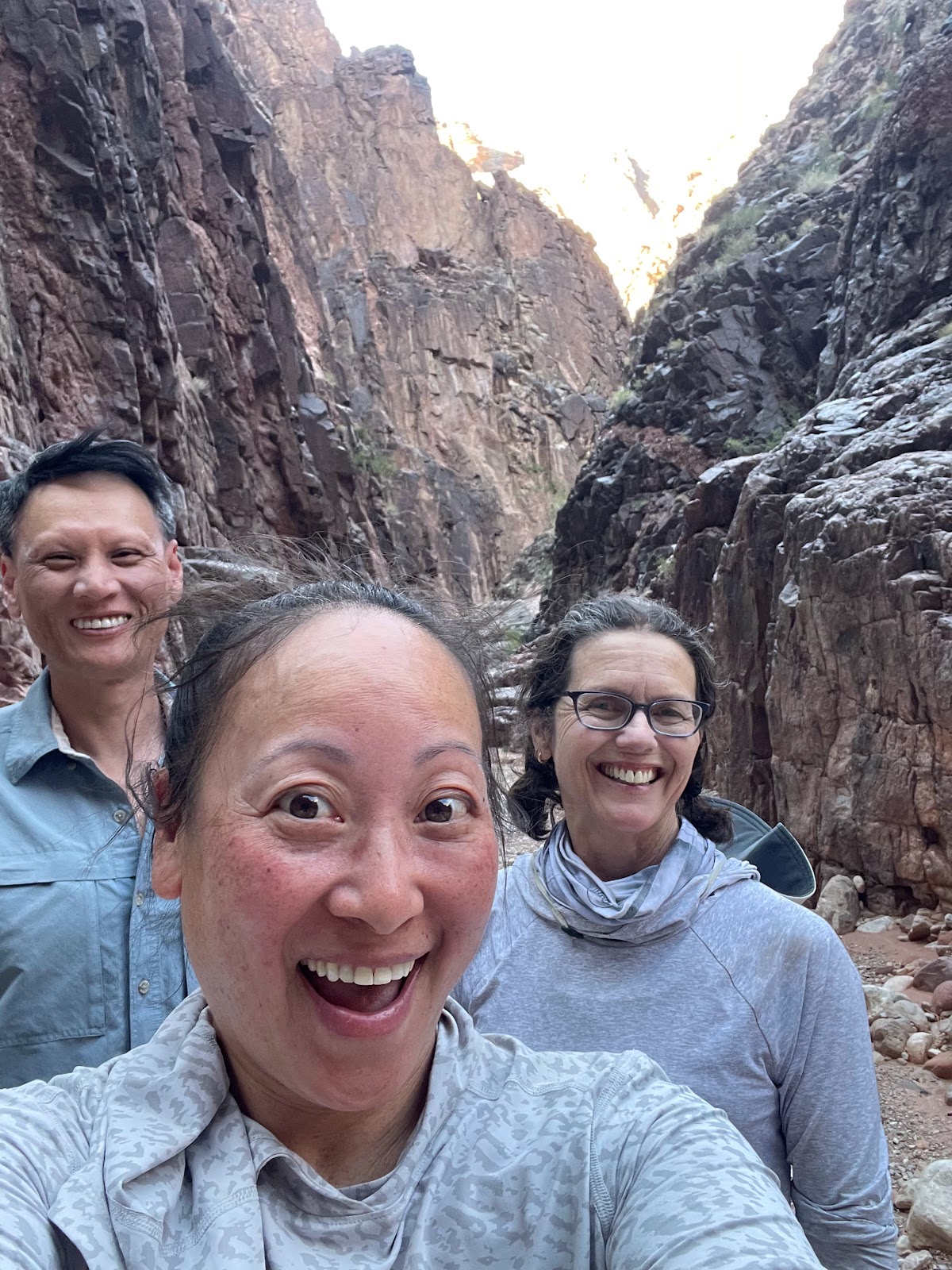
Behind the canyon groover, there was a nice hike into the gorge, so Dustin, Jenny, and I decided to explore before dinner. It was fun sliding down the rocks to get out! After dinner we even tried to find scorpions in the gorge with my blacklight - even though we didn't find any, we did find some strange day-glow orange fluorescent rocks.


There were some pretty fun animals that we saw in the canyon, like bighorn sheep, pink rattlesnakes, collard lizards, and even one poor ornate tree lizard who had grown a second tail:


Thurs June 29 

The next morning started wet, with a series of rapids (Granite, Hermit, Crystal, and the gem rapids) in quick succession.  Crystal rapids became much larger overnight from a debris flow in 1966, when car-sized boulders came down the side canyon during a flash flood. Pre-dam times, periodic flooding would disperse smaller boulders to make the rapids smaller, but not anymore! 

One lovely side hike was to Elves Chasm, a moss-covered waterfall not far from the river. There was a deep pool so a few people jumped in from an opening in the rock, but many of us were way too cold to get in!


We did stop at Blacktail Canyon to see (and touch!) the Great Unconformity. This is where we could see a nearly billion year gap in geologic history, between the 505 million year old Tapeats (marine/beach) sandstone sitting directly above the 1.2 billion year old Vishnu Schist. For our group of science nerds, this was geology heaven! 

A billion years, at my fingertip!
For an extra treat at our Stone Creek campsite (mile 132.5) that night, a small waterfall lay at the end of a short hike. This became our first “shower” in 5 days! 

Fri June 30 

Dustin, jumping into the narrowest
(and deepest) part of the river
After passing the narrowest point in river, at 76 ft wide (and where a handful of people braved the cold and jumped in), we stopped for a leisurely morning at Deer Creek Falls. 
The hike to the Patio

While some of the group stayed at the bottom of the falls,  the majority chose to hike up to the top, following a narrow canyon carved into the Tapeats sandstone. 

At one point, we had to hug the cliff as we maneuvered across a narrow ledge with a sheer drop into the slot canyon below. Hidden along the walls were different pictographs of handprints - some say they were put there by the Ancient Puebloans, others thing they're a hoax left by bored boatmen. At the end of the hike, we found a lovely little oasis with an unexpected stand of cottonwood trees - an area known as the Patio. It was a nice area to lounge around and relax.

Cooling off after a hot hike!

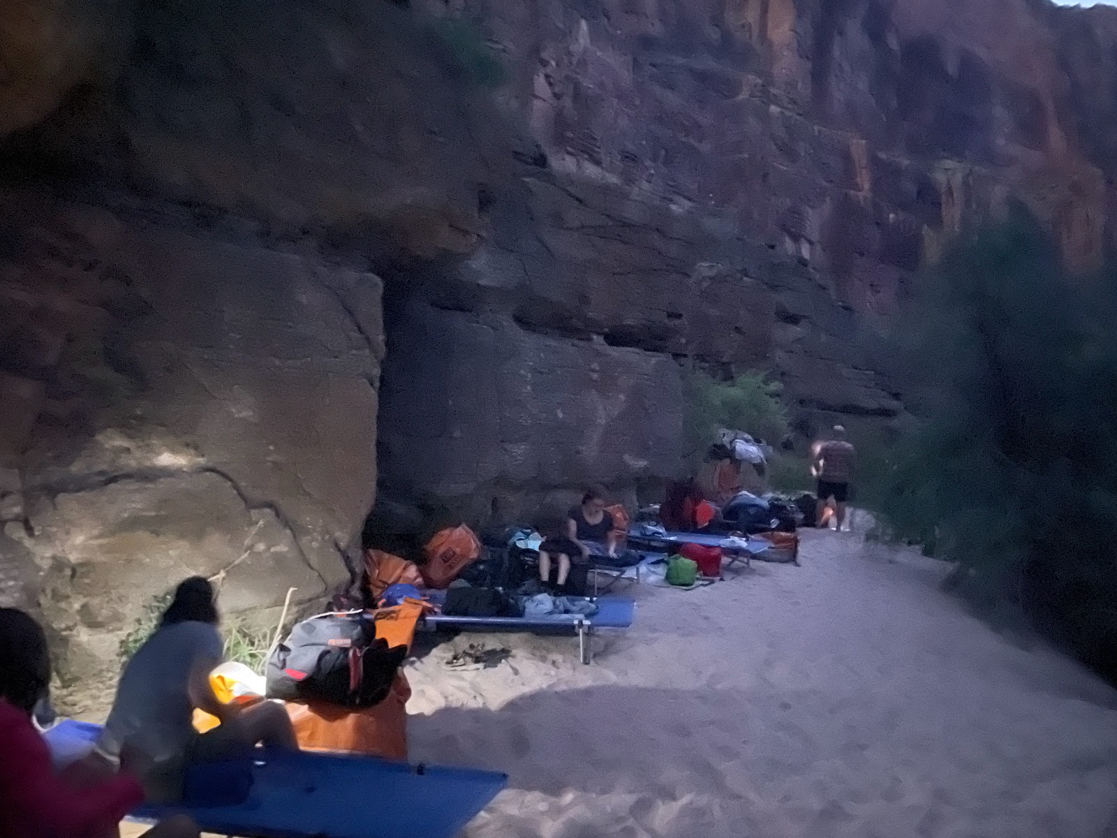
Camp that night was at the Matkat Hotel, a narrow ledge nestled at the base of a sheer cliff wall. With virtually no beach, we found sleeping spots in a row against the rock. It was like sleeping next to a furnace, since the rock sat baking in the sun all the day and radiated heat all night. 


Sat July 1 

Our final full day in the Canyon started with a harrowing (for our boat drivers) stop at Havasu Creek. Since the pullout was in the middle of a rapid, it was harder for them to tie off (and in fact another boat that came after us pushed our (Holden's) boat so close to the adjoining boat that we couldn't unhitch from Josh's boat, so when we left Zach had to make a daring quick-clip-jump maneuver to get us safely out of the rapid.) 
The lovely waters of Havasu Creek


But Havasu was worth it - we climbed around in the Travertine ledges and boulders and played in lots of small pools and waterfalls. The area was much more crowded than any other place we'd been - the guides called it HavaZoo, but it was still well worth the visit.

Shortly thereafter, we reached the edge of the National Park and the border of the Hualapai Reservation. The landscape was distinctly volcanic, with dark black waves of lava clearly identifiable - this area is known as the Uinkaret Volcanic Field, an area of 213 cinder cones. All around we could see remnants of the lava dams that once reached from Lee's Ferry down past Lava Falls, as well as peacock tail and fan structures formed by cooling lava. 
The columnar basalt of the Uinkaret Volcanic Field

August 25, 1869 – “Great Quantities of lava are seen on either side; and then we come to an abrupt cataract. Just over the fall a cinder cone, or extinct volcano stands on the very brink of the canyon. What a conflict of water and fire there must have been here! Just imagine a river of molten rock running down into a river of melted snow. What a seething and boiling of waters; what clouds of steam rolled into the heavens!” ~ Powell Report 

Soon we saw a large volcanic plug jutting out of the river - Vulcan's Anvil, the marker that warned us the most notorious rapid on the river, Lava Falls, was just a mile ahead. It's flat water for that mile, but as we got closer, the low hum became louder and louder until it was an ominous thunderous roar. Lava Falls, a class 10 (on the Grand Canyon 1 through 10 rapids rating system), was formed in the sediment debris of the alluvial fan accumulated at the foot of Prospect Canyon. The rapids at Lava Falls are famous for the giant Ledge Hole that has capsized many boats, and the V-Waves along the side. Nonetheless, we tackled it head on (much easier to do in a motorized raft), and came out the other side with no casualties.

The final night was spent at Whitmore Wash, where in the morning we were picked up by helicopter and taken to Bar 10 for a cleansing shower. In that final 24 hours, I took a raft, helicopter, van, plane, bus, train, and car. Phew.
Bye, Colorado River!


The plane back to Las Vegas
Things I learned while rafting the Grand Canyon:

1. After crossing Navajo Bridge, you’re completely cut off from the rest of the world. No phones, no internet, no signs of civilization! It hit home when Holden was injured and we wondered how they were going to get him out, and how a replacement guide would get to us. I also wondered what it would have been like for a group to set off right before the start of the pandemic, then come out at the other end not realizing the world had completely shut down. What a surprise that would have been!

2. There is sand E V E R Y W H E R E. In all the places. In your hair (but you aren’t washing it anyway), your sleeping bag (after day 1, you’re dirty anyway so who cares), your sunscreen (which makes for a lovely facial every time you reapply), and in all your food and drink. Nuthin' like crunching your Gatorade.

3. It’s dry dry dry down there! Your fingers and toes start feeling like sandpaper, and you have to constantly drink water...

4. …which makes you have to pee a lot, but there is zero privacy, and after half a day, there’s no shame. At each stop, all the women go in one direction and just squat together, in a line, butts in the river - when you gotta go, you gotta go.

5. Speaking of pee, you aren’t supposed to pee in the groover, so you have to learn to pee first into a bucket, do your business in the groover, then carry your pee to the river to dump it out. Makes for some strong pelvic muscles.

6. There’s something ineffable about sleeping in the open at the bottom of the Grand Canyon. At night, the looming black cliffs tower above you, and only a slice of sky is visible - full of the brightest of stars. A palpable blanket of heat radiates off the rocks, making even a sheet too uncomfortably warm. The constant roar of the river sings you to sleep. It’s sublime.

7. Nothing can prepare you for that heart-pounding buildup as you approach Lava Falls. There’s smooth, calm water in the mile leading up to it, lulling you into a sense of complacency. Then the low rumble reaches your ears, and you sit up straighter and hold onto your straps tighter. As the thunder grows louder, you begin to feel it in your chest. Your hands tighten into a death grip as you plunge into that first hole, a wall of water crashing over the entire boat and you bounce off your seat as you plummet into the second drop in a disorienting, dizzying rollercoaster ride. It’s thrilling and humbling and impossible not to let our an exuberant whoop of triumph when you come out the other side, soaking wet but still in the boat!

8. It’s a jarring transition to return to the ‘rim world.’ After six days of lazily floating down a pristine and isolated wilderness, getting pulled out by helicopter is instantly going from 2 billion years in the past to the epitome of technological advancement. Being at the bottom of the canyon is hard. But being at the top makes you appreciate every moment of the experience.

Thank you to Bertha, Kenny, Len, TIES, and all the teachers who made this a wonderful memory!

We survived!


Saturday, June 10, 2023

🔍🦴 Fossils in the Field 🦖🐊


A fossil is the preserved trace of any living thing – it’s not just the remains of the organism itself (bones, teeth, etc.), but it could be a trace of what it leaves behind (footprints, imprint, scales, hair, etc.). Fossils are formed when an object is quickly covered by sediment, then - most importantly - it is sealed. The tissue decomposes and is replaced by minerals, which take the shape of the original object. Most things don’t get turned into fossils since it takes just the right conditions - in fact, Sterling believes around 99.9% of things are NOT turned into fossils, and most fossils are delicate and are therefore destroyed through the passage of time. Nonetheless, we found plenty. 

Arriving at the Green Site
The second day of the workshop was dedicated to fossil hunting. The guiding questions was: How do you know where to go to find a fossil? If you know your geology, you look in the places where they should be. Dr. Sterling explained it best by asking where do we go to find milk? We know to go to a grocery store, and we can guess that the refrigerated section is probably somewhere near the back of the building. Then, we can narrow it down to the dairy section, but after that it becomes luck whether the store has our brand in stock, and exactly where on the shelf it is placed. 

Hunting for fossils is a similar process – if you correctly read the landscape, you can make an educated guess where fossils might be, and it becomes luck after that.  

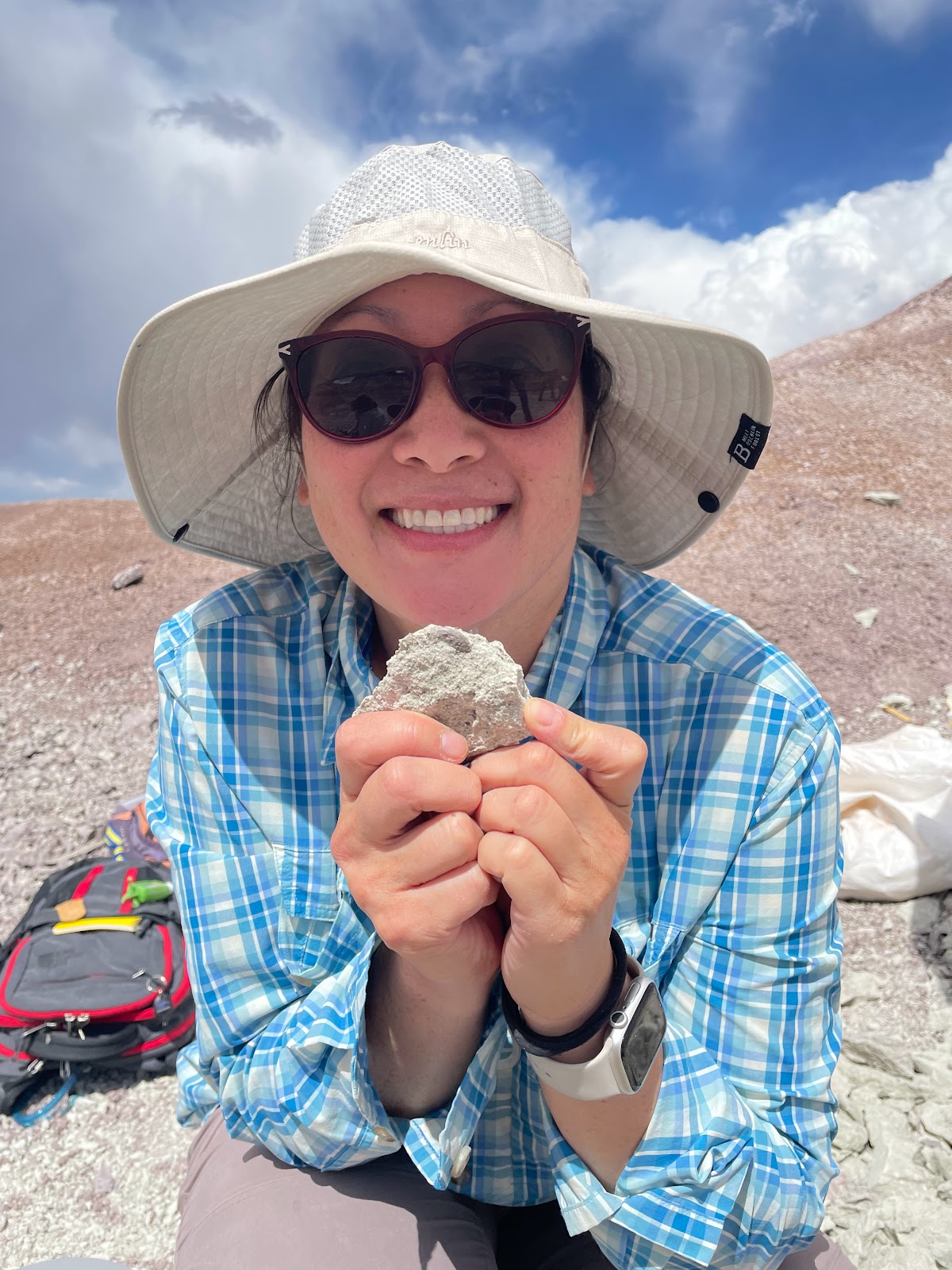
Michelle, with her find!
We first stopped at the Rainbow Forest Museum for an overview of the Triassic creatures found within Petrified Forest NP. Michelle had done much of her research here at PEFO, and some of her finds are displayed in the museum!

It was also interesting to see the different animals found in the park during the Triassic, including aetosaurs (big, heavily armored reptiles that sometimes grew spiked bony plates), metoposaurs (3 meter long salamander-like amphibians whose heads can be described as 'toilet seats'), and phytosaurs (huge crocodile-like reptiles that grew up to 4 meters long with long pointed snouts and huge sharp teeth at the end). One note - there were very few dinosaurs in the park and our main digs were not looking for dinosaurs.


THE GREEN SITE - DIGGING FOR FOSSILS

We traveled just outside the National Park to private land that Sterling and Michelle had found several years ago. To identify the site, they'd looked at the landscape on Google Earth and, based on color and texture, determined it was a good location; they then contacted the owners and got permission to prospect. They camped and hiked around the badlands until they spotted some fossil teeth on the ground. Sterling says he put his hand in the dirt and pulled out a handful of teeth, so they knew it would be a good fossil site.  

The Green Site, where we spent the day, is located in the Jim Camp Beds of the Sonsela Member of the Chinle Formation, formed between 212 and 216 million years ago. The different layers are bluish/purple, and faintly green, located just below the tan Martha’s Butte sandstone. (Martha's Butte beds were easy to distinguish, as it was the only layer that had plants growing in it.) The purple color of the Jim Camp beds tells us there was standing water, and sure enough we found remnants from several aquatic species.  We were digging in one of the lighter layers of the Jim Camp beds, where the soil had a bit of a greenish tint - thus the name Green Site.

It was so frustrating at first as everything seemed
to look the same, but very quickly I learned how
to spot the fossils - and they truly were everywhere!
We started by just sitting and scouring the ground for fossils. At first I found it really hard to find anything, but after seeing a few examples, it started to get easier to differentiate between fossils and rocks. 
My haul, that we were allowed to keep:
teeth, coprolite, and bone fragments
The most common fossil we saw was coprolite – fossilized poop, which was smooth and oblong and has a very uniform makeup.  And as we learned, 'where there's poop, there's bone!" 


Bone fragments are porous and often have a textured section that looks just like modern bone. Because it is porous, it will stick to your tongue, so sometimes paleontologists will lick their find as a test. 
So clear under a microscope!
Fossilized teeth are often smooth and shiny, and some have serration along their edges. It was interesting to view the teeth under a microscope, since sometimes it was hard to see any fine details with the naked eye. This is why paleontologists carry loupes (small magnifying glasses) when working in the field.

In the past at this site, the team had found several phytosaurs –  large, semi-aquatic, armored carnivores that resemble modern-day crocodiles (but aren’t related – it’s just parallel evolution), so there was a definite possibility of finding larger fossils. But I spent the day working with post-doc researcher Davide, who was looking for microfossils. To do this, we learned how to split rocks.  

Being a paleontologist for the day!

We sat in the dirt with a shoe-box sized hunk of rock, then put a flathead screwdriver along one of the natural seams and hammered until the rock split. We then examined the newly exposed surface, looking for anomalies in the light grey surface. Most dark specks were traces of some former organic material – often a tooth, scale, jaw, or poop. It was like opening Christmas presents! Sometimes it was nothing good – like getting socks or underwear. But once in a while… you unwrap an Xbox! 
The drepanosaur claw
At first, we had no clue what we were looking at. The fossils we were looking for were tiny - most of which were about a centimeter or smaller. We were sure that in the first several rocks we opened, we must have thrown away so many fossils without realizing it! Of my larger finds, there was a phytosaur osteoderm (an armored plate like the scale of a crocodile), the long front tooth of a phytosaur, a coelacanth scale, lungfish teeth, and a rare drepanosaur hand claw! On top of that, if we found a rock that was particularly rich in microfossils, we kept it for future screening. 

Another side note: the Drepanosaur is a very wacky creature. It’s a… lizard (?). With a hump like a bison, opposable toes, a prehensile tail ending in a scorpion-like spike, and a single giant claw on its front ‘hand’. It's like the maker took all the leftover parts when he was making creatures and lumped them all together!  
 
The partially-excavated osteoderm
An exciting find... but what is it???
Finding the phytosaur osteoderm was also really fun. Initially, I saw only part of the broken scute and had no idea what it was. It was first completely imbedded in the rock, so I showed it to Davide who slowly chipped away at the surrounding sandstone to figure out what it was. A phytosaur is a large reptile that has bony scales on it's back, much like a crocodile. With just a few centimeters visible, Michelle confirmed that yes, it was a phytosaur osteoderm, and Davide helped to excavate it from the rock. 
 
The complete osteoderm
The fossil itself is very delicate, so he showed me how to reinforce it with a mixture of acetone and glue - an easily reversible solution that helps support the fossil while we were excavating it. After the glue dried, Davide was able to remove the majority of rock. It was then wrapped in toilet paper and foil to be transported back to the lab.

Prepping the fossil for its cast
Nobody expected the day to be as fun as it was! We had to be told several times to break for lunch, and when asked if we wanted to help with other jobs, those of us splitting rocks didn’t want to move. So I don't really know much about the other jobs out in the field! 
Closing up the jacket

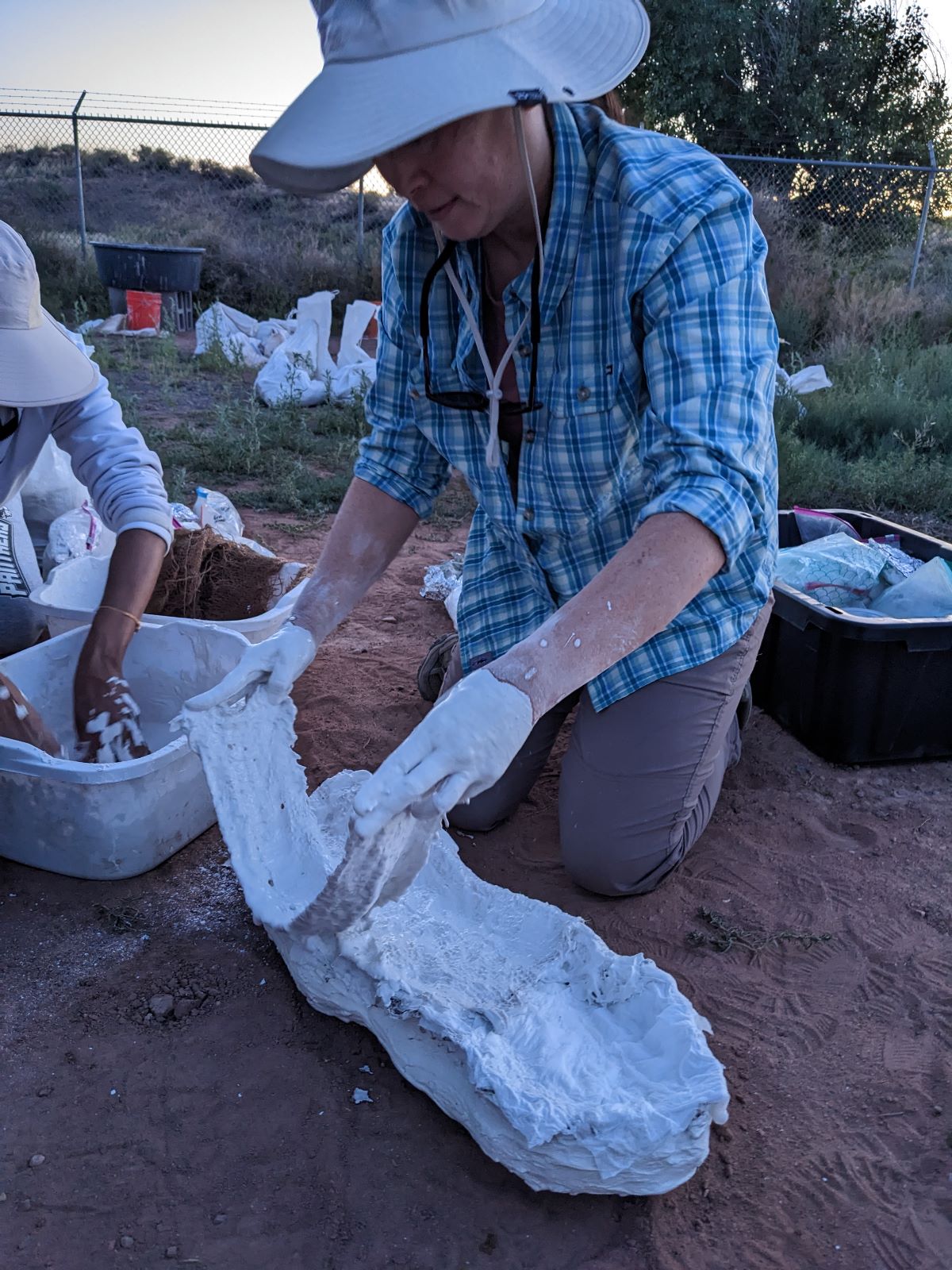
I did for a moment look in on the plaster casting - creating a protective "jacket" around larger fossils so that they can be safely moved from the field (but I returned to splitting rocks and didn't help out). To create the jacket, the top half of the fossil is encased in plaster in situ, then the dirt around it is carefully scraped away and the fossil is brought back to camp. There, the rest of the jacket is plastered on to fully protect the fossil. Since I missed out on the process in the field, I tried my hand at closing up the jacket at camp.

To finish plastering the sample, we first laid down a thick layer of toilet paper over any exposed rock, keeping it in place with a little dab of water. After the entire rock was covered, we mixed plaster (the more you agitate it, the harder the final cast!) and quickly covered the rest of the specimen.

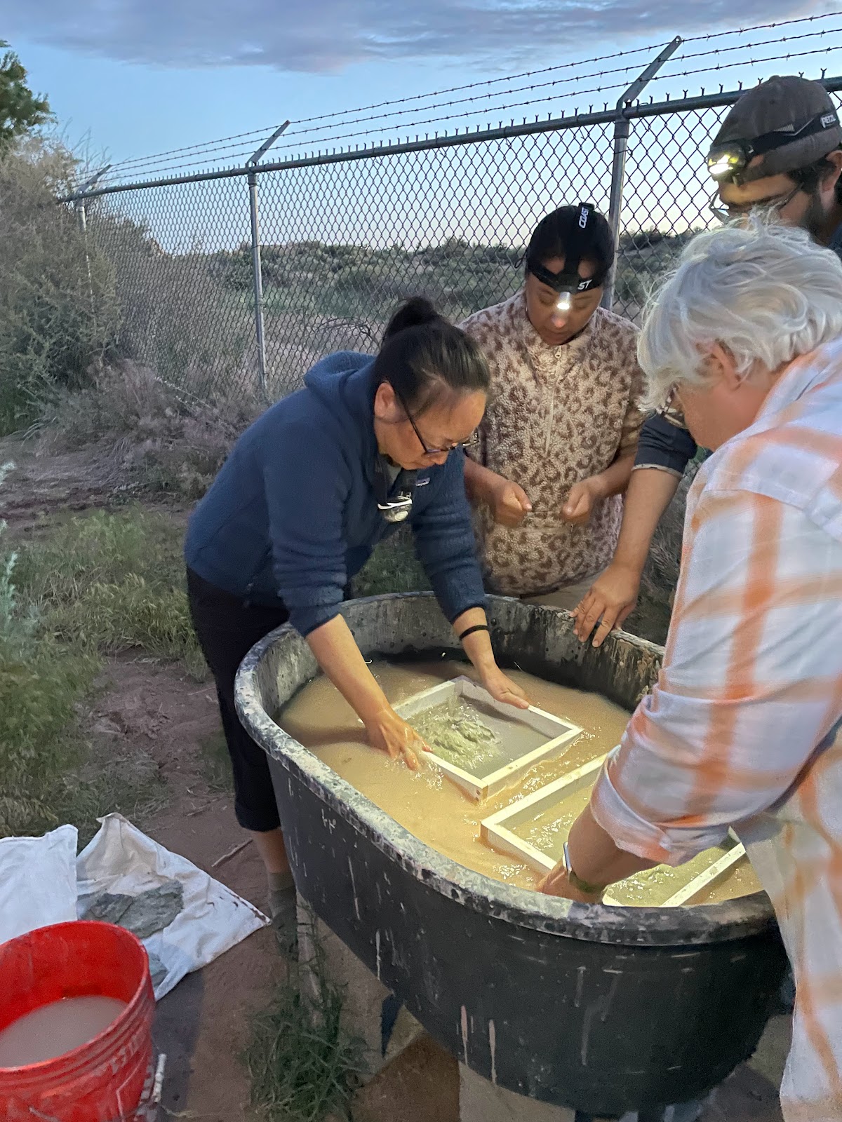
The other process we learned was how to sift for microfossils. Davide showed us how to process the many pounds of rocks we’d brought back so that he wouldn't have to transport it all back to his lab. He soaked the sandstone chunks in water for several hours until it turned into mud. Then, we put the mud through a sieve and swirled it in water, much like panning for gold, to filter out all the unwanted sediment. We had to take care not to agitate the mix too hard for fear of destroying all the delicate pieces. The smaller sand and mud filtered out the bottom of the sieve, leaving behind the larger pieces including all the fossils. These remnants would be left to dry, and then collected and brought back to the lab to be sorted under a microscope. By going through this process, a huge 50-pound bag of rocks could be reduced to the size of a gallon Ziploc bag.  

CRYSTAL FOREST – PETRIFIED TREES 

The next morning, we went to see one of the park’s namesake Petrified Forests. The Crystal Forest is known for its ‘clunkers’ – trees with a high concentration of quartz crystals. Trace minerals cause different colors in these trees, including reds/oranges/yellows from iron and manganese, and blues/greens from cobalt, copper, and chromium. And apparently there used to be a lot of amethyst (!!) but much of it was taken by past visitors. There are also ‘clinkers’ – petrified trees that make a ‘clinking’ sound when knocked together.  

225 million years ago when these trees were alive, Pangaea had yet to break apart and this area of Arizona was much closer to the equator. The environment was much more tropical - hot and humid, with many lakes, rivers, and rainforests. The fallen trees (many were conifers like monkey puzzle trees) were covered by high-energy water, which moved enough sediment to completely bury the logs. A clue that the water was fast-moving are the rounded pebbles, which needed fast water to rub them smooth. After petrification, the landscape must have been uplifted, then eroded to uncover the petrified logs. In some areas, the logs look as though they have been cut cleanly into pieces with a saw – these have been broken from the movement of shifting land; but if there is enough support, the log stays fairly intact. In other areas, the trees have crumbled and look a lot like wood chips. 

 BLUE MESA – DYING GROUNDS

Learning about the landscape
with Ranger Bill
After a lunch stop at Chinde Point (with a great view of the Painted Desert), we headed back to Blue Mesa with park paleontologist Bill Parker. Bill took us to an area called the Dying Grounds, where we practiced prospecting for fossils - reading the landscape and looking for clues of fossil deposits. The Blue Mesa area is named for the blue and purple sandstone layers, indicating the presence of water. We hiked into the badlands to learn and practice how to find fossil beds.

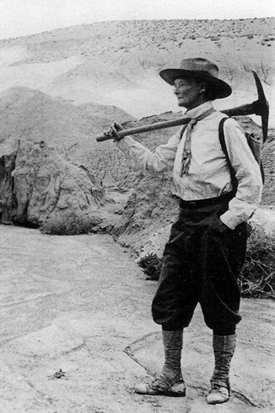
Woman with pick axe over her shoulder in old photo
Annie Alexander:
how badass is she???
Along the way, we stopped at the campsite of Annie Alexander, the UC Berkeley paleontologist who explored the area in the 1920s. Great seeing some female STEM representation!!

The yellow and white streaks are possible signs of past life

Near Annie's campsite, we stopped to examine a section of newly exposed cliff to see if we could 'read the rock'. Sterling showed us signs of bioturbation - areas where something organic disturbed the soil, leaving traces of its presence. These discolored sections could have been from animals that burrowed into the ground causing a mixing of the soil, or roots whose nitrogen nodules discolor the dirt. Sometimes, the disturbance causes two rocks to rub against each other, creating a small patch of shiny surface known as a slickenside.

Lots of things died in the Dying Grounds - and fossils were abundant!
Because the layers of sandstone are weathering away, fossils are continuously being uncovered and often being transported downhill. We were looking for exposed fossils, then following them uphill to areas of higher concentration and digging into the dirt. 

Again, it was interesting how quickly I learned to spot a fossil. Initially, I just saw dirt and rocks and was amazed when Sterling kept picking up fossils and handing them to me, saying "Here's a tooth. Here's a metoposaur." 
A nice collection of fossils!
Metoposaur interclavicle fragments
I couldn't understand how he was doing it, but he said it was from the experience of 10 years walking in deserts. Once I had some fossils examples, it started getting easier and easier to spot them myself. Metoposaur bone fragments have a very distinct texture, vertebrae look just like modern bones, and teeth retain a shininess like enamel. If you find a fossil fragment, you follow the wash uphill until you find a concentration of fossils, then locate the source and dig for more.
A huge phytosaur front tooth, in situ
 PAINTED DESERT – PROJECT DAY
Into the Painted Desert we go!

The final day of the workshop was a culmination of everything we'd learned - we were split into teams and sent out into the field. We were told that a paleontologist had lost their field notebook, leaving nothing behind but the coordinates of their find. Our task was to locate their find using a GPS, then read the surrounding landscape to tell the story of that fossil.

Sterling led our team (Kiki, Mary Ellen, Molly, and I) up to the northern end of the park and into the Painted Desert. Using a GPS unit, we found the site of an active dig where they had found dinosaur fossils - an early carnivorous therapod called Coelophysis. Based on the clues around us, we had to tell its story - where it lived and what its environment was like.
Time to read that rock!
By carefully examining the rock, we discovered layers of siltstone, sandstone, and mudstone. Mudstone and siltstone are very fine layers of sediment, where the grains that make up the rock are too small to see with the naked eye. To differentiate the two, you can take a small piece and rub it between your teeth - siltstone feels gritty since it is slightly larger; mudstone is smaller and will feel smooth. In sandstone, the grains are larger and can be seen with the naked eye. Based on the grainsize of the sediment, you can determine the energy level of the water that deposited it. Fast flowing water (high energy) will carry away smaller sediments and leave larger pebbles, and slower or standing water (low energy) will deposit finer sediment. Because we were finding mudstone and siltstone, we could determine the layer was deposited perhaps in a lake or pond-like environment. The lake dried and reappeared several times throughout history, as evidenced by the differing color layers that we observed.
Phytosaur and lungfish teeth, along with
other bone fragments found at the site
A clue that pointed to a swampy or shoreline habitat was the presence of the lungfish teeth that we found. Because modern lungfish have the ability to crawl out of the water and into the mud on the banks of a lake, we could conclude that our ancient lungfish may have lived in a similar environment. Another clue that supported this theory was the phytosaur teeth that we found, since phytosaurs also lived in a swamp-like environment.
The stratigraphy of the project site

We learned how to draw a stratigraphic diagram, showing the differing layers of rock and the items we found in each layer.  From our notes, we needed to come up with the story of our missing paleontologist's find and present it to the rest of the group.
Delivering our story!
It was nerve-racking presenting our story since I was still not very confident about my rock-reading abilities, but my team pulled through!


Overall, the DIG workshop was an amazing and eye-opening experience. I learned so much, not just about paleontology, but about geology and the ancient history of the area. It gave me a profound appreciation for the deep history of the earth - about how old it is and how many stories are hidden in the layers of rock. I'll never look at dirt the same way again!

Monday, June 5, 2023

The DIG Field School - Exploring Paleontology!

It’s just about every child’s dream to dig for fossils, and this year I got to fulfill my lifelong goal of doing paleontology field work! Thanks to program director Dr. Sterling Nesbitt, Dr. Michelle Stocker (a phytosaur expert), and the Virginia Tech Paleo team, the DIG Field School program expanded into Petrified Forest National Park where during the Triassic, a large river system helped preserve huge forests of trees. In this humid, tropical environment, giant amphibians, reptiles, fish, and early dinosaurs lived and died – and their fossils can be found in and around the park! 

The origin and early radiation of dinosaurs - ScienceDirect
On a side note, did you know that the term ‘dinosaur’ actually refers to a very small percentage of vertebrate fossils that have been found? Scientifically speaking, a dinosaur is an ancient reptile that appeared when birds and crocodiles split on the evolutionary tree - they are on the arm that evolves into birds. Creatures like mosasaurs, pterodactyls, dimetrodon, and plesiosaurs aren’t technically dinosaurs. It’s more accurate to call all those ancient animals ‘archosaurs’.

The program began when we were picked up from the airport in Phoenix by Sterling, the program director. He is a professor at Virginia Tech studying vertebrate morphology – ie the body shapes and how they evolve, and he told us all about the geology of the northern Arizona landscape during our 4+ hour drive to Petrified Forest. For the most part, paleontologists are also geologists – they can read the area’s stratigraphy and identify the origin and composition of the rock. The main thing to remember is the Law of Superposition – that lower layers of soil were laid down first, so deeper layers are older than the ones above.

Geologists divide the rock layers based on different characteristics, and between each layer there must be an definable change.  Petrified Forest (PEFO), where we were doing most of our work, is entirely in the Chinle Formation – formed during the Upper Triassic period of the Mesozoic Era – ie. between 208 and 227 million years ago. This is early in the age of dinosaurs, who lived primarily in the Mesozoic between 250 to 66 million years ago. 

This may sound like a really long time ago, but we soon learned that Earth’s geologic time scale is reaaaaaallllly long. This was clearly demonstrated on our first full day, during our visit to the Grand Canyon.


GRAND CANYON NATIONAL PARK – UNDERSTANDING DEEP TIME

During the past 2 billion years, igneous, metamorphic, and sedimentary rock were deposited to form the layers of the Grand Canyon region. Through uplift caused by plate tectonics, the entire area was pushed upwards and eroded into a giant flat area, forming the Colorado Plateau. The Colorado River then began carving away a canyon as it traveled downstream,  exposing the underlying rock layers - and that's what we came here to see. We traveled to the park to meet with Ranger Brandi Stewart, who coincidentally was the same ranger I met with during my trip to Death Valley NP 5 years ago.
Hi Ranger Brandi!


There are a few misconceptions about the Grand Canyon that Ranger Brandi wanted to address. The biggest misconception by visitors to the South Rim is that it is cooler at the bottom of the canyon than on the rim. Quite the contrary – for every 1000 feet of elevation down, you gain about 5° F in temperature. So the bottom of the canyon is about 25° hotter than where we were standing – an important thing to remember if you’re hiking down to the river! And a good thing for me to know, since I’ll be rafting the Colorado River in about 2 weeks...

Two other misconceptions that students have are that rocks don’t change and that rivers passively flow – both of which can be debunked looking at the Grand Canyon.

Most interestingly, Ranger Brandi helped us understand Deep Time. It’s hard to conceptualize the huge numbers used to describe the age of the Earth and the things on it, since 100 million years and 2 billion years both just seem like… well, a loooong time. But there's a big difference between the two, and a lot a time that has passed between now and the formation of the Grand Canyon and the creation of the Earth. A great way to visualize it is to think of the timeline of the earth on our outstretched arms. The earth is about 4.55 billion years old, so if the creation of earth is on our left fingertip, the creation of the Basement rock – the very oldest bottom layer of the Grand Canyon – would be at our right shoulder. Dinosaurs appear at around the knuckle of our right middle finger, and humans don’t show up until the very tip of our fingernail!

4.5 km later,
waaaayy into the past
The start of the walk,
representing present day
The best part of the visit was the Trail of Time - a 4.5 km walk along the canyon rim, with ground markers indicating the passage of time. At the beginning, every meter had a brass marker representing the passage of one year. As you move down the trail, it logarithmically increases until each step equals one million years. By the end, we've walked back in time 2 BILLION years! And the best part is that they actually went into the canyon and brought up sample rocks from different strata and placed them on their birthdays, so you can see and feel how different the layers actually are.


Looking down into the Grand Canyon is like looking back in time – the very bottom rocks of the inner gorge are ancient igneous and metamorphic rocks known as Vishnu Schist, about 2 billion years old. And where we’d be fossil hunting at Petrified Forest, the Chinle Formation is actually younger than the top layer of the Grand Canyon so it wasn’t even visible from the South Rim! It's also interesting to note that the canyon itself was carved rather recently - only over the last 5 or 6 million years.

While it was hard for me to identify individual strata along the canyon walls, it was easy to spot different layers through the varying textures and colors of the cliffs. One of the most interesting and important things to note was that there are huge periods of missing time – known as unconformities. This could be because it was a period of weathering and erosion and the layer has been destroyed, or it was because the environment at the time wasn’t conducive to creating the rock. So when we look at the sides of the Grand Canyon, there is actually more time that is missing than there is represented in rock!

Seeing the actual layers of time exposed at the Grand Canyon was a great introduction to geology, and helped us understand how rock can tell the story of the past. 
A fun dinner stop in Winslow, Arizona with teacher Molly

Welcome to Camp!
We returned that night to camp in Petrified Forest National Park, our home for the next four nights. Our tents were set up on the old Civilian Conservation Corp campground near the Rio Puerco, where the CCC first stayed in the 1930s. At the time, young men looking for work during the Great Depression helped build up the park's infrastructure by paving roads, creating trails, and building the park's museum, headquarters, and ranger housing. 

We were some of the only people to camp inside the park since PEFO has no public campsites, so it was a privilege to stay there!