Thursday, August 1, 2019

Adventures in Alaska: Glacier Bay National Park


30 July – Anchorage to Glacier Bay
A mostly travel day today – we’re flying out of Anchorage to Juneau, then on to Gustavus, to spend a day in Glacier Bay National Park.
Flying over, we had a clear beautiful day and a great view of the landscape below us. We took several videos, and afterwards realized we were looking at Glacier Bay National Park and the waterways and glaciers that we’d be visiting. Seeing it from up above gave a much clearer picture of how the glacier system worked, and the ‘rivers’ of ice were easily traced back to the enormous ice field that was feeding it.
Because we had a few hour layover in Juneau, we decided to Uber downtown (about a 10 minute ride) for lunch. There’s a harbor where all the gigantic cruise ships dock – the town has about 35,000 residents, and each one of the ships hold around 6-7,000 passengers. When we were there, 6 ships were docked...!
Also at the harbor are many sea plane companies. We had lunch at a dockside restaurant, and every so often the loud whirl of the propellers would drone in or out, stopping conversation. It was a gorgeous day – around 74° and sunny – which was wonderful for us, but terrible for the environment.
The ride to Gustavus, the jumping off point for Glacier Bay, is 12 minutes long. Probably the fastest plane ride I’ve ever been on. But it just goes to show how remote some of these places are – there are no roads to get there, so the only ways to get around are by plane or boat. That’s why there are more bush pilots per capita in Alaska than anywhere else in the world.
Gustavus is about a 15 minute bus ride from Glacier Bay National Park, where we’re staying for one night. We checked in around 6pm, which gave us enough time to go on a short hike before dinner. We took our junior ranger books out on the Forest Trail, and found a lovely little lagoon in the middle of the rainforest where we worked on our books. There’s a thick layer of moss covering everything, and we found tons of different lichens, fungi, mosses, berries, and other vegetation. The trees grow right up to the short beach, so it’s an interesting coastal ecosystem unlike the ones I’ve seen before.
We have to be up early for breakfast tomorrow, so it’s off to bed for us!
31 July – Glacier Bay to Juneau
Woke up early this morning and took a boat ride through Glacier Bay. This National Park is interesting because the entire bay was created only 300 years ago. During the Little Ice Age in the 1700s, the area filled with ice, covering the native Tlingit Village that existed here before it was a bay. As the ice field retreated, it carved out the valleys that were then filled in with seawater, leaving a 1300 ft deep bay with several smaller glaciers still existing and reshaping the environment.
We sailed out of Bartlett Cove and up around the Beardslee Islands up Sitakaday Narrows. In the distance, we spotted several humpback whales, including one that breached. There were so many that we didn’t even stop to observe them. Up by South Marbel Island, we slowed to see the nesting sea birds – including cormorants, pigeon guillemots, kittiwakes, glaucus gulls, and tuffed puffins.
By Tlingit Point, we sailed past Sebree Island – which actually is no longer an island. Because Glacier Bay was formed so recently, the ground underneath is still very active – the retreating glacier is taking pressure off the land, so the entire area is slowly rising as the weight is taken off.
We took a brief detour up Bear Inlet to look for wildlife on the shore – animals come down to the beach to find mussels and other tidal creatures – and saw a mother brown bear and her cub foraging in the brush. Soon after, up along the cliffs, we spotted several mountain goats (some with their kids), high up on the steep slopes. 
Then we sailed up Glacier Bay to Johns Hopkins Glacier, passing Reid Glacier and Lamplugh Glacier along the way. There were several bergy bits and small ice floes in the inlet, and the closer we got to the glacier the more harbor seals we saw hauled out on the ice. 
Harbor seals rely on sea ice to have their pups; with the loss of sea ice, fewer harbor seals are able to find a safe place to rest. In addition, kayakers and tourist  boats sometime startle the seals who then escape off the ice, and if it happens too often they will abandon their pups to get away.


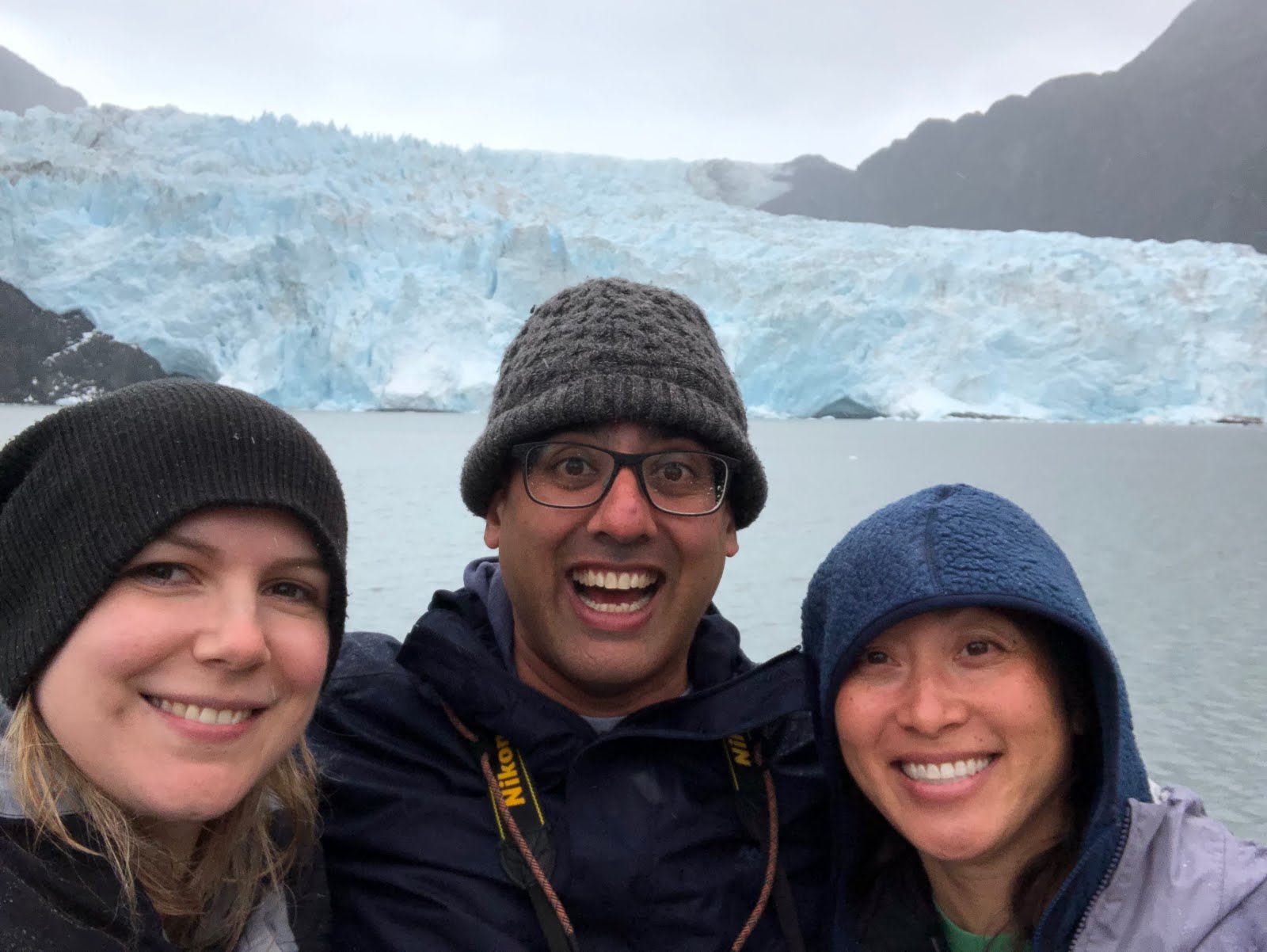
We idled for about 20 minutes in front of Johns Hopkins Glacier, watching it calve. The katabatic winds coming off the top of the glacier sent a constant cold breeze over us, also creating swells in the water. We could hear the rumbling and thundering inside the glacier, and five or six times a hunk of snow and ice would crumble and splash into the sea. The massive expanse of wall made it hard to tell how big each calving event was, but still an enormous amount of ice was falling each time.
We had just enough time after the cruise to get to the Gustavus flight back to Juneau, where we went downtown for a crab feast at Tracy’s Crab Shack. Tasty!
1 August – Anchorage
Awesome day today, hiking Mendenhall Glacier. Guide Daniel picked us up at 7:30 and we headed straight to the trailhead. We each had a backpack with our helmets, harnesses, walking stick, and crampons (and most importantly, snacks!) and went out the 4 miles to the base of the glacier. The trail went first through Sitka Spruce and hemlocks in the Tongass National Forest, then started getting rougher through brush and up rock scrambles.
It was disturbing to see the year markers for where the edge of the glacier used to be – halfway through the hike we reached the 1946 marker, and as we grew closer the signs began popping up closer and closer together. At this rate, the glacier will be inaccessible in only a few short years; even now, they are discussing plans to move the Forest Service visitor center (the most-visited tourist site in Juneau) and potentially closing the trail.
We were lucky enough to get there earlier than most other groups, so we went down to the side of the glacier and found an ice cave. The colors were mesmerizing – the deeper the blue, the more hard-packed and therefore stronger the ice. Down below, the dirt and gravel had turned the ice into a grey-black, so it looked more like rock than ice. Melting ice water continuously drained from the sides, not quite a waterfall but definitely disconcerting on such a warm day – as Daniel explained, just the week before that ice cave hadn’t been there, and in a week or so, it would be totally gone.
Daniel went first to scope out the security and strength of the ice, then set up climbing anchors and ropes while we put on our harnesses, helmets, and crampons. In turn, we each strapped in and scrambled up the icy slope into the cave. There were so many different features and crevices found in the ice –it looked almost as though we were looking underwater. It was also interesting to see the distinct layers and types of ice, the holes and cracks, and to feel the smooth, glassy surface of the clear blue ceiling.
See the people behind me?? Goes to show how BIG the glacier is!
From there, we went around to the front and climbed up to the surface of Mendenhall. We had to carefully stay in a single-file line and follow the path that Daniel was taking, in order to avoid the crevasses (cracks) and moulins (shafts) that might be under the surface. And nearing the gaping maws was exhilarating and a bit frightening – the vibrant blues and whites were mesmerizing, and it was hard to gauge the depths of the pits. More than once I felt the ‘call of the void’!
It was definitely a weird warping of scale being up on the glacier - each of the crevasses that we looked in stretch down 100 feet or more, yet don't look it when you look down. Daniel stood near the edge and dug his crampons in, and when we wanted a peek he'd grab on to our harnesses - just in case.

We also wanted to hike further up the glacier, but after calling on the radio to the group that was up ahead, it was a definite 'no go' - the ice wasn't very stable and the route was difficult to traverse.

I felt really fortunate to get such an up close and personal visit with a glacier. The entire time we were there, a constant stream of melting water could be heard from all around - even with the katabatic winds, it wasn't very cold and many of the formations that we were admiring weren't there the week before. There's a big discussion about how much longer Mendenhall will be accessible to visitors, since it's melting at such a rapid rate that soon we won't be able to reach it. It's melting fast - and given how warm and relatively nice the weather was the entire time we were in Alaska, it's only going to get worse.

Monday, July 29, 2019

Adventures in Alaska: Kenai Fjords National Park


26 July – Kenai Fjords
What a different landscape!! Today we took the 4 hour boat ride out of Seward to the Kenai Fjords Glacier Lodge, at the base of the Pedersen Glacier – the only lodge inside Kenai Fjords National Park. We’ll be here for the next two days, exploring the ecoystem surrounding this coastal habitat, and hopefully seeing some very different plants and animals.
Kenai Fjords contains the many fjords created by the Harding Ice Field, a 700 square mile area of ice that has caused dozens of glaciers to push through into the sea. The geology of this area is what caused the formation of the ice field – the Pacific tectonic plate subducted under the North American plate millions of years ago, creating such mountain ranges such as the Alaskan, Brooks and this Chugach Range. The proximity to the ocean allows for a weather pattern that produces vast amounts of precipitation; in some years, the Harding Ice Field gets over 100 inches of snow. The pressure caused by the accumulation of this much weight is what created the ice field, and like a tube of toothpaste being squeezed, the ice is getting pushed out through the mountain channels in the form of glaciers.
A fjord is any bay created by a glacier and filled in with water – it’s a remarkable ecosystem that is uniquely suited for an abundance of wildlife. At times during their creation, the glacier pauses and sediment from the glacier is deposited at a certain spot; this means some bays such as Aialit Bay where the Kenai Fjords Glacier Lodge is located has dramatic depth changes because of undersea shelves – at points the depth goes from 700 meters to 35 meters, then back down to 700 meters. Upwelling from currents makes for strange pockets where sometimes hunks of ice accumulate.
Additionally, minerals carried by glaciers feeds these coasts, and the nutrient rich water is ideal for algae, jellyfish, plankton, and small fish. This in turn drives up the larger marine mammal and sea bird populations.
As we drove out of Seward harbor, we first saw a small group of sea otters. They just stared curiously, but were unafraid even when we drifted to within 25 feet of them. It interesting that they were the first animal we saw, since the establishment of Seward and the very first arrival of Russian traders in this area was driven by the desire for sea otter pelts. Otters have some of the warmest, softest hair in the world – they can have up to 1 million individual hairs per square inch (in comparison, humans might have around 100,000 hairs on their entire head).
We stopped to see Spire Cove which look like fingers sticking out from the sea. They're leftover from the time when glaciers retreated from the bay, carving out the many inlets and leaving interesting formations. From there, we saw several sea birds, including cormorants and horned puffins. Puffins are funny looking birds – easiest to describe as flying potatoes. They flap furiously to keep in the air, but amazingly they “fly” just as well underwater while trying to catch fish.
As we continued out of Resurrection Bay, we were surprised by a pod of about 7 orca. They started a few hundred yards away from us, but as they came closer they suddenly started to breach. Our captain Shawn said in the 10 years he’d been here, he had never seen a male breaching so we got lucky. About three of them jumped out of the water two or three times each – it was a great show.

Our next stop was to the Holgate Glacier, to see the incredibly blue ice. As we drew close, we could feel the cool air coming off the top, known a katabatic wind. A few small pieces came off but we didn’t see or hear any of the major calving.
Near Holgate, we saw a strange cloudy area in the water; getting closer, we realized it was a smack of jellyfish (love that it’s called a smack!) – moon jellies. There were thousands in the grouping, all clustered together feeding on whatever was in the water at that point.
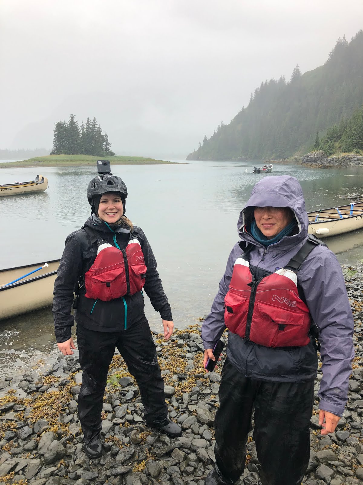
We got to the lodge right by Pedersen Glacier soon after 2pm and walked the half mile to the lodge. From here we can see lower Pedersen Lagoon, and across from that, Pedersen Glacier on the lagoon's far side. After checking into our room (Puffin), we went on a canoe ride into the lagoon. It was drizzling, but the lodge provided us with wading boots and waterproof pants. The lagoon itself is really calm brackish water – fed on one side by a small channel into the bay for salt water, and by a stream of glacial melt on the other bringing in fresh water.
We saw several more marbled murrelets and pigeon guillemots (some of which took off flying by running across the water and furiously flapping before taking off – reminding me of a B-52 bomber in their lumbering gravity-defying way – showing us their bright red feet). We also saw several harbor seals and two sea otters.
We made it back to the lodge in time for happy hour, where they were serving “glacieritas” – margaritas served over glacier ice that had been harvested by one of the naturalists. (I had a soda water over glacier ice. Refreshing!). The group is very friendly, many of whom were interested in our project, which was nice to hear!
27 July – Kenai Fjords
It was a wet, wonderful, active day today in Kenai Fjords! We had breakfast here at the lodge, with the wide picture window looking out into Pedersen Lagoon. On clear days, you can see the glacier in the distance but that morning was drizzly and a bit foggy. Even so, it's a beautiful view - we even saw a young black bear walking past the window!

We did the Pederson Glacier hike for the morning activity –  we took the kayak across Pederson Lagoon (after stopping to see a sea otter with her baby) and hiked about a mile through the rainforest (and rain) to Upper Pederson Lagoon.
Not much view of the glacier from
Upper Pedersen Lagoon
It was really cloudy/foggy and we couldn’t see the glacier at all. The weather in this part of Alaska is normally very wet (we’re in a rainforest), and they usually get rain 200 days each year. But they had recently been going through a dry spell (and a heat wave), which is really not a good sign for the health of this ecosystem. So we were actually glad that it was a drizzly, cloudy morning.
But it was interesting to see the different types of vegetation that changed as we got closer to the glacier – it has receded almost 1500 feet in the past 100 years so the areas closer to the glacier are really mossy, gravel/rock-strewn, and have no larger trees or brambles. Our guide, Benny, is a bird expert, and he gave us some interesting insight to being out here in the Alaskan backcountry. He thinks of ‘wilderness’ as being more a state of mind than a place, which then makes it easier to understand wilderness if you don’t have the ability to actually go there and experience it for yourself.
We went back to the lodge for lunch, dropping our wet things off in the drying room (a room heated by the residuals from the generators and kept at around 100 degrees – which easily dries all our wet items in just an hour or two. Genius!).
In the afternoon, we went on the Addison Lake hike –which was great for seeing the different types of salmon which come up to spawn. Guide Grace took us along with George and Susan (the couple from Florida that we met on the boat ride over). We canoed across the lower lagoon and hiked about an hour across to Addison Lake, where we dragged another canoe into the water. It is just about the time of year for spawning, which means they have been using all their energy to get ready (thus turning basically into zombie fish which will soon die).
Salmon are interesting because they are born in freshwater, swim into the ocean to live for 2-6 years, then swim upstream against the current to return to the lakes and ponds where they were born in order to lay their eggs. In their ocean stage, salmon all look fairly uniform – a silvery color. When they are ready to reproduce, their colors and bodies change; the males get their distinctive hooked mouths, they change to their bright red-orange-green colors, and the bodies of some species build up muscle to help them make it up the rivers to their lake birthplaces. Once they spawn, they die, and their bodies return to the pond to feed the multitude of organisms that thrive there – including their babies. In Addison Lake, we saw Chum, King, and Sockeye salmon.
We also saw a black bear in the distance, a harbor seal, a bald eagle, and a family of swans in the lake. On the way back to the lodge, we decided to do some audio recording which means we had a “quiet paddle” and for a few minutes even stopped paddling and just sat silently listening to nature. It was really cool to hear the rain pattering on the lake, the cries of the sea birds who were excited about a chum ball dropped by one of the boats, and the occasional splash from different diving birds, seals, otters, or fish. To the side we could hear the running of several small waterfalls feeding down into the lake. It was definitely something special and helped us notice things we most likely wouldn’t otherwise have noticed.

28 July – Kenai Fjords to Cooper Landing
This morning we woke up to sunny skies and a clear view of Pedersen Glacier. We went on the Slate Island kayak tour – after an early breakfast, we split up from the main group and had a tour with guide Randy, Jeff (an employee of Alaska Wilderness) and his girlfriend Jen. It was nice having a semi-private tour – we talked to several of the guides who were all so supportive of our project and willing to help us out.
Randy took us out 2 miles to Slate Island, where we were able to kayak partway into a couple caves.
Slate Island sea cave
Because we went first up the eastern side of the island, we got a wonderful view of Aialik Glacier right when we reached the end of the island.
The first peek of Aialik Glacier


There was a small gap between the main island and a smaller outcropping, and we could just see the first peek of the glacier between the gap. Randy maneuvered us through the narrow gap, where the current shot us out the other side and into full view of the glacier. We could hear the rumbling of the calving glacier, and the air was definitely cooler on that side of the island.
Being down on the water and looking up at the huge glacier was deceptive – it felt as though we were really close, but we were still about 3 miles away from the base of the glacier!
On the northwest corner of the island, we found a bald eagle nest on a spruce tree; we waited a few minutes and a bald eagle came soaring into view and landed on the highest ledge above the tree. In the water we saw hundreds of tiny (quarter and dime sized) moon jellyfish, with one or two lion’s mane jellyfish thrown into the mix.
It was a smooth, easy paddle back to shore – overall a beautiful morning. We left the lodge at 2 to return to Seward on the sightseeing boat. First we stopped in a small bay across from the lodge to see a huge smack of moon jellyfish. It was much larger than the one we saw on the ride in, and the water was so clean and clear that we could easily see through the water and notice the gorgeous patterns in each individual jellyfish.
Along the intertidal zone we saw dozens of sea birds – including both tufted and horned puffin, pigeon guillemot, cormorants, glaucous gulls, and kittiwakes. Along an outcropping, a small group of Stellar sea lions had hauled out – most likely just to rest.
Crossing Resurrection Bay, we were greeted by a humpback whale. Humpbacks come to this part of Alaska to feed on the rich bounty of krill fed by the glacial waters, some coming from as far away as Baja California, Hawaii, and Japan. They typically dive for around 6 minutes, and we watched it dive twice – when it does, it flashes his fluke (tail fin) – each humpback can be identified by the individual bumps and ridges in the tail.
Right before coming in to Seward, a huge, bright rainbow appeared, right next to Paradise Glacier. It was the perfect way to end a great expedition.

29 July – Kenai Peninsula to Anchorage
A nice and relaxing day today! We spent last night in Cooper Landing, mainly because Seward is so expensive. But we decided to drive back to town this morning to see Exit Glacier. We had breakfast at the Train Rec (the small grouping of renovated train cars that is a landmark in Seward), then went out to the Exit Glacier Visitor Center. We picked up the Discovery Backpacks for the Junior Ranger Program – there’s one for art and another for science – a great idea to get a more in-depth experience at Exit Glacier. And it’s for all ages even though it is geared for kids, but I personally think everyone should do it in order to enrich their experience in the Park!
We joined the guided hike to the base of the glacier, stopping at various points along the way. It was disheartening to see the signs posted for the terminal ends of the glacier during different years in the past – in the last 100 years, it has receded over 1,000 feet and is melting faster and faster. There’s even a small structure built in the 1980’s that was meant to be the end viewpoint of the glacier – today, you can’t even see very far because the view is completely obscured by alder, birch, willow, and pine trees. And even if the vegetation were removed, the glacier is so much further up the valley that it wouldn’t give a very good view.
We stopped near the end of the trail to open our Discovery Backpacks – we decided to do the art activity, which instructed us to create a piece of work based on what we saw. Gemma and I used colored pencils while Anil made a watercolor, all of the view to Exit Glacier. It was actually amazing how much detail you observe when you take the time to truly look  - seeing the different colors in the earth, the trees, and especially in the glacier itself was amazing.
On our hike back, we saw a little vole darting across the trail. It was the only wildlife we saw, despite the fact that the main trail to Exit Glacier was closed because of a black bear sow and her two cubs that were roaming around the area.
After stopping at the post office and having a quick lunch, we went to the Alaska Sealife Center based on several recommendations. It’s a great little aquarium, reminiscent of the Monterey Bay Aquarium, but focusing on the marine diversity particularly in the Kenai Fjords area. It was particularly interesting to see an up-close view of the horned and tufted puffins, since they’re so skittish in the wild and hard to get close to.
On our drive out of Seward and up the Turnagain Arm, we stopped at one of the pullouts to see the view of the arm. It was a low tide, but not the right time for the Bore Tide so we didn’t see the dramatic change in sea level. Even so, it’s a beautiful drive, and it was hard to say goodbye to the Kenai Peninsula!

Thursday, July 25, 2019

Adventures in Alaska: Denali National Park


22 July – Denali
It’s difficult to describe the vastness of the 49th state, Alaska. It’s huge and wild and imposing. It’s home to 8 National Parks, including 6 which are more than 3 million acres. And a vast portion of the state lies north of the Arctic Circle, making it particularly vulnerable to climate change. So of course, it was high on my list of places to visit.
Anil, Gemma, and I all had around a 4 hour layover, in Seattle, so we decided to meet downtown and see the Klondike Gold Rush National Monument. Because of delays I ended up only having about an hour at the visitor center, but it was enough time to learn a little bit about the mad dash for gold in the Klondike and have our own mad dash to earn our Junior Ranger badges. And one cool thing about their badges is that they are numbered, much like the miners who registered during the Gold Rush! I'm Junior Ranger number 13528! We then flew another 3 hours to Anchorage, arriving a bit after 9PM. We rented a car and drove to Wasilla for the night. It felt strange, since we had plenty of light to look across the lake even though it was 11:30 PM!
We're in the 30% Club!
The next morning we woke up early and drove straight to Denali National Park. The weather is unusually warm, and it was a shock when we turned a corner and saw Denali looming in the distance. We were lucky, because what we didn’t know at the time is that only 30% of visitors to Denali actually get to see the mountain -since it’s so high, it has its own microclimate so even in nice weather it is often hiding behind mist and fog. Denali, meaning “The High One” or “The Tall One” in Athabascan, reaches up 20,310 feet. It was originally called Mount McKinley by a gold prospector who named it after then-presidential candidate William McKinley, who was a champion of the Gold Standard. Unfortunately, he was assassinated before he was ever able to visit the mountain named after him.
The National Park was established because of the work of Charles Sheldon, a hunter who came to Alaska to hunt the Dall sheep and soon realized that if the area wasn’t protected, that this magnificent wild place would be lost to the many miners, hunters, and railroad workers who were abusing its resources. Because of Sheldon's efforts, Mount McKinley National Park was signed into law in 1917 by Woodrow Wilson. It was later expanded (from 2 million to 6 million acres) and renamed Denali National Park and Preserve in 1980 by Jimmy Carter. And in 1995, President Obama officially changed the name of the mountain back to Denali.
We stopped first at the Visitor Center, looking at some of the exhibits and watching the film ‘Backcountry Hiking in Denali’. We then met our bus which took us to Kantinsha, the farthest end of the road, 92 miles in the heart of Denali. Private cars aren’t allowed into the park past mile 15 – only shuttles and buses, which is one of the reasons why we decided to stay inside the park and why we chose one of the most remote lodges.
Savage River, mile 15: the end of the
road for private vehicles. The rest of
the road is only open to Denali buses
The bus ride in took about 7 hours, with several stops for wildlife and scenic views along the way. The first hour or so was lovely but a fairly uniform landscape of hills and trees. At this point in the journey, there was very little wildlife – not even birds or squirrels. 
Polychrome Overlook


We did stop at the Polychrome Overlook, at mile 46. A short hike takes you to the crest of the hill, which gives a good view of the valley and the Polychrome Glaciers and the Toklat River.
It was a beautiful day, and unusually warm weather mean there was an abundance of wildflowers - especially fireweed, which turned the hillside purple.
Surprisingly, the very first animal we spotted was a solitary grizzly bear, wandering around on the hillside several hundred yards away. Because of the remoteness of Denali, the rules in the park surrounding wildlife are strict to keep you safe - humans need to stay 300 yards away from bears - the length of 3 football fields. But considering a brown bear can run upwards of 35 miles an hour, they can run that 300 yards in less than a minute.
All told, we saw 7 grizzlies, 4 moose, and many caribou. Additionally, we saw golden eagles, a merlin, and several ptarmigan – including a family that was startled by two grizzly cubs and one flitted around as though it was injured, trying to lure the bears away.
Guide Joke: Why can't you hear a ptarmigan
going to the bathroom? Because of the silent "P"!


High on my bucket list was seeing a real live moose,
and Denali did not disappoint!


We arrived at Kantishna at around 7:45pm and quickly cleaned up at in our room – it's kind of nice and convenient that the lodge is a keyless property, mainly because it is so remote and there aren’t many people here. We had dinner at 8 and were completely exhausted by the time we got into bed at 11, even though it was still light outside.

23 July – Denali
A fun but tiring day! We were up by 6, and wandered around the property in the morning before breakfast. Anil and I went down to Moose Creek, but were quickly chased away from fear of mosquitoes. After breakfast, we geared up and got ready for our guided hike – marked as ‘strenuous’ even though it was only 6 miles. But it was up to the top of Busia Peak (pronounced “boo-shay”), a 2,500 ft elevation gain. To get there, we had to put on thigh-high waders to cross Moose Creek, then slogged through some muddy, soft tundra to get up the mountain.
Along the way, we saw fresh tracks and scat from moose, caribou, grizzly bear, and lynx.
It was a steep climb through both Alpine and dry tundra, at times bushwhacking through alders and scrabbling through mud. 


We made it up to the peak in about 2.5 hours, enjoyed the view of the Alaska Range while we had our lunch, then speed-hiked back down since we wanted to be back in time to hear the sled-dog presentation. 
Clearly, they love to run and were chomping at the bit to get started!

Even though we missed the first part of the talk, we were able to see the demonstration where Emmitt Peters Jr, the son of a former Iditarod winner, ran 6 dogs around the property by hitching them to a quad bike. During the Iditarod, the sled could be between 800-1000 pounds, but when they are in training they pull almost 1,500 pounds.
After relaxing for a bit, (when it started raining HARD), we had dinner then went for the Mosquito Talk. Guide Emily is a mosquito enthusiast, and did her best to get us to appreciate mosquitoes... and surprisingly, she succeeded.
There are actually a few redeeming qualities about mosquitoes, and a few facts that we learned that made them not as awful as we originally thought. Did you know? All mosquitoes primarily vegetarian, surviving on nectar for sustenance. Male mosquitoes stay vegetarian their whole lives, and it’s only the female of some species who needs blood when her hormones kick in and she needs to reproduce, using the extra nutrients to help produce eggs. And only certain species of mosquitoes are virus vectors, with each virus surviving in different species.
Mosquitoes are beneficial in environments like Alaska; because they feed on nectar, they are pollinators for many of the plants (and the sole pollinator for a specific orchid!). They help feed animals such as birds, dragonflies, frogs, bats, and spiders; one researcher calculated that 50% of the migratory birds would disappear if we got rid of all the mosquitoes.
Most surprisingly, mosquitoes can actually influence the migratory habits of animals. Did you know? The favorite animal for blood-sucking mosquitoes is.... the caribou. Young caribou have been known to die from blood loss. Caribou have thick hide and fur, so one of the few body parts vulnerable to mosquito attack is the nose -  some caribou have even asphyxiated because their nasal passages have been so clogged by mosquitoes. Because of this, caribou may change their migration path – given the choice between an area with no mosquitoes but predators, versus a safe path but filled with mosquitoes, the caribou would choose the mosquito-free route. This lures predators such as wolves, who will change directions to follow their dinners.
So yeah, mosquitoes do play an important part in the Alaskan ecosystem, and do in their own way benefit the environment. While there aren’t as many as I was expecting, there still are a ton – and they are dang annoying. And P.S.: I’ve been using a combination of repellants but mostly oil of lemon eucalyptus – and it seems to be working surprisingly well!
After the mosquito talk, the rain lightened up to a light drizzle and we decided to go to Wonder Lake. It’s less than a 10 minute van ride down, and since all of us were tired, we knew we wouldn’t be gone long. We didn’t see any of the beavers that sometimes show themselves, the often-smooth surface of the water was ripply because of the wind and rain, and the Alaskan Range (including Denali) was hidden behind clouds. So we only stayed a few minutes then came back to the lodge for bed.
24 July – Denali
This morning, we decided (on the advice of guide Michelle) to take the medium hike to Willow Ridge. Her main selling point was because of the experience coming down from the ridge - there’s no trail so hikers have to make their way through the tundra, experiencing the spongy bounce and doing a bit of bushwhacking. It's an 800’ elevation gain during the 3 mile hike, and the rain from the day before (and the slight drizzle during the first half of the hike) makes for a very wet and muddy time. As the guides say, just embrace the wetness – that’s the true Alaskan experience! Plus, it’s just a lot of fun.
Much like the Busia hike, we saw many plants, including several kinds of wildflowers and berries. We snacked on the crowberry, blueberries, and cloudberries that we found along the trail, following the 4 to 1 rule (for every 4 berries you see, eat one and leave the rest for the bears).
The most fun part of the hike was the trip down, tromping through the tundra. There is no trail, so we spread out (so as not to etch a path) and made our way across about a mile to get back to the van. Tundra is basically a treeless ecosystem with long, cold winters and short, usually cool summers. There is low precipitation and persistent winds, plus a layer of permafrost underneath which prevents deeply rooting vegetation such as trees. The permafrost also means a permanently water-saturated soil, limiting the number of plant species that can survive there.
But the tundra is amazingly diverse. There are tons of organisms that not only survive, but thrive. The ground is a thick, dense layer of spongy vegetation, with different berries, bushes, and low-laying shrubs. There are patches of area where the permafrost has melted, and either gullies and muddy ponds or dips form, or taller trees have taken root. And walking on the permafrost is like jumping on a soft mattress or trampoline – you bounce across, smelling the fresh scent of wet grass and the lemony-herbal aroma of labrador tea.


We looked our hardest for a wood frog (to no avail), but we did see several spiders and even one huge, gorgeously colored fat caterpillar. We returned to camp after finishing the hike, and quickly cleaned up.

We were tired, but wanted to try the gold-mining activity, learning a bit about Kantishna’s role in the mining business. Back in the late 1800 to early 1900s, miners came out during the Klondike Gold Rush to mine the hills and streams in and around Kantishna. Prospectors could stake out a claim on a plot of land and record it in the miner’s office here in Kantishna, and for a while the area was booming. But it was a rough life, and difficult to get supplies in and out, and the boom only lasted a few years.
We did a little gold panning ourselves, and I actually found a teeny tiny speck of gold! Don’t sneeze, or you’ll blow it away.
We met 11 year old Alexis during the gold mining, a friendly girl who was traveling with her grandparent but who was by herself since they didn’t want to do any of the afternoon activities. She ended up hanging out with us for the rest of the afternoon, and we taught her about the Junior Ranger programs and did the Jr. Ranger book with her. She seemed excited and willing to do it, and hopefully she’ll get her badge and continue collecting badges at all the parks she travels to!
Then we went on the Fanny Quigley Cabin Tour – about a mile and a half down the mountain near the end of the Denali Road was the the second and final cabin of Fanny Quigley, one of the original gold miners who lived in the Kantishna Valley in the early 1900s. Fanny was a tough, independent, hard-working woman who, after her husband ran off with his nurse, lived alone year-round in the small cabin. Her only neighbor, Johnnie Busia, lived about a mile down across the Moose River, which in the dead of winter might as well have been a million miles away.
Before heading back to Kantishna Lodge, we drove on to the End of the Road, the furthest point in the road to Denali. There are 6 million acres of land within Denali Park and Preserve, but this is the only road access into the park. The majority is pristine wilderness, to an extent that is difficult to fathom. That's one of the reasons why we wanted to fly out of the park, for that aerial overview to give us the scope.
After dinner, Gem and I walked around a bit (we saw a snowshoe hare – turned brown for the summer), then talked to Shelley, our guide from the Willow Ridge hike. She invited us to the staff kickball game at the air strip later that night, but we were exhausted so we didn’t go (kind of a bummer, as we were later told it was interrupted by a mother moose and her calf). But we did chat for quite a while, and she seemed really interested in our project and wants to help in any way she can!
25 July – Denali to Seward
We had to wake up reaaaaallly early this morning to get our plans settled. The bus back to the park entrance was leaving at 6:30AM, so we needed to make sure we were going to fly out since weather might cancel the flights. Regardless, we had to get our bags onto the bus by 5:20 since we weren’t going to be able to fit them on the little plane.
But we did get word that we were good to fly, and it meant a lazy, slow morning (yay!) So even though we woke up at 5AM, we were picked up at 9:30 to go to the airstrip. We attached a Gopro to the tail of the plane (after some stressing and trial-and-error), and took the 50 minute scenic flight back out of the park. It was a beautiful view, looking across the panorama into the wilderness with very little sign of humans. The best part was seeing three giant bull moose which we swooped around and saw twice, plus we flew up near a rather large herd of Dall sheep on the side of a cliff (that was actually below us on the mountain.)
After landing we shuttled back to the Denali Train Station, picked up our bags, and had lunch at the Visitor’s Center. We posted a few post cards, then started our long (7 hour) drive down to Seward, on the Kenai Peninsula. The nice thing about Alaska is there aren’t many roads and the highways aren’t too congested, so it was easy to find our way. Along the route we did see one bald eagle sitting atop a tree, but it was a little far away so hopefully we’ll see more when we’re in Kenai Fjords!
After crossing through Anchorage, we skirted the Turnagain Arm into Kenai. This is a shallow inlet that is famous for the Bore Tide – the dramatic changing of the sea level during low tides, so hopefully we’ll be able to see it when we return in a few days! We had a lovely dinner near the hotel (very fresh Alaskan halibut, salmon, and king crab), then off to bed since we were all so exhausted!